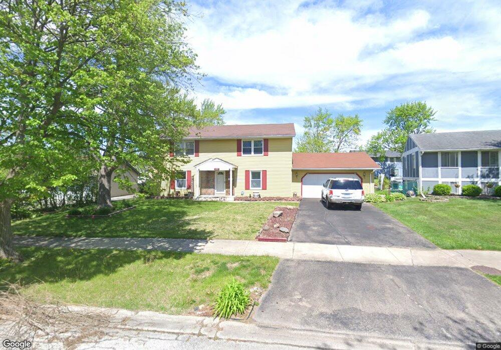
835 Purdue Ln Matteson, IL 60443
West Matteson NeighborhoodEstimated Value: $217,000 - $257,463
About This Home
This home is located at 835 Purdue Ln, Matteson, IL 60443 and is currently estimated at $241,616, approximately $147 per square foot. 835 Purdue Ln is a home located in Cook County with nearby schools including Colin Powell Middle School and Southland College Prep.
Ownership History
We collect this data history from publicly available records. To have your information removed, we recommend requesting removal directly through your county’s website.
Purchase Details
Purchase Details
Purchase Details
Home Financials for this Owner
Home Financials are based on the most recent Mortgage that was taken out on this home.Home Values in the Area
Average Home Value in this Area
Purchase History
We collect this data history from publicly available records. To have your information removed, we recommend requesting removal directly through your county’s website.
| Date | Buyer | Sale Price | Title Company |
|---|---|---|---|
| -- | None Listed On Document | ||
| -- | Attorney | ||
| $98,000 | -- |
Mortgage History
We collect this data history from publicly available records. To have your information removed, we recommend requesting removal directly through your county’s website.
| Date | Status | Borrower | Loan Amount |
|---|---|---|---|
| Previous Owner | $97,751 |
Tax History
We collect this data history from publicly available records. To have your information removed, we recommend requesting removal directly through your county’s website.
| Year | Tax Paid | Tax Assessment Tax Assessment Total Assessment is a certain percentage of the fair market value that is determined by local assessors to be the total taxable value of land and additions on the property. | Land | Improvement |
|---|---|---|---|---|
| 2025 | $8,290 | $16,085 | $3,365 | $12,720 |
| 2024 | $8,290 | $16,085 | $3,365 | $12,720 |
| 2023 | -- | $20,000 | $3,365 | $16,635 |
| 2022 | $0 | $12,784 | $2,944 | $9,840 |
| 2021 | $6,008 | $12,783 | $2,944 | $9,839 |
| 2020 | $6,008 | $12,783 | $2,944 | $9,839 |
| 2019 | $0 | $14,852 | $2,733 | $12,119 |
| 2018 | $0 | $14,852 | $2,733 | $12,119 |
| 2017 | $6,008 | $14,852 | $2,733 | $12,119 |
| 2016 | $5,375 | $12,884 | $2,523 | $10,361 |
| 2015 | $5,214 | $12,884 | $2,523 | $10,361 |
| 2014 | $5,099 | $12,884 | $2,523 | $10,361 |
| 2013 | $4,033 | $11,396 | $2,523 | $8,873 |
Map
- 848 Notre Dame Dr
- 651 Central Ave
- 937 Notre Dame Dr
- 920 Central Ave
- 5631 Colgate Ln
- 818 Princeton Ave
- 953 Dartmouth Ave
- 5503 Georgetown Dr
- 5327 Northwestern Dr
- 997 Regent Dr
- 1010 Regent Dr
- 5620 Feathercreek Rd
- 301 Providence Dr
- 5171 Monroe St
- 161 Briarwood Ct Unit 2131
- 909 Berkshire Dr
- 6037 Spring Ln
- 222 Owen St
- 130 Central Ave Unit 1194
- 5102 Monroe St
- 804 Notre Dame Dr
- 812 Notre Dame Dr
- 762 Notre Dame Dr
- 815 Purdue Ln
- 809 Purdue Ln
- 821 Purdue Ln
- 758 Notre Dame Dr
- 818 Notre Dame Dr
- 803 Purdue Ln
- 827 Purdue Ln
- 815 Notre Dame Dr
- 750 Notre Dame Dr
- 826 Notre Dame Dr
- 801 Harvard Ln
- 835 Purdue Ln
- 814 Purdue Ln
- 826 Purdue Ln
- 751 Harvard Ln
- 825 Notre Dame Dr
- 834 Notre Dame Dr
Ask me questions while you tour the home.