Estimated Value: $388,000 - $452,000
3
Beds
4
Baths
2,334
Sq Ft
$182/Sq Ft
Est. Value
About This Home
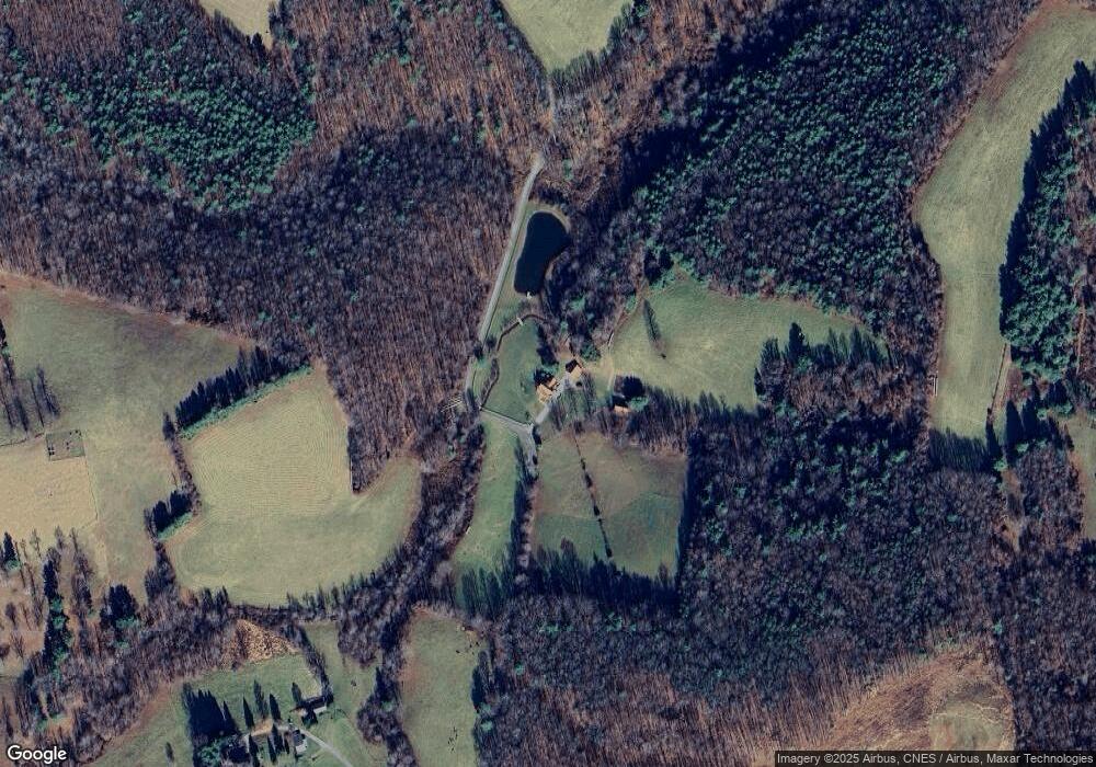
This home is located at 835 Spring Dale Rd SW, Floyd, VA 24091 and is currently estimated at $425,667, approximately $182 per square foot. 835 Spring Dale Rd SW is a home located in Floyd County with nearby schools including Floyd County High School.
Ownership History
Date
Name
Owned For
Owner Type
Purchase Details
Closed on
Apr 20, 2022
Sold by
Getgood John H
Bought by
Kirby Sarah G
Current Estimated Value
Purchase Details
Closed on
Aug 28, 2017
Sold by
Getgood Betty W
Bought by
Getgood John H and Getgood Betty W
Home Financials for this Owner
Home Financials are based on the most recent Mortgage that was taken out on this home.
Original Mortgage
$110,000
Interest Rate
3.93%
Mortgage Type
New Conventional
Create a Home Valuation Report for This Property
The Home Valuation Report is an in-depth analysis detailing your home's value as well as a comparison with similar homes in the area
Purchase History
| Date | Buyer | Sale Price | Title Company |
|---|---|---|---|
| Kirby Sarah G | -- | None Listed On Document | |
| Getgood John H | -- | None Available |
Source: Public Records
Mortgage History
| Date | Status | Borrower | Loan Amount |
|---|---|---|---|
| Previous Owner | Getgood John H | $110,000 |
Source: Public Records
Tax History
| Year | Tax Paid | Tax Assessment Tax Assessment Total Assessment is a certain percentage of the fair market value that is determined by local assessors to be the total taxable value of land and additions on the property. | Land | Improvement |
|---|---|---|---|---|
| 2025 | $1,581 | $359,400 | $43,200 | $316,200 |
| 2024 | $1,481 | $221,100 | $29,200 | $191,900 |
| 2023 | $1,437 | $221,100 | $29,200 | $191,900 |
| 2022 | $1,437 | $221,100 | $29,200 | $191,900 |
| 2021 | $1,393 | $221,100 | $29,200 | $191,900 |
| 2020 | $1,327 | $221,100 | $29,200 | $191,900 |
| 2019 | $1,320 | $220,000 | $29,200 | $190,800 |
| 2018 | $1,320 | $220,000 | $29,200 | $190,800 |
| 2017 | $1,210 | $220,000 | $29,200 | $190,800 |
| 2016 | $1,210 | $220,000 | $29,200 | $190,800 |
| 2015 | -- | $220,000 | $29,200 | $190,800 |
| 2014 | -- | $226,500 | $29,200 | $197,300 |
Source: Public Records
Map
Nearby Homes
- 15885 Woolwine Hwy
- 1481 Fairview Church Rd SW
- 1398 Cox Store Rd SW
- 0 Fairview Church Rd SW
- 543 Cox Store Rd SW
- 1004 Rock Castle Ln SE
- 00 Morning Dew Ln SE
- 939 Widgeon Creek Rd
- 170 & 174 Sarvisberry Ln SW
- 173 Long Level Rd SW
- 145 Long Level Rd SW
- TBD Franklin Pike SE
- 148 Mill Pond Rd SW
- 329 Parkway Ln S
- 220 Annie Ln SW
- 3384 Fairview Church Rd SW
- 0 0 Unit VAHA2001058
- 00 Woolwine Hwy
- 00 Belcher Mountain Rd
- 00 TBD Belcher Mountain Rd
- tbd Springdale Rd
- bd Springdale Rd
- 959 Spring Dale Rd SW
- 3028 Parkway Ln S
- 1030 Spring Dale Rd SW
- 1039 Spring Dale Rd SW
- 837 Tuggles Gap Rd SW
- 903 Tuggles Gap Rd SW
- 975 Fairview Church Rd SW
- 1103 Fairview Church Rd SW
- 789 Tuggles Gap Rd SW
- 789 Tuggles Gap Rd SW
- 949 Tuggles Gap Rd SW
- 859 Tuggles Gap Rd SW
- 337 Tuggles Gap Rd SW
- tbd Tuggles Gap Rd SW
- 899 Fairview Church Rd SW
- 1151 Fairview Church Rd SW
- 905 Fairview Church Rd SW
- 0 Tuggles Gap Rd
