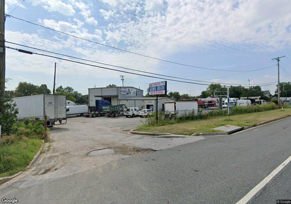
8351 Pulaski Hwy Baltimore, MD 21237
Estimated Value: $1,577,864
--
Bed
--
Bath
4,000
Sq Ft
$394/Sq Ft
Est. Value
About This Home
This home is located at 8351 Pulaski Hwy, Baltimore, MD 21237 and is currently estimated at $1,577,864, approximately $394 per square foot. 8351 Pulaski Hwy is a home located in Baltimore County with nearby schools including Red House Run Elementary School, Golden Ring Middle School, and Overlea High School.
Ownership History
Date
Name
Owned For
Owner Type
Purchase Details
Closed on
Aug 22, 2022
Sold by
Pascal Enterprises Inc
Bought by
Suburban Propane Lp
Current Estimated Value
Purchase Details
Closed on
Mar 5, 1996
Sold by
Samples Beverly Dean
Bought by
Pascal Enterprises Inc
Purchase Details
Closed on
Oct 16, 1986
Sold by
Beard Russell
Bought by
Samples Beverly Dean
Create a Home Valuation Report for This Property
The Home Valuation Report is an in-depth analysis detailing your home's value as well as a comparison with similar homes in the area
Home Values in the Area
Average Home Value in this Area
Purchase History
| Date | Buyer | Sale Price | Title Company |
|---|---|---|---|
| Suburban Propane Lp | $1,360,000 | Chicago Title | |
| Suburban Propane Lp | $1,360,000 | Chicago Title | |
| Pascal Enterprises Inc | $454,400 | -- | |
| Samples Beverly Dean | $80,000 | -- |
Source: Public Records
Tax History Compared to Growth
Tax History
| Year | Tax Paid | Tax Assessment Tax Assessment Total Assessment is a certain percentage of the fair market value that is determined by local assessors to be the total taxable value of land and additions on the property. | Land | Improvement |
|---|---|---|---|---|
| 2025 | $17,249 | $1,348,400 | $433,000 | $915,400 |
| 2024 | $17,249 | $1,348,400 | $433,000 | $915,400 |
| 2023 | $9,014 | $1,408,300 | $433,000 | $975,300 |
| 2022 | $17,854 | $1,408,300 | $433,000 | $975,300 |
| 2021 | $17,836 | $1,408,300 | $433,000 | $975,300 |
| 2020 | $19,358 | $1,523,200 | $433,000 | $1,090,200 |
| 2019 | $16,569 | $1,367,100 | $0 | $0 |
| 2018 | $15,410 | $1,211,000 | $0 | $0 |
| 2017 | $12,645 | $1,054,900 | $0 | $0 |
| 2016 | $8,685 | $944,367 | $0 | $0 |
| 2015 | $8,685 | $833,833 | $0 | $0 |
| 2014 | $8,685 | $723,300 | $0 | $0 |
Source: Public Records
Map
Nearby Homes
- 8300 Berkwood Ct
- 1225 Landover Rd
- 1221 Berkwood Rd
- 1202 Rosegate Ct
- 1229 Berkwood Rd
- 1239 Hilldale Rd
- 1263 Neighbors Ave
- 1236 Primrose Ave
- 1318 Chapel Hill Dr
- 1400 Mount Airy Rd
- 8029 Duvall Ave
- 8504 Bassett Rd
- 8205 Dorset Ave
- 6516 Golden Ring Rd
- 8020 Old Philadelphia Rd
- Lot #133/Lot #134 Sumter Ave
- 0 Sumter Ave
- 1015 Sumter Ave
- 8416 Allison Ln
- 1520 Neighbors Ave
- 8355 Pulaski Hwy
- 8343 Pulaski Hwy
- 8359 Pulaski Hwy
- 8350 Pulaski Hwy
- 11212 Old Philadelphia Rd
- 8384 Old Philadelphia Rd
- 8334 Pulaski Hwy
- 8386 Old Philadelphia Rd
- 8341 Pulaski Hwy
- 8368 Old Philadelphia Rd
- 8380 Old Philadelphia Rd
- 8339 Pulaski Hwy
- 8366 Old Philadelphia Rd
- 8388 Old Philadelphia Rd
- 8364 Old Philadelphia Rd
- 8358 Pulaski Hwy
- 8331 Pulaski Hwy
- 8360 Pulaski Hwy
- 1208 Berk Ave
- 8362 Pulaski Hwy