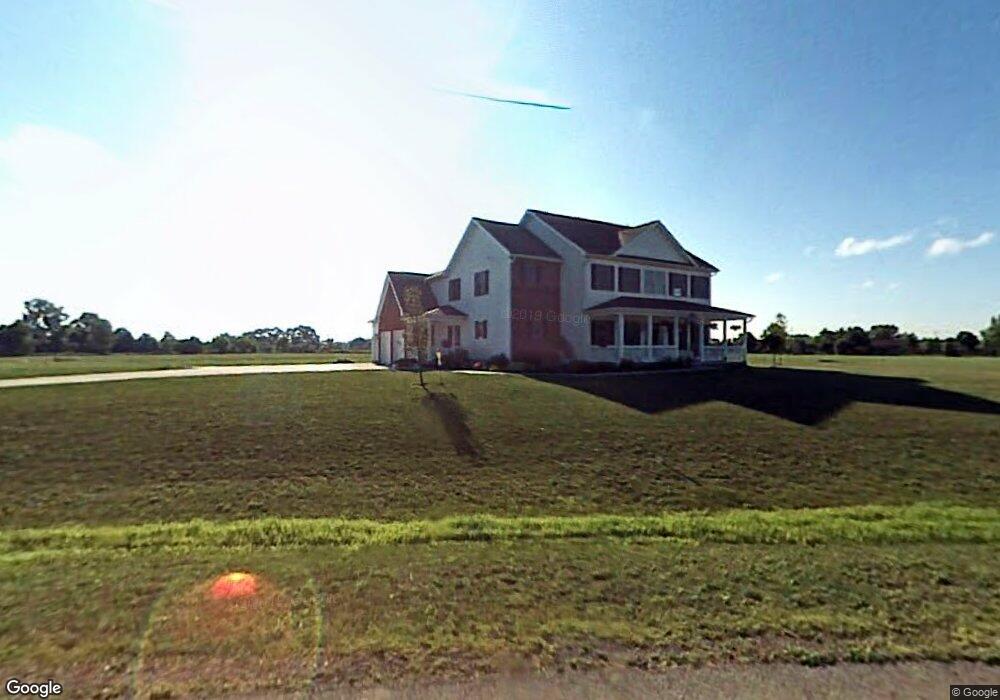
8353 Adams Ln Hilliard, OH 43026
Brown NeighborhoodEstimated Value: $540,000 - $792,000
5
Beds
4
Baths
3,151
Sq Ft
$219/Sq Ft
Est. Value
About This Home
This home is located at 8353 Adams Ln, Hilliard, OH 43026 and is currently estimated at $690,650, approximately $219 per square foot. 8353 Adams Ln is a home located in Franklin County with nearby schools including Brown Elementary School, Hilliard Station Sixth Grade Elementary School, and Hilliard Memorial Middle School.
Ownership History
Date
Name
Owned For
Owner Type
Purchase Details
Closed on
Sep 2, 2025
Sold by
Poff Jared Andrew and Poff Rebecca Marie
Bought by
Poff Rebecca Marie
Current Estimated Value
Home Financials for this Owner
Home Financials are based on the most recent Mortgage that was taken out on this home.
Original Mortgage
$352,295
Outstanding Balance
$351,064
Interest Rate
6.72%
Mortgage Type
New Conventional
Estimated Equity
$339,586
Create a Home Valuation Report for This Property
The Home Valuation Report is an in-depth analysis detailing your home's value as well as a comparison with similar homes in the area
Home Values in the Area
Average Home Value in this Area
Purchase History
| Date | Buyer | Sale Price | Title Company |
|---|---|---|---|
| Poff Rebecca Marie | -- | Doma Title |
Source: Public Records
Mortgage History
| Date | Status | Borrower | Loan Amount |
|---|---|---|---|
| Open | Poff Rebecca Marie | $352,295 |
Source: Public Records
Tax History
| Year | Tax Paid | Tax Assessment Tax Assessment Total Assessment is a certain percentage of the fair market value that is determined by local assessors to be the total taxable value of land and additions on the property. | Land | Improvement |
|---|---|---|---|---|
| 2025 | $12,752 | $208,920 | $63,420 | $145,500 |
| 2024 | $12,752 | $208,920 | $63,420 | $145,500 |
| 2023 | $11,204 | $208,915 | $63,420 | $145,495 |
| 2022 | $12,064 | $178,610 | $63,840 | $114,770 |
| 2021 | $12,070 | $178,610 | $63,840 | $114,770 |
| 2020 | $12,080 | $178,610 | $63,840 | $114,770 |
| 2019 | $11,842 | $149,730 | $55,510 | $94,220 |
| 2018 | $12,150 | $149,730 | $55,510 | $94,220 |
| 2017 | $12,502 | $149,730 | $55,510 | $94,220 |
| 2016 | $13,194 | $154,770 | $43,190 | $111,580 |
| 2015 | $12,489 | $154,770 | $43,190 | $111,580 |
| 2014 | $12,526 | $154,770 | $43,190 | $111,580 |
| 2013 | $5,744 | $147,385 | $41,125 | $106,260 |
Source: Public Records
Map
Nearby Homes
- 1276 Four Star Dr E
- 0 Dellinger Rd Unit 9 2030113
- 8458 Squad Dr
- 8652 Westpoint Dr
- 8873 Canoe Dr
- 716 Academy Dr
- 652 Academy Dr
- 638 Darlene Place
- 6875 Woodedge Ln
- 375 Darby Ct
- 6891 Woodedge Ln
- 6899 Woodedge Ln
- 6754 Forest Ln
- 6745 Forest Ln
- 6793 Brookview Place
- 6801 Brookview Place
- 6784 Brookview Place
- 6737 Brookview Place
- 6824 Northfield Place
- 6825 Northfield Place
- 8425 Adams Ln
- 0 Adams Ln Unit LOT4 2001864
- 0 Adams Ln Unit Lot 1 2943702
- 8324 Adams Ln
- 8376 Roberts Rd
- 8400 Roberts Rd
- 8330 Roberts Rd
- 8410 Roberts Rd
- 1100 Amity Rd
- 8300 Roberts Rd
- 8310 Roberts Rd
- 8261 Adams Ln
- 3444 Amity Rd
- 8238 Adams Ln
- 8411 Roberts Rd
- 8333 Roberts Rd
- 8268 Roberts Rd
- 8217 Adams Ln
- 8190 Adams Ln
Your Personal Tour Guide
Ask me questions while you tour the home.