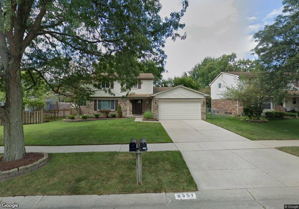
8357 Mannington Rd Canton, MI 48187
Estimated Value: $400,000 - $448,000
3
Beds
3
Baths
1,952
Sq Ft
$217/Sq Ft
Est. Value
About This Home
This home is located at 8357 Mannington Rd, Canton, MI 48187 and is currently estimated at $424,361, approximately $217 per square foot. 8357 Mannington Rd is a home located in Wayne County with nearby schools including Canton High School, Salem High School, and East Middle School.
Ownership History
Date
Name
Owned For
Owner Type
Purchase Details
Closed on
May 6, 2008
Sold by
Prudential Relocation Inc
Bought by
Farkas John F
Current Estimated Value
Purchase Details
Closed on
Apr 30, 2008
Sold by
Cruz Edwin C
Bought by
Prudential Relocation Inc
Purchase Details
Closed on
Apr 8, 2008
Sold by
Stio Angela Elizabeth and Cruz Angela Elizabeth
Bought by
Cruz Edwin C
Purchase Details
Closed on
May 21, 2004
Sold by
Crews Ted A and Crews Catherine
Bought by
Cruz Edwin C
Purchase Details
Closed on
Nov 20, 2000
Sold by
Yoder Carole M
Bought by
Crews Catherine
Create a Home Valuation Report for This Property
The Home Valuation Report is an in-depth analysis detailing your home's value as well as a comparison with similar homes in the area
Home Values in the Area
Average Home Value in this Area
Purchase History
| Date | Buyer | Sale Price | Title Company |
|---|---|---|---|
| Farkas John F | $190,000 | Stewart Title Guaranty Co | |
| Prudential Relocation Inc | $190,000 | Stewart Title | |
| Cruz Edwin C | -- | None Available | |
| Cruz Edwin C | $242,000 | Multiple | |
| Crews Catherine | $215,000 | -- |
Source: Public Records
Tax History
| Year | Tax Paid | Tax Assessment Tax Assessment Total Assessment is a certain percentage of the fair market value that is determined by local assessors to be the total taxable value of land and additions on the property. | Land | Improvement |
|---|---|---|---|---|
| 2025 | $2,042 | $198,000 | $0 | $0 |
| 2024 | $1,984 | $183,000 | $0 | $0 |
| 2023 | $1,892 | $167,600 | $0 | $0 |
| 2022 | $4,158 | $145,700 | $0 | $0 |
| 2021 | $4,044 | $138,600 | $0 | $0 |
| 2020 | $3,984 | $138,500 | $0 | $0 |
| 2019 | $3,917 | $128,630 | $0 | $0 |
| 2018 | $1,608 | $127,320 | $0 | $0 |
| 2017 | $4,002 | $124,400 | $0 | $0 |
| 2016 | $3,536 | $124,000 | $0 | $0 |
| 2015 | $8,769 | $113,580 | $0 | $0 |
| 2013 | $8,495 | $91,150 | $0 | $0 |
| 2010 | -- | $88,680 | $38,897 | $49,783 |
Source: Public Records
Map
Nearby Homes
- 43529 Oakbrook Rd
- 8830 Northern Ave
- 8815 Marlowe Ave
- 9011 Elmhurst Ave
- 0 Joy Rd Unit Parcel 3
- 0 Joy Rd Unit Parcel 2
- 0 Joy Rd Unit Parcel B
- 0 Joy Rd Unit Parcel A
- 9048 Brookline Ave
- 44570 Tillotson Dr
- 43086 Versailles Rd
- 7925 N Sheldon Rd
- 9021 Elmhurst Ave
- 44805 Joy Rd
- 8887 Morrison Ave
- 9453 Brookline Ave
- 44432 Newburyport Dr
- 9195 N Canton Center Rd
- 990 Ross St
- 45325 Stonehedge Dr
- 8381 Mannington Rd
- 8256 Westchester Ln
- 8292 Westchester Ln
- 8364 Westchester Ln
- 8328 Westchester Ln
- 8403 Mannington Rd
- 8382 Westchester Ln
- 8358 Mannington Rd
- 8334 Mannington Rd
- 8400 Westchester Ln
- 8382 Mannington Rd
- 8427 Mannington Rd
- 8310 Mannington Rd
- 8406 Mannington Rd
- 8418 Westchester Ln
- 8430 Mannington Rd
- 8255 Westchester Ln
- 8273 Westchester Ln
- 8359 Congress Dr
- 8436 Westchester Ln
Your Personal Tour Guide
Ask me questions while you tour the home.