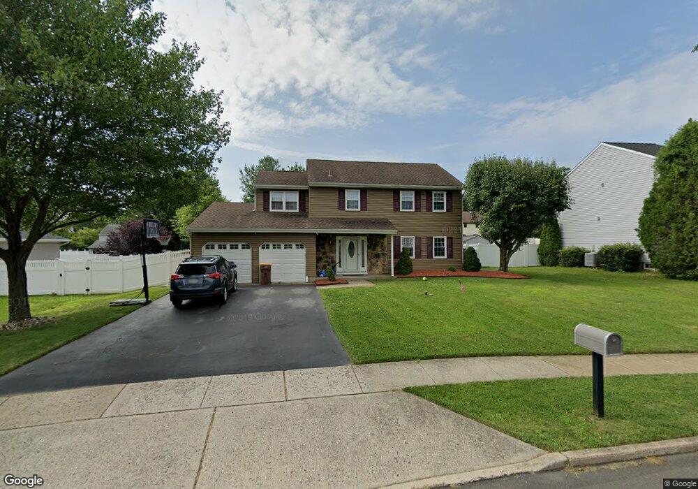
836 Cliff Rd Bensalem, PA 19020
Estimated Value: $561,000 - $638,000
4
Beds
3
Baths
2,133
Sq Ft
$284/Sq Ft
Est. Value
About This Home
This home is located at 836 Cliff Rd, Bensalem, PA 19020 and is currently estimated at $605,907, approximately $284 per square foot. 836 Cliff Rd is a home located in Bucks County with nearby schools including School Lane Charter School, St Ephrem School, and Holy Ghost Preparatory School.
Ownership History
Date
Name
Owned For
Owner Type
Purchase Details
Closed on
Jul 14, 2008
Sold by
Walder Linda L
Bought by
Lowery Guy B and Bourque Nicole M
Current Estimated Value
Home Financials for this Owner
Home Financials are based on the most recent Mortgage that was taken out on this home.
Original Mortgage
$367,100
Outstanding Balance
$238,025
Interest Rate
6.17%
Mortgage Type
FHA
Estimated Equity
$367,882
Purchase Details
Closed on
May 5, 2000
Sold by
Walder John W and Walder Linda L
Bought by
Walder Linda L
Home Financials for this Owner
Home Financials are based on the most recent Mortgage that was taken out on this home.
Original Mortgage
$153,000
Interest Rate
8.21%
Purchase Details
Closed on
Jul 25, 1997
Sold by
Emmi Ronald P and Emmi Carol A
Bought by
Walder John W and Walder Linda L
Home Financials for this Owner
Home Financials are based on the most recent Mortgage that was taken out on this home.
Original Mortgage
$130,000
Interest Rate
7.5%
Create a Home Valuation Report for This Property
The Home Valuation Report is an in-depth analysis detailing your home's value as well as a comparison with similar homes in the area
Home Values in the Area
Average Home Value in this Area
Purchase History
| Date | Buyer | Sale Price | Title Company |
|---|---|---|---|
| Lowery Guy B | $370,000 | Lawyers Title Ins | |
| Walder Linda L | -- | -- | |
| Walder John W | $176,000 | -- |
Source: Public Records
Mortgage History
| Date | Status | Borrower | Loan Amount |
|---|---|---|---|
| Open | Lowery Guy B | $367,100 | |
| Previous Owner | Walder Linda L | $153,000 | |
| Previous Owner | Walder John W | $130,000 |
Source: Public Records
Tax History
| Year | Tax Paid | Tax Assessment Tax Assessment Total Assessment is a certain percentage of the fair market value that is determined by local assessors to be the total taxable value of land and additions on the property. | Land | Improvement |
|---|---|---|---|---|
| 2025 | $7,237 | $33,150 | $9,080 | $24,070 |
| 2024 | $7,237 | $33,150 | $9,080 | $24,070 |
| 2023 | $7,032 | $33,150 | $9,080 | $24,070 |
| 2022 | $6,991 | $33,150 | $9,080 | $24,070 |
| 2021 | $6,991 | $33,150 | $9,080 | $24,070 |
| 2020 | $6,921 | $33,150 | $9,080 | $24,070 |
| 2019 | $6,767 | $33,150 | $9,080 | $24,070 |
| 2018 | $6,610 | $33,150 | $9,080 | $24,070 |
| 2017 | $6,372 | $33,150 | $9,080 | $24,070 |
| 2016 | $6,372 | $32,160 | $9,080 | $23,080 |
| 2015 | -- | $32,160 | $9,080 | $23,080 |
| 2014 | -- | $32,160 | $9,080 | $23,080 |
Source: Public Records
Map
Nearby Homes
- 323 Harvard Square
- 367 Dartmouth Ct Unit 367
- 419 Rutgers Ct
- L:15 Dunston Rd
- 1049 Wayland Ave
- 4517 E Yates Rd
- 0 Newportville Rd Unit PABU2115306
- 4387 Bensalem Blvd
- 901 Spencer Dr
- 5284 Merganser Way
- 208 Neshaminy Rd
- 1706 Spencer Dr
- 3307 Sheldon Ave
- 1511 Moore St Unit 301
- 1103 Nancy Dr
- 1509 Moore St Unit 202
- 3 McLevins Ct
- 10 McLevins Ct
- 1502 Moore St Unit 304
- 1355 Amwell St
Your Personal Tour Guide
Ask me questions while you tour the home.