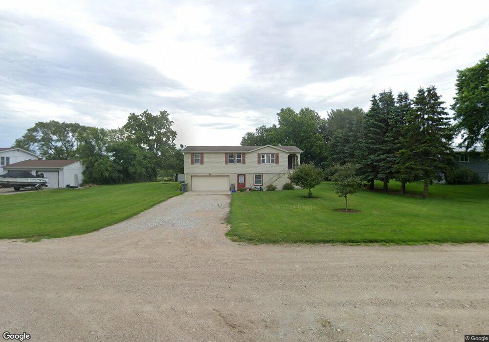
83692 Jerry Dr Norfolk, NE 68701
Estimated Value: $195,943 - $278,000
3
Beds
2
Baths
1,343
Sq Ft
$167/Sq Ft
Est. Value
About This Home
This home is located at 83692 Jerry Dr, Norfolk, NE 68701 and is currently estimated at $224,486, approximately $167 per square foot. 83692 Jerry Dr is a home located in Madison County with nearby schools including Battle Creek Elementary School and Battle Creek High School.
Ownership History
Date
Name
Owned For
Owner Type
Purchase Details
Closed on
Feb 4, 2010
Sold by
Smith James D and Smith Tami J
Bought by
Deutsche Bank Trust Co Trs
Current Estimated Value
Purchase Details
Closed on
Apr 29, 2005
Sold by
Dickes Steven F and Dickes Carol A
Bought by
Smith James D and Smith Tami J
Home Financials for this Owner
Home Financials are based on the most recent Mortgage that was taken out on this home.
Original Mortgage
$84,720
Outstanding Balance
$48,231
Interest Rate
7.3%
Mortgage Type
Adjustable Rate Mortgage/ARM
Estimated Equity
$176,255
Create a Home Valuation Report for This Property
The Home Valuation Report is an in-depth analysis detailing your home's value as well as a comparison with similar homes in the area
Home Values in the Area
Average Home Value in this Area
Purchase History
| Date | Buyer | Sale Price | Title Company |
|---|---|---|---|
| Deutsche Bank Trust Co Trs | $109,506 | -- | |
| Smith James D | $105,900 | -- | |
| Smith James D | $106,000 | Northeast Nebr Title |
Source: Public Records
Mortgage History
| Date | Status | Borrower | Loan Amount |
|---|---|---|---|
| Open | Smith James D | $84,720 |
Source: Public Records
Tax History Compared to Growth
Tax History
| Year | Tax Paid | Tax Assessment Tax Assessment Total Assessment is a certain percentage of the fair market value that is determined by local assessors to be the total taxable value of land and additions on the property. | Land | Improvement |
|---|---|---|---|---|
| 2024 | $1,081 | $122,822 | $10,016 | $112,806 |
| 2023 | $1,537 | $108,969 | $10,016 | $98,953 |
| 2022 | $1,366 | $96,817 | $10,016 | $86,801 |
| 2021 | $1,223 | $87,517 | $10,016 | $77,501 |
| 2020 | $1,204 | $87,517 | $10,016 | $77,501 |
| 2019 | $1,168 | $87,517 | $10,016 | $77,501 |
| 2018 | $1,033 | $81,118 | $10,016 | $71,102 |
| 2017 | $971 | $75,247 | $10,016 | $65,231 |
| 2016 | $907 | $69,861 | $10,016 | $59,845 |
| 2015 | $905 | $69,861 | $10,016 | $59,845 |
| 2014 | $933 | $64,920 | $10,016 | $54,904 |
| 2013 | $1,051 | $64,920 | $10,016 | $54,904 |
Source: Public Records
Map
Nearby Homes
- 5105 W Sherwood Rd
- 101 Frank Ave
- 101 Adealia Ave
- 100 Henry Ave
- 100 Helen Ave
- 101 Henry Ave
- 837 Rd
- 837th Rd
- 2208 S 1st St
- 808 Andy's Shore N
- 3407 Bradford Ave
- 3507 Bradford Ave
- 2500 W Pasewalk
- 3406 Bradford Ave
- 3506 Bradford Ave
- 3307 W Michigan Ave
- 3206 W Michigan Ave
- 3205 W Michigan Ave
- 3306 W Michigan Ave
- 2500 W Cooper Dr **