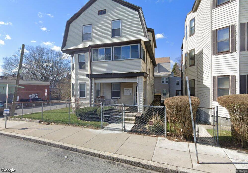
837 Cummins Hwy Mattapan, MA 02126
Southern Mattapan NeighborhoodEstimated Value: $753,655 - $1,156,000
6
Beds
3
Baths
3,644
Sq Ft
$270/Sq Ft
Est. Value
About This Home
This home is located at 837 Cummins Hwy, Mattapan, MA 02126 and is currently estimated at $983,164, approximately $269 per square foot. 837 Cummins Hwy is a home located in Suffolk County with nearby schools including KIPP Academy Boston Charter School, Berea Seventh-day Adventist Academy, and St. Mary of the Hills School.
Ownership History
Date
Name
Owned For
Owner Type
Purchase Details
Closed on
Aug 1, 2014
Sold by
Pierre Marie S and Bazile Marie S
Bought by
Mitchell Fitzroy A
Current Estimated Value
Home Financials for this Owner
Home Financials are based on the most recent Mortgage that was taken out on this home.
Original Mortgage
$280,125
Outstanding Balance
$214,152
Interest Rate
4.18%
Mortgage Type
New Conventional
Estimated Equity
$769,012
Create a Home Valuation Report for This Property
The Home Valuation Report is an in-depth analysis detailing your home's value as well as a comparison with similar homes in the area
Home Values in the Area
Average Home Value in this Area
Purchase History
| Date | Buyer | Sale Price | Title Company |
|---|---|---|---|
| Mitchell Fitzroy A | $373,500 | -- |
Source: Public Records
Mortgage History
| Date | Status | Borrower | Loan Amount |
|---|---|---|---|
| Open | Mitchell Fitzroy A | $280,125 |
Source: Public Records
Tax History Compared to Growth
Tax History
| Year | Tax Paid | Tax Assessment Tax Assessment Total Assessment is a certain percentage of the fair market value that is determined by local assessors to be the total taxable value of land and additions on the property. | Land | Improvement |
|---|---|---|---|---|
| 2025 | $7,211 | $622,700 | $197,200 | $425,500 |
| 2024 | $5,891 | $540,500 | $210,900 | $329,600 |
| 2023 | $5,637 | $524,900 | $204,800 | $320,100 |
| 2022 | $5,437 | $499,700 | $195,000 | $304,700 |
| 2021 | $5,177 | $485,200 | $189,300 | $295,900 |
| 2020 | $4,808 | $455,300 | $185,400 | $269,900 |
| 2019 | $4,338 | $411,600 | $146,900 | $264,700 |
| 2018 | $4,147 | $395,700 | $146,900 | $248,800 |
| 2017 | $3,916 | $369,800 | $146,900 | $222,900 |
| 2016 | $3,802 | $345,600 | $146,900 | $198,700 |
| 2015 | $3,897 | $321,800 | $117,900 | $203,900 |
| 2014 | $3,748 | $297,900 | $117,900 | $180,000 |
Source: Public Records
Map
Nearby Homes
- 770 Cummins Hwy Unit 1
- 770 Cummins Hwy Unit 22
- 10 Brockton St
- 95 Woodhaven St
- 48-50 Rockdale St
- 90 Hollingsworth St
- 839-843 Cummins Hwy
- 23 Caton St
- 645 River St
- 1465 Blue Hill Ave
- 16 Blue Hill Ave
- 84 Blue Hills Pkwy
- 25 Alpine St Unit 7
- 231 Itasca St
- 20 Monterey Ave
- 4 Crossman St Unit 4
- 100 Itasca St
- 60 and 64 Monterey Ave
- 34 Ridlon Rd
- 24 Constitution Rd
- 837 Cummins Hwy Unit 2
- 837 Cummins Hwy Unit 1
- 837 Cummins Hwy Unit 3
- 833 Cummins Hwy
- 7 Rosewood St
- 825 Cummins Hwy Unit 827
- 825 Cummins Hwy Unit 3
- 11 Rosewood St
- 839 Cummins Hwy
- 4 Hollingsworth St
- 821 Cummins Hwy
- 8 Rosewood St
- 15 Rosewood St
- 8 Hollingsworth St
- 864 Cummins Hwy
- 12 Rosewood St
- 849 Cummins Hwy
- 849 Cummins Hwy Unit 2
- 849 Cummins Hwy Unit 3
- 12 Hollingsworth St