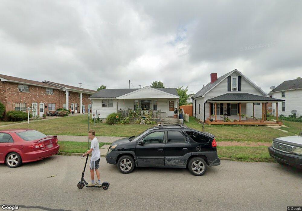
837 E Wheeling St Lancaster, OH 43130
Estimated Value: $169,972 - $194,000
2
Beds
1
Bath
936
Sq Ft
$196/Sq Ft
Est. Value
About This Home
This home is located at 837 E Wheeling St, Lancaster, OH 43130 and is currently estimated at $183,243, approximately $195 per square foot. 837 E Wheeling St is a home with nearby schools including Thomas Ewing Junior High School, Lancaster High School, and St Mary Elementary School.
Ownership History
Date
Name
Owned For
Owner Type
Purchase Details
Closed on
Jun 27, 2022
Sold by
Alfred Warner Boyd and Mae Donna
Bought by
Warner Boyd A and Warner Donna M
Current Estimated Value
Purchase Details
Closed on
Oct 2, 1997
Sold by
Keller Ruth M
Bought by
Warner Boyd A and Warner Donna M
Home Financials for this Owner
Home Financials are based on the most recent Mortgage that was taken out on this home.
Original Mortgage
$285,000
Interest Rate
9%
Mortgage Type
Commercial
Create a Home Valuation Report for This Property
The Home Valuation Report is an in-depth analysis detailing your home's value as well as a comparison with similar homes in the area
Home Values in the Area
Average Home Value in this Area
Purchase History
| Date | Buyer | Sale Price | Title Company |
|---|---|---|---|
| Warner Boyd A | -- | Sitterley Vandervoort & Nixon | |
| Warner Boyd A | $325,000 | -- |
Source: Public Records
Mortgage History
| Date | Status | Borrower | Loan Amount |
|---|---|---|---|
| Previous Owner | Warner Boyd A | $285,000 |
Source: Public Records
Tax History
| Year | Tax Paid | Tax Assessment Tax Assessment Total Assessment is a certain percentage of the fair market value that is determined by local assessors to be the total taxable value of land and additions on the property. | Land | Improvement |
|---|---|---|---|---|
| 2025 | $3,292 | $52,920 | $22,300 | $30,620 |
| 2024 | $3,292 | $36,620 | $11,520 | $25,100 |
| 2023 | $1,361 | $36,620 | $11,520 | $25,100 |
| 2022 | $1,369 | $36,620 | $11,520 | $25,100 |
| 2021 | $1,244 | $31,200 | $11,520 | $19,680 |
| 2020 | $1,194 | $31,200 | $11,520 | $19,680 |
| 2019 | $1,136 | $31,200 | $11,520 | $19,680 |
| 2018 | $561 | $0 | $0 | $0 |
| 2017 | $560 | $11,740 | $11,520 | $220 |
| 2016 | $541 | $11,740 | $11,520 | $220 |
| 2015 | $546 | $11,740 | $11,520 | $220 |
| 2014 | $522 | $11,740 | $11,520 | $220 |
| 2013 | $522 | $11,740 | $11,520 | $220 |
Source: Public Records
Map
Nearby Homes
- 844 E Wheeling St
- 869 E Mulberry St
- 859 E Mulberry St
- 846 E Main St
- 1106 E Walnut St
- 641 King St
- 621 E Mulberry St
- 1113 E Locust St
- 621 Harding Ave
- 736 E Allen St
- 632 N Eastwood Ave
- 547 E Mulberry St
- 545 E Main St
- 534 E Wheeling St
- 627 Sheridan Dr
- 641 Sheridan Dr
- 630 Sheridan Dr
- 705 Madison Ave
- 403 S Ewing St
- 515 E Chestnut St
- 845 E Wheeling St
- 835 E Wheeling St
- 849 E Wheeling St
- 212 Oakwood Ave
- 833 E Wheeling St
- 838 E Wheeling St
- 830 E Wheeling St
- 861 E Wheeling St
- 828 E Wheeling St
- 824 E Wheeling St
- 865 E Wheeling St
- 858 E Wheeling St
- 822 E Wheeling St
- 836 E Mulberry St
- 838 E Mulberry St
- 842 E Mulberry St
- 834 E Mulberry St
- 860 E Wheeling St
- 846 E Mulberry St
- 846 E Mulberry St Unit A
Your Personal Tour Guide
Ask me questions while you tour the home.