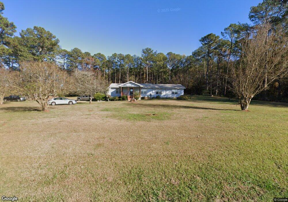
837 Gabbettville Rd Lagrange, GA 30240
Estimated Value: $236,519 - $328,000
3
Beds
2
Baths
1,755
Sq Ft
$156/Sq Ft
Est. Value
About This Home
This home is located at 837 Gabbettville Rd, Lagrange, GA 30240 and is currently estimated at $273,630, approximately $155 per square foot. 837 Gabbettville Rd is a home located in Troup County with nearby schools including Long Cane Elementary School, West Point Elementary School, and Whitesville Road Elementary School.
Ownership History
Date
Name
Owned For
Owner Type
Purchase Details
Closed on
Jun 3, 2021
Sold by
May Terressa L
Bought by
Kim Kwon Soo
Current Estimated Value
Home Financials for this Owner
Home Financials are based on the most recent Mortgage that was taken out on this home.
Original Mortgage
$181,550
Outstanding Balance
$164,371
Interest Rate
2.9%
Mortgage Type
FHA
Estimated Equity
$109,259
Purchase Details
Closed on
Nov 1, 1991
Sold by
May Teressa L
Bought by
May Teressa L and May Phillip E
Purchase Details
Closed on
Dec 1, 1985
Bought by
May Teressa L
Purchase Details
Closed on
Jan 1, 1985
Purchase Details
Closed on
Dec 1, 1984
Purchase Details
Closed on
Jan 1, 1901
Create a Home Valuation Report for This Property
The Home Valuation Report is an in-depth analysis detailing your home's value as well as a comparison with similar homes in the area
Home Values in the Area
Average Home Value in this Area
Purchase History
| Date | Buyer | Sale Price | Title Company |
|---|---|---|---|
| Kim Kwon Soo | $184,900 | -- | |
| May Teressa L | -- | -- | |
| May Teressa L | -- | -- | |
| -- | -- | -- | |
| -- | -- | -- | |
| -- | -- | -- |
Source: Public Records
Mortgage History
| Date | Status | Borrower | Loan Amount |
|---|---|---|---|
| Open | Kim Kwon Soo | $181,550 |
Source: Public Records
Tax History Compared to Growth
Tax History
| Year | Tax Paid | Tax Assessment Tax Assessment Total Assessment is a certain percentage of the fair market value that is determined by local assessors to be the total taxable value of land and additions on the property. | Land | Improvement |
|---|---|---|---|---|
| 2024 | $2,046 | $75,028 | $9,640 | $65,388 |
| 2023 | $2,054 | $75,308 | $9,640 | $65,668 |
| 2022 | $2,000 | $71,668 | $9,640 | $62,028 |
| 2021 | $1,072 | $35,532 | $7,760 | $27,772 |
| 2020 | $1,072 | $35,532 | $7,760 | $27,772 |
| 2019 | $1,056 | $35,020 | $7,760 | $27,260 |
| 2018 | $981 | $32,544 | $7,760 | $24,784 |
| 2017 | $982 | $32,544 | $7,760 | $24,784 |
| 2016 | $962 | $31,911 | $7,784 | $24,128 |
| 2015 | $964 | $31,911 | $7,784 | $24,128 |
| 2014 | $959 | $31,686 | $7,784 | $23,902 |
| 2013 | -- | $33,467 | $7,784 | $25,684 |
Source: Public Records
Map
Nearby Homes
- 797 Gabbettville Rd
- Sandtown Road Unit: 1 2+ - Acre
- 0 Sandtown Rd Unit 10255987
- 0 Lambert Rd
- 648 Warner Rd
- 5714 W Point Rd
- 345 Robert Taylor Rd
- 0 Robert Hayes Rd Unit 10611067
- 202 Reed Rd
- 4172 Bartley Rd
- 1248 Cannonville Rd
- 333 Shoemaker Rd
- 0 Johns Rd Unit 10615130
- 118 Woodstream Trail
- 0 Cannonville Rd
- 208 Harris Walk Unit 80
- 0 Ga Highway 0116 Unit 10619139
- 508 Pine St
- 111 Tudor Way
- 1903 Ridgewood Dr
- 2202 Abbey Glen Ln
- 1 Sandtown Rd
- 1 Sandtown Rd Unit 1B
- 830 Gabbettville Rd
- 0 Sandtown Rd Unit 8130031
- 0 Sandtown Rd Unit LOT C 2754243
- 0 Sandtown Rd Unit LOT D 2754240
- 0 Sandtown Rd Unit LOT B 2754249
- 0 Sandtown Rd Unit LOT D 7160906
- 0 Sandtown Rd Unit 3163126
- 0 Sandtown Rd Unit 1C 8048872
- 0 Sandtown Rd Unit 1.2+/- ACRE 10512037
- 0 Sandtown Rd Unit 22056579
- 0 Sandtown Rd Unit 10419233
- 0 Sandtown Rd Unit 7348041
- 0 Sandtown Rd Unit 8848118
- 0 Sandtown Rd Unit 8554805
- 0 Sandtown Rd Unit 1B 8505901
- 2200 Abbey Glen Ln
- 723 Gabbettville Rd