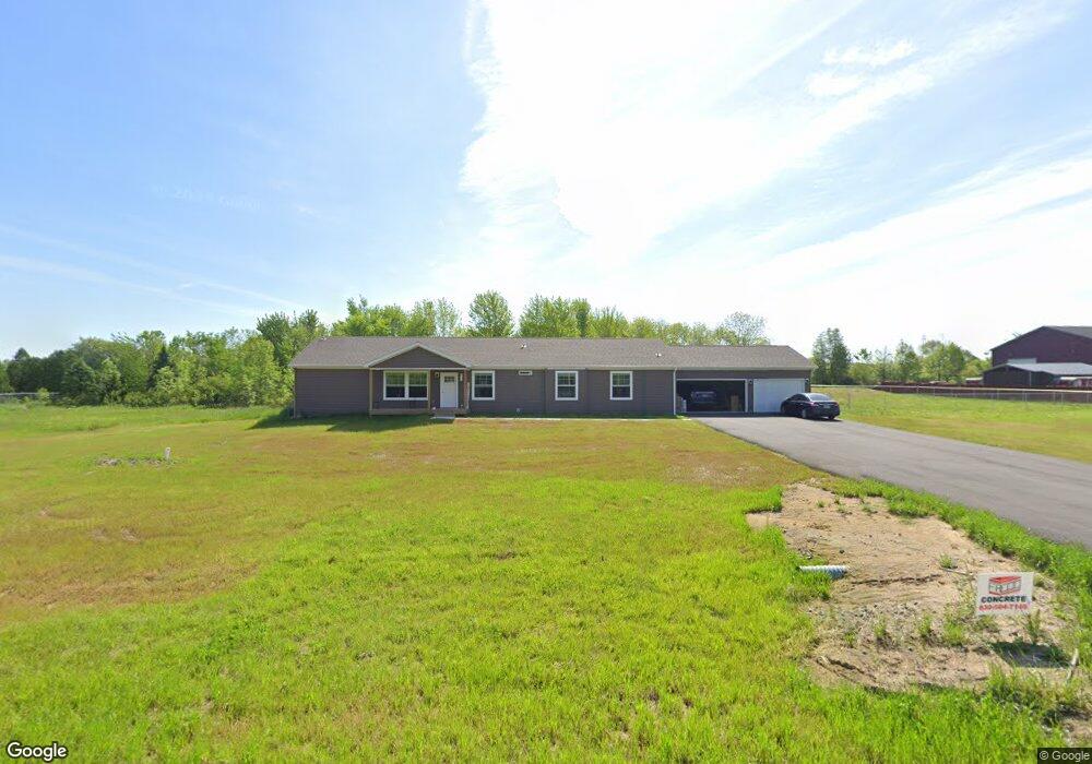
837 N 75 W Valparaiso, IN 46385
Porter County NeighborhoodEstimated Value: $463,000 - $790,493
4
Beds
3
Baths
2,288
Sq Ft
$263/Sq Ft
Est. Value
About This Home
This home is located at 837 N 75 W, Valparaiso, IN 46385 and is currently estimated at $601,164, approximately $262 per square foot. 837 N 75 W is a home with nearby schools including Liberty Elementary School, Liberty Intermediate School, and Chesterton Middle School.
Ownership History
Date
Name
Owned For
Owner Type
Purchase Details
Closed on
Jul 15, 2022
Sold by
Demack Tracie L
Bought by
Martin Mary M and Martin Michael J
Current Estimated Value
Home Financials for this Owner
Home Financials are based on the most recent Mortgage that was taken out on this home.
Original Mortgage
$160,000
Outstanding Balance
$159,734
Interest Rate
5.78%
Mortgage Type
New Conventional
Estimated Equity
$441,430
Purchase Details
Closed on
Feb 28, 2017
Sold by
Bochlke Robert and De Mack Tracie
Bought by
Demack Tracie
Create a Home Valuation Report for This Property
The Home Valuation Report is an in-depth analysis detailing your home's value as well as a comparison with similar homes in the area
Home Values in the Area
Average Home Value in this Area
Purchase History
| Date | Buyer | Sale Price | Title Company |
|---|---|---|---|
| Martin Mary M | $200,000 | Chicago Title | |
| Demack Tracie | -- | None Available |
Source: Public Records
Mortgage History
| Date | Status | Borrower | Loan Amount |
|---|---|---|---|
| Open | Martin Mary M | $160,000 |
Source: Public Records
Tax History Compared to Growth
Tax History
| Year | Tax Paid | Tax Assessment Tax Assessment Total Assessment is a certain percentage of the fair market value that is determined by local assessors to be the total taxable value of land and additions on the property. | Land | Improvement |
|---|---|---|---|---|
| 2024 | $287 | $603,000 | $163,400 | $439,600 |
| 2023 | $233 | $15,700 | $15,700 | -- |
| 2022 | $198 | $12,400 | $12,400 | $0 |
| 2021 | $198 | $10,700 | $10,700 | $0 |
| 2020 | $202 | $10,600 | $10,600 | $0 |
| 2019 | $241 | $12,500 | $12,500 | $0 |
| 2018 | $1,696 | $95,700 | $95,700 | $0 |
| 2017 | $289 | $15,900 | $15,900 | $0 |
| 2016 | $292 | $16,400 | $16,400 | $0 |
| 2014 | $283 | $17,100 | $17,100 | $0 |
| 2013 | -- | $99,200 | $99,200 | $0 |
Source: Public Records
Map
Nearby Homes
- 843 Mirmar Dr
- 122 W 850 N
- 8 W Shakespeare Dr
- 17 Mark Twain Dr
- 120 W Us Highway 6
- 812 Concord St
- 882 Hemingway Trail
- 38 Elderberry Ln
- 792 Merganser Ln
- 733 Meridian Rd
- ESSEX Plan at St. Andrews
- NANDINA Plan at St. Andrews
- DUPONT Plan at St. Andrews
- ASPEN Plan at St. Andrews
- 875 Dunhill Dr
- 877 Argyle Ct
- 886 Argyle Ct
- 186 Mallard Pointe Dr
- 706 Meridian Rd
- 748 N 200 W