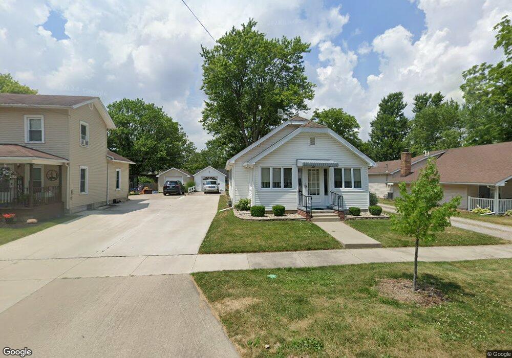
837 N Fulton St Wauseon, OH 43567
Estimated Value: $116,231 - $143,000
2
Beds
1
Bath
1,411
Sq Ft
$91/Sq Ft
Est. Value
About This Home
This home is located at 837 N Fulton St, Wauseon, OH 43567 and is currently estimated at $128,058, approximately $90 per square foot. 837 N Fulton St is a home located in Fulton County with nearby schools including Wauseon Primary School, Wauseon Elementary School, and Wauseon Middle School.
Ownership History
Date
Name
Owned For
Owner Type
Purchase Details
Closed on
Aug 4, 2000
Sold by
Trst Darrel L Hayes
Bought by
Lillich Phillip
Current Estimated Value
Purchase Details
Closed on
Jan 1, 1990
Bought by
Hayes Fern A Trustee
Create a Home Valuation Report for This Property
The Home Valuation Report is an in-depth analysis detailing your home's value as well as a comparison with similar homes in the area
Home Values in the Area
Average Home Value in this Area
Purchase History
| Date | Buyer | Sale Price | Title Company |
|---|---|---|---|
| Lillich Phillip | $69,000 | -- | |
| Hayes Fern A Trustee | -- | -- |
Source: Public Records
Tax History Compared to Growth
Tax History
| Year | Tax Paid | Tax Assessment Tax Assessment Total Assessment is a certain percentage of the fair market value that is determined by local assessors to be the total taxable value of land and additions on the property. | Land | Improvement |
|---|---|---|---|---|
| 2024 | $1,013 | $30,180 | $5,290 | $24,890 |
| 2023 | $1,013 | $30,180 | $5,290 | $24,890 |
| 2022 | $825 | $22,860 | $4,410 | $18,450 |
| 2021 | $882 | $22,860 | $4,410 | $18,450 |
| 2020 | $811 | $22,860 | $4,410 | $18,450 |
| 2019 | $735 | $21,350 | $4,410 | $16,940 |
| 2018 | $355 | $21,350 | $4,410 | $16,940 |
| 2017 | $696 | $21,350 | $4,410 | $16,940 |
| 2016 | $558 | $18,590 | $4,410 | $14,180 |
| 2015 | $522 | $18,590 | $4,410 | $14,180 |
| 2014 | $497 | $18,590 | $4,410 | $14,180 |
| 2013 | $723 | $22,020 | $3,960 | $18,060 |
Source: Public Records
Map
Nearby Homes
- 227 Wabash St
- 428 N Brunell St
- 351 E Walnut St
- 217 Marshall St
- 139 Marshall St
- 1270 S Park Ln
- 527 E Elm St
- 1285 N Shoop Ave
- 524 E Elm St
- 1338 N Park Ln
- 234 W Chestnut St
- 252 W Chestnut St
- 125 Cherry St
- 00 Glenwood
- 0 Glenwood Unit 6124946
- 840 Pine St
- 303 Eastwood St
- 460 Airport Hwy
- 14578 Us Highway 20a
- 420 Clover Ln
- 833 N Fulton St
- 841 N Fulton St
- 827 N Fulton St
- 845 N Fulton St
- 904 N Ottokee St
- 830 N Ottokee St
- 821 N Fulton St
- 914 N Ottokee St
- 824 N Ottokee St
- 832 N Fulton St
- 817 N Fulton St
- 838 N Fulton St
- 916 N Ottokee St
- 828 N Fulton St
- 812 N Ottokee St
- 861 N Fulton St
- 127 W Linfoot St
- 864 N Fulton St
- 820 N Fulton St
- 918 N Ottokee St