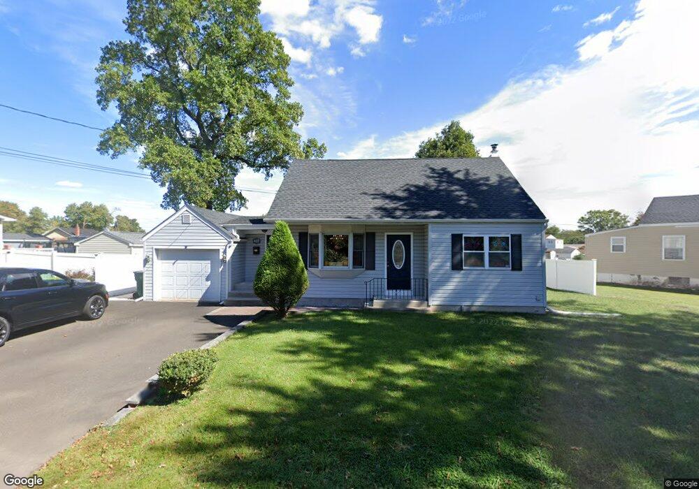
837 Stella Ave Croydon, PA 19021
Estimated Value: $322,000 - $429,000
4
Beds
2
Baths
2,200
Sq Ft
$181/Sq Ft
Est. Value
About This Home
This home is located at 837 Stella Ave, Croydon, PA 19021 and is currently estimated at $397,889, approximately $180 per square foot. 837 Stella Ave is a home located in Bucks County with nearby schools including Truman Senior High School, Doane Academy, and St. Mark Elementary School.
Ownership History
Date
Name
Owned For
Owner Type
Purchase Details
Closed on
Jun 27, 2020
Sold by
Coar Michael R
Bought by
Coar Michael R and Coar Tricia Elizabeth
Current Estimated Value
Home Financials for this Owner
Home Financials are based on the most recent Mortgage that was taken out on this home.
Original Mortgage
$224,300
Interest Rate
3.1%
Mortgage Type
New Conventional
Purchase Details
Closed on
Dec 30, 2014
Sold by
Coar Michael R and Sturkey Katie
Bought by
Coar Michael R
Purchase Details
Closed on
Jul 18, 2008
Sold by
Shisler Daniel and Shisler Shannon
Bought by
Coar Michael R and Sturkey Katie
Home Financials for this Owner
Home Financials are based on the most recent Mortgage that was taken out on this home.
Original Mortgage
$256,969
Interest Rate
6.17%
Mortgage Type
FHA
Create a Home Valuation Report for This Property
The Home Valuation Report is an in-depth analysis detailing your home's value as well as a comparison with similar homes in the area
Home Values in the Area
Average Home Value in this Area
Purchase History
| Date | Buyer | Sale Price | Title Company |
|---|---|---|---|
| Coar Michael R | -- | Amrock | |
| Coar Michael R | -- | None Available | |
| Coar Michael R | $259,000 | None Available |
Source: Public Records
Mortgage History
| Date | Status | Borrower | Loan Amount |
|---|---|---|---|
| Previous Owner | Coar Michael R | $224,300 | |
| Previous Owner | Coar Michael R | $256,969 |
Source: Public Records
Tax History
| Year | Tax Paid | Tax Assessment Tax Assessment Total Assessment is a certain percentage of the fair market value that is determined by local assessors to be the total taxable value of land and additions on the property. | Land | Improvement |
|---|---|---|---|---|
| 2025 | $4,345 | $16,000 | $2,800 | $13,200 |
| 2024 | $4,345 | $16,000 | $2,800 | $13,200 |
| 2023 | $4,313 | $16,000 | $2,800 | $13,200 |
| 2022 | $4,313 | $16,000 | $2,800 | $13,200 |
| 2021 | $4,313 | $16,000 | $2,800 | $13,200 |
| 2020 | $4,313 | $16,000 | $2,800 | $13,200 |
| 2019 | $4,297 | $16,000 | $2,800 | $13,200 |
| 2018 | $4,228 | $16,000 | $2,800 | $13,200 |
| 2017 | $4,164 | $16,000 | $2,800 | $13,200 |
| 2016 | $3,127 | $16,000 | $2,800 | $13,200 |
| 2015 | $2,955 | $16,000 | $2,800 | $13,200 |
| 2014 | $2,955 | $16,000 | $2,800 | $13,200 |
Source: Public Records
Map
Nearby Homes
Your Personal Tour Guide
Ask me questions while you tour the home.