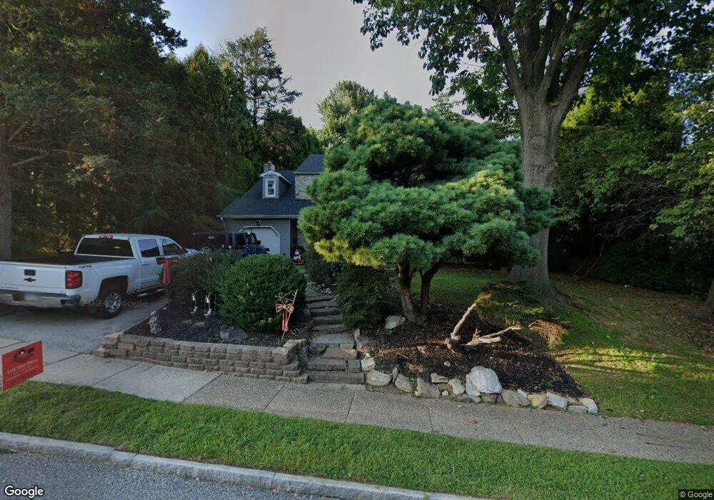
837 W Rolling Rd Springfield, PA 19064
Estimated Value: $632,552 - $698,000
4
Beds
3
Baths
2,475
Sq Ft
$272/Sq Ft
Est. Value
About This Home
This home is located at 837 W Rolling Rd, Springfield, PA 19064 and is currently estimated at $673,388, approximately $272 per square foot. 837 W Rolling Rd is a home located in Delaware County with nearby schools including Springfield High School, St Francis Of Assisi School, and St Dorothy School.
Ownership History
Date
Name
Owned For
Owner Type
Purchase Details
Closed on
Aug 12, 2005
Sold by
Mclaughlin Nancy and Mclaughlin James
Bought by
Mclaughlin Nancy
Current Estimated Value
Purchase Details
Closed on
Jul 12, 2004
Sold by
Pham Vy T and Nguyen Mimi D
Bought by
Mclaughlin Nancy and Mclaughlin James
Home Financials for this Owner
Home Financials are based on the most recent Mortgage that was taken out on this home.
Original Mortgage
$262,500
Outstanding Balance
$111,577
Interest Rate
3.98%
Mortgage Type
Purchase Money Mortgage
Estimated Equity
$561,811
Purchase Details
Closed on
Aug 10, 1995
Sold by
Meth Donald P
Bought by
Meth Donald P and Meth Eric J
Create a Home Valuation Report for This Property
The Home Valuation Report is an in-depth analysis detailing your home's value as well as a comparison with similar homes in the area
Home Values in the Area
Average Home Value in this Area
Purchase History
| Date | Buyer | Sale Price | Title Company |
|---|---|---|---|
| Mclaughlin Nancy | -- | None Available | |
| Mclaughlin Nancy | $350,000 | Commonwealth Title | |
| Meth Donald P | -- | -- |
Source: Public Records
Mortgage History
| Date | Status | Borrower | Loan Amount |
|---|---|---|---|
| Open | Mclaughlin Nancy | $262,500 |
Source: Public Records
Tax History
| Year | Tax Paid | Tax Assessment Tax Assessment Total Assessment is a certain percentage of the fair market value that is determined by local assessors to be the total taxable value of land and additions on the property. | Land | Improvement |
|---|---|---|---|---|
| 2025 | $9,991 | $355,470 | $100,100 | $255,370 |
| 2024 | $9,991 | $355,470 | $100,100 | $255,370 |
| 2023 | $9,620 | $355,470 | $100,100 | $255,370 |
| 2022 | $9,412 | $355,470 | $100,100 | $255,370 |
| 2021 | $14,577 | $355,470 | $100,100 | $255,370 |
| 2020 | $8,933 | $197,130 | $52,270 | $144,860 |
| 2019 | $8,723 | $197,130 | $52,270 | $144,860 |
| 2018 | $8,598 | $197,130 | $0 | $0 |
| 2017 | $8,399 | $197,130 | $0 | $0 |
| 2016 | $1,082 | $197,130 | $0 | $0 |
| 2015 | $1,082 | $197,130 | $0 | $0 |
| 2014 | $1,082 | $197,130 | $0 | $0 |
Source: Public Records
Map
Nearby Homes
- 736 Timber Trail Ln
- 114 Pilgrim Ln
- 68 Pilgrim Ln
- 501 Flora Cir
- 505 Glendale Rd
- 412 N Rolling Rd
- 237 Talbot Dr
- 606 W Springfield Rd
- 220 N Rolling Rd
- 4938 State Rd
- 415 Westfield Dr
- 4928 State Rd
- 400 Glendale Rd Unit D33
- 400 Glendale Rd Unit G33
- 400 Glendale Rd Unit J13
- 908 Roberts Ave
- 120 W Springfield Rd
- 113 James Dr
- 29 School Ln
- 842 Alexander Ave
- 845 W Rolling Rd
- 400 Ridge Ln
- 406 Ridge Ln
- 836 W Rolling Rd
- 842 W Rolling Rd
- 830 W Rolling Rd
- 412 Ridge Ln
- 848 W Rolling Rd
- 819 W Rolling Rd
- 854 W Rolling Rd
- 824 W Rolling Rd
- 411 Ridge Ln
- 418 Ridge Ln
- 818 W Rolling Rd
- 352 Foulke Ln
- 346 Foulke Ln
- 358 Foulke Ln
- 813 W Rolling Rd
- 340 Foulke Ln
- 429 Ridge Ln
Your Personal Tour Guide
Ask me questions while you tour the home.