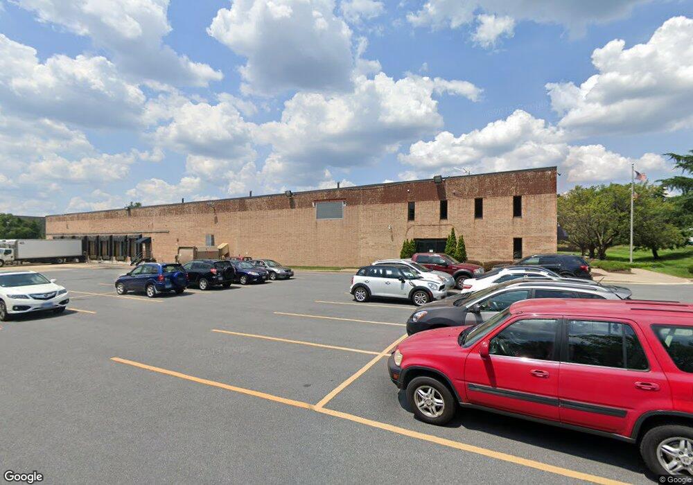
8375 Patuxent Range Rd Jessup, MD 20794
Estimated Value: $6,866,610
Studio
--
Bath
57,600
Sq Ft
$119/Sq Ft
Est. Value
About This Home
This home is located at 8375 Patuxent Range Rd, Jessup, MD 20794 and is currently estimated at $6,866,610, approximately $119 per square foot. 8375 Patuxent Range Rd is a home located in Howard County with nearby schools including Hanover Hills Elementary, Thomas Viaduct Middle School, and Bethel Christian Academy.
Ownership History
Date
Name
Owned For
Owner Type
Purchase Details
Closed on
Dec 20, 2010
Sold by
Ews Realty Corporation
Bought by
Honey Mountain Llc and Sun Belle Inc
Current Estimated Value
Purchase Details
Closed on
Apr 21, 1988
Sold by
Maryland National Bank
Bought by
Ews Realty Corporation
Home Financials for this Owner
Home Financials are based on the most recent Mortgage that was taken out on this home.
Original Mortgage
$2,000,000
Interest Rate
10.19%
Create a Home Valuation Report for This Property
The Home Valuation Report is an in-depth analysis detailing your home's value as well as a comparison with similar homes in the area
Purchase History
| Date | Buyer | Sale Price | Title Company |
|---|---|---|---|
| Honey Mountain Llc | $4,250,000 | -- | |
| Ews Realty Corporation | $2,301,000 | -- |
Source: Public Records
Mortgage History
| Date | Status | Borrower | Loan Amount |
|---|---|---|---|
| Previous Owner | Ews Realty Corporation | $2,000,000 |
Source: Public Records
Tax History
| Year | Tax Paid | Tax Assessment Tax Assessment Total Assessment is a certain percentage of the fair market value that is determined by local assessors to be the total taxable value of land and additions on the property. | Land | Improvement |
|---|---|---|---|---|
| 2025 | $64,707 | $4,195,200 | $1,298,900 | $2,896,300 |
| 2024 | $64,707 | $4,101,400 | $0 | $0 |
| 2023 | $60,476 | $4,007,600 | $0 | $0 |
| 2022 | $59,060 | $3,913,800 | $1,298,900 | $2,614,900 |
| 2021 | $49,911 | $3,610,633 | $0 | $0 |
| 2020 | $49,911 | $3,307,467 | $0 | $0 |
| 2019 | $45,336 | $3,004,300 | $1,298,900 | $1,705,400 |
| 2018 | $43,595 | $3,004,300 | $1,298,900 | $1,705,400 |
| 2017 | $51,026 | $3,474,800 | $0 | $0 |
| 2016 | -- | $3,475,500 | $0 | $0 |
| 2015 | -- | $3,117,433 | $0 | $0 |
| 2014 | -- | $2,759,367 | $0 | $0 |
Source: Public Records
Map
Nearby Homes
- 8304 Firewood Ct
- 8353 Ashwood Rd Unit 8353
- 10075 Guilford Rd
- 8923 Carroll Heights Ave
- 8162 Mission Rd
- 8253 Macintosh Ct
- 8449 Oak Meade Way
- 7927 Red Jacket Way
- Lot 7 Cedar Ave
- Lot 6 Cedar Ave
- 7370 Cedar Ave
- 7368 Cedar Ave
- 8304 Granville Rd
- 2357 Terrapin Crossing
- 9046 LOT 5 Gorman Rd
- 9590 Glen Oaks Ln
- 9538 Oakhurst Dr
- 9519 Oakhurst Dr
- 8759 Weathered Stone Way
- 7366 Matchbox Aly
- 8325 Patuxent Range Rd
- 8220 Wellmoor Ct
- 8106 NW Stayton Dr
- 8210 Wellmoor Ct
- 8301 Patuxent Range Rd
- 8331 Bristol Ct
- 8391 Washington Blvd
- 8552 Washington Blvd
- 8414 Washington Blvd
- 8200 Stayton Dr
- 8406 Washington Blvd
- 8332 Bristol Ct
- 8520 Washington Blvd
- 8107 Stayton Dr
- 8306 Patuxent Range Rd
- 8402 Washington Blvd
- 8291 Patuxent Range Rd
- 8685 Washington Blvd
- 8351 Bristol Ct
- 8290 Patuxent Range Rd
Your Personal Tour Guide
Ask me questions while you tour the home.