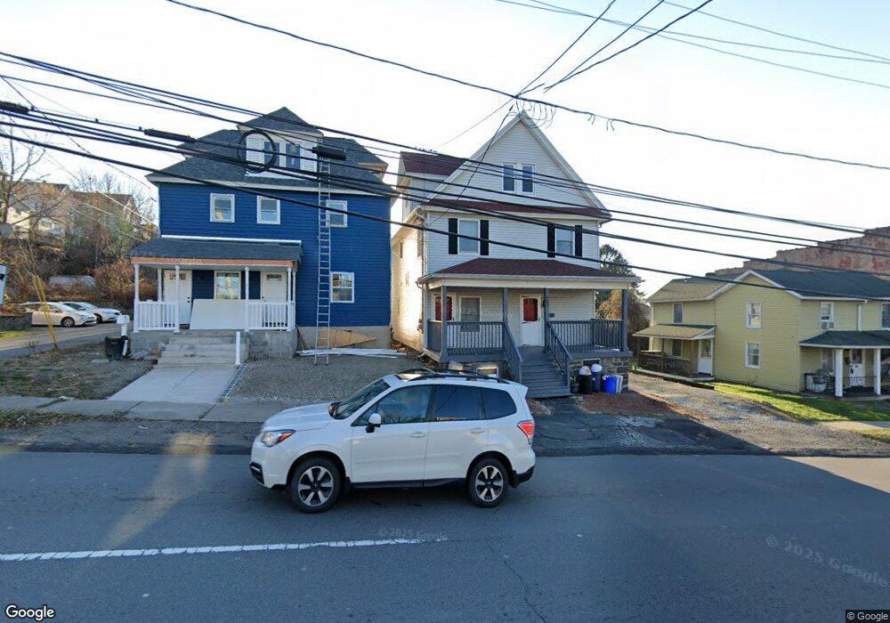
838 Moosic St Scranton, PA 18505
South Side NeighborhoodEstimated Value: $284,000 - $324,000
2
Beds
1
Bath
719
Sq Ft
$420/Sq Ft
Est. Value
About This Home
This home is located at 838 Moosic St, Scranton, PA 18505 and is currently estimated at $302,000, approximately $420 per square foot. 838 Moosic St is a home located in Lackawanna County with nearby schools including John G. Whittier Elementary School, South Scranton Intermediate, and Scranton High School.
Ownership History
Date
Name
Owned For
Owner Type
Purchase Details
Closed on
Nov 8, 2012
Sold by
Deutsche Bank National Trust Company
Bought by
Rv Holdings Eleven Llc
Current Estimated Value
Purchase Details
Closed on
Dec 21, 2011
Sold by
Sheriff Of The County Of Lackawanna
Bought by
Deutsche Bank National Trust Company
Purchase Details
Closed on
Apr 3, 2006
Sold by
Engel Lipa
Bought by
Engel Herschel
Create a Home Valuation Report for This Property
The Home Valuation Report is an in-depth analysis detailing your home's value as well as a comparison with similar homes in the area
Home Values in the Area
Average Home Value in this Area
Purchase History
| Date | Buyer | Sale Price | Title Company |
|---|---|---|---|
| Rv Holdings Eleven Llc | $22,725 | None Available | |
| Deutsche Bank National Trust Company | $925 | None Available | |
| Engel Herschel | -- | None Available |
Source: Public Records
Tax History
| Year | Tax Paid | Tax Assessment Tax Assessment Total Assessment is a certain percentage of the fair market value that is determined by local assessors to be the total taxable value of land and additions on the property. | Land | Improvement |
|---|---|---|---|---|
| 2025 | $6,005 | $20,000 | $1,000 | $19,000 |
| 2024 | $5,460 | $20,000 | $1,000 | $19,000 |
| 2023 | $5,460 | $20,000 | $1,000 | $19,000 |
| 2022 | $5,338 | $20,000 | $1,000 | $19,000 |
| 2021 | $5,338 | $20,000 | $1,000 | $19,000 |
| 2020 | $5,231 | $20,000 | $1,000 | $19,000 |
| 2019 | $4,911 | $20,000 | $1,000 | $19,000 |
| 2018 | $4,911 | $20,000 | $1,000 | $19,000 |
| 2017 | $4,817 | $20,000 | $1,000 | $19,000 |
| 2016 | $1,193 | $20,000 | $1,000 | $19,000 |
| 2015 | $3,537 | $20,000 | $1,000 | $19,000 |
| 2014 | -- | $20,000 | $1,000 | $19,000 |
Source: Public Records
Map
Nearby Homes
- 217 Crown Ave
- 102 S Irving Ave
- 910 Orchard St
- 417 S Irving Ave
- 636 Orchard St
- 119 Prospect Ave Unit L5
- 342 Harrison Ave
- 321 Prospect Ave
- 1031 Alder St
- 409 Prospect Ave
- 623 Crown Ave
- 522 524 River St
- 201 Pittston Ave
- 432 Taylor Ave
- 1513 1515 Vine St
- 719 S Webster Ave
- 516 Harrison Ave
- 0 Colfax Ave
- 529 Taylor Ave
- 518 Kirst Ct
- 838 Moosic St
- 838 Rear Moosic St
- 840 Moosic St
- 816 Moosic St
- 842 Moosic St
- 21 Rear Stafford Ave
- 838 Moosic St
- 820 Moosic St
- 820 Moosic St
- 108 Crown Ave
- 812 Moosic St Unit 814
- 841 Moosic St
- 110 Crown Ave
- 843 Moosic St
- 808 Moosic St Unit 810
- 808 Moosic St
- 808-810 Moosic St
- 100 Crown Ave
- 831 Moosic St
- 847 Moosic St
Your Personal Tour Guide
Ask me questions while you tour the home.