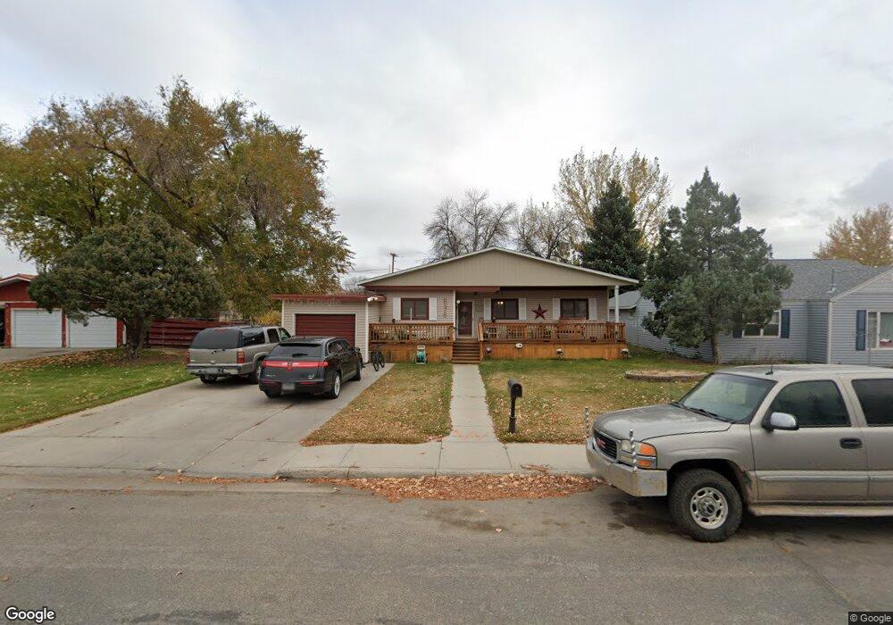
838 Park Ave Worland, WY 82401
Estimated Value: $186,000 - $196,000
2
Beds
2
Baths
1,266
Sq Ft
$151/Sq Ft
Est. Value
About This Home
This home is located at 838 Park Ave, Worland, WY 82401 and is currently estimated at $191,467, approximately $151 per square foot. 838 Park Ave is a home located in Washakie County with nearby schools including South Side Elementary School, West Side Elementary School, and East Side Elementary School.
Ownership History
Date
Name
Owned For
Owner Type
Purchase Details
Closed on
Jun 4, 2021
Sold by
Molitor Nathan L
Bought by
Brown Stephen and Brown Terisa
Current Estimated Value
Home Financials for this Owner
Home Financials are based on the most recent Mortgage that was taken out on this home.
Original Mortgage
$117,133
Outstanding Balance
$106,049
Interest Rate
2.9%
Mortgage Type
Purchase Money Mortgage
Estimated Equity
$85,418
Create a Home Valuation Report for This Property
The Home Valuation Report is an in-depth analysis detailing your home's value as well as a comparison with similar homes in the area
Home Values in the Area
Average Home Value in this Area
Purchase History
| Date | Buyer | Sale Price | Title Company |
|---|---|---|---|
| Brown Stephen | -- | Amrock Inc | |
| Brown Stephen | -- | None Listed On Document |
Source: Public Records
Mortgage History
| Date | Status | Borrower | Loan Amount |
|---|---|---|---|
| Open | Brown Stephen | $117,133 | |
| Closed | Brown Stephen | $117,133 |
Source: Public Records
Tax History Compared to Growth
Tax History
| Year | Tax Paid | Tax Assessment Tax Assessment Total Assessment is a certain percentage of the fair market value that is determined by local assessors to be the total taxable value of land and additions on the property. | Land | Improvement |
|---|---|---|---|---|
| 2025 | $496 | $6,509 | $1,592 | $4,917 |
| 2024 | $733 | $12,625 | $3,169 | $9,456 |
| 2023 | $739 | $12,711 | $3,619 | $9,092 |
| 2022 | $982 | $12,900 | $3,619 | $9,281 |
| 2021 | $723 | $12,494 | $3,619 | $8,875 |
| 2020 | $732 | $12,614 | $3,619 | $8,995 |
| 2019 | $711 | $12,333 | $3,619 | $8,714 |
| 2018 | $840 | $14,035 | $3,619 | $10,416 |
| 2017 | $885 | $14,619 | $3,610 | $11,009 |
| 2016 | $854 | $14,220 | $3,373 | $10,847 |
| 2015 | -- | $10,854 | $3,373 | $7,481 |
| 2014 | -- | $9,414 | $3,168 | $6,246 |
Source: Public Records
Map
Nearby Homes
- 821 Obie Sue Ave
- 711 Washakie Ave
- 615 Holly Ave
- 520 Obie Sue Ave
- 739 S 13th St
- 501 Obie Sue Ave
- 624 S 5th St
- 317 Thomas Ave
- 1205 Coburn Ave
- 1300 Coburn Ave
- 611 S 3rd St
- 813 S 15th St
- 708 S 16th St
- 408 S 16th St
- 728 S 3rd St
- 1015 Robertson Ave
- 1012 Pulliam Ave
- 1701 Coburn Ave
- 1301 Pulliam Ave
- 1221 Pulliam Ave