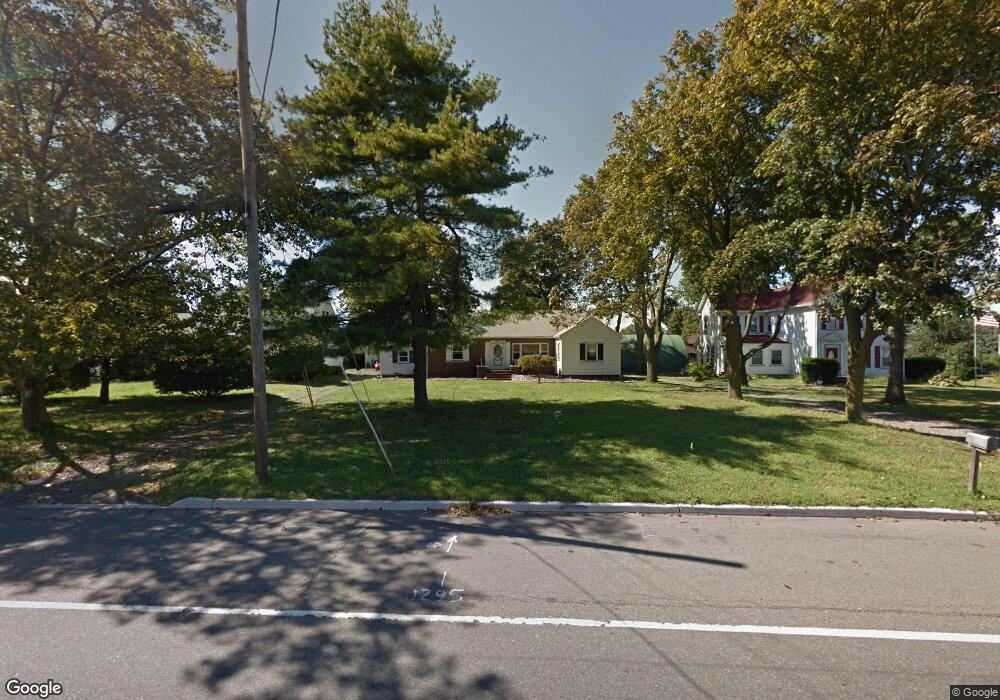
838 Route 9 None Sayreville, NJ 08879
Estimated Value: $495,000
3
Beds
2
Baths
--
Sq Ft
0.31
Acres
About This Home
This home is located at 838 Route 9 None, Sayreville, NJ 08879 and is currently estimated at $495,000. 838 Route 9 None is a home located in Middlesex County with nearby schools including Sayreville War Memorial High School, St. Mary Elementary School, and Cardinal Mccarrick High School.
Ownership History
Date
Name
Owned For
Owner Type
Purchase Details
Closed on
Jun 18, 2020
Sold by
Federal National Mortgage Association
Bought by
Tejera Diblain and Tejera Wendy
Current Estimated Value
Home Financials for this Owner
Home Financials are based on the most recent Mortgage that was taken out on this home.
Original Mortgage
$270,000
Interest Rate
3%
Mortgage Type
New Conventional
Purchase Details
Closed on
Mar 4, 2020
Sold by
Kovaleski Keith and Kovaleski John
Bought by
Oceanfirst Bank
Purchase Details
Closed on
May 21, 2009
Sold by
Kovaleski John and Kovaleski Bernice
Bought by
Kovaleski Bernice
Home Financials for this Owner
Home Financials are based on the most recent Mortgage that was taken out on this home.
Original Mortgage
$345,000
Interest Rate
3.04%
Mortgage Type
Reverse Mortgage Home Equity Conversion Mortgage
Create a Home Valuation Report for This Property
The Home Valuation Report is an in-depth analysis detailing your home's value as well as a comparison with similar homes in the area
Home Values in the Area
Average Home Value in this Area
Purchase History
| Date | Buyer | Sale Price | Title Company |
|---|---|---|---|
| Tejera Diblain | $285,700 | None Available | |
| Oceanfirst Bank | -- | None Available | |
| Kovaleski Bernice | -- | Speedy Title Llc |
Source: Public Records
Mortgage History
| Date | Status | Borrower | Loan Amount |
|---|---|---|---|
| Previous Owner | Tejera Diblain | $270,000 | |
| Previous Owner | Kovaleski Bernice | $345,000 |
Source: Public Records
Tax History Compared to Growth
Tax History
| Year | Tax Paid | Tax Assessment Tax Assessment Total Assessment is a certain percentage of the fair market value that is determined by local assessors to be the total taxable value of land and additions on the property. | Land | Improvement |
|---|---|---|---|---|
| 2025 | $9,328 | $152,800 | $51,300 | $101,500 |
| 2024 | $9,070 | $152,800 | $51,300 | $101,500 |
| 2023 | $9,070 | $152,800 | $51,300 | $101,500 |
| 2022 | $8,473 | $152,800 | $51,300 | $101,500 |
| 2021 | $8,380 | $152,800 | $51,300 | $101,500 |
| 2020 | $8,167 | $152,800 | $51,300 | $101,500 |
| 2019 | $7,996 | $152,800 | $51,300 | $101,500 |
| 2018 | $7,852 | $152,800 | $51,300 | $101,500 |
| 2017 | $7,671 | $152,800 | $51,300 | $101,500 |
| 2016 | $7,466 | $152,800 | $51,300 | $101,500 |
| 2015 | $7,024 | $147,100 | $51,300 | $95,800 |
| 2014 | $6,836 | $147,100 | $51,300 | $95,800 |
Source: Public Records
Map
Nearby Homes
- 15 Bertram Ave
- 741 Bordentown Ave
- 243 Elm St
- 320 Parker Ave
- 442 Bordentown Ave
- 326 Walnut St
- 433 Gordon St
- 110 N Pine Ave
- 2950 Washington Rd
- 365 John St
- 221 S Pine Ave
- 370 6th St
- 3350 Washington Rd
- 363 Ferris St
- 42 Merritt Ave
- 322 George St
- 5 Gardner Place
- 309 Main St
- 363 Portia St
- 123 S Stevens Ave
- 838 U S 9
- 20 Hilltop Ave
- 18 Hilltop Ave
- 834 Upper Main St
- 860 Upper Main St
- 22 Hilltop Ave
- 16 Hilltop Ave
- 862 Upper Main St
- 835 Upper Main St
- 830 Upper Main St
- 23 Hilltop Ave
- 19 Hilltop Ave
- 17 Hilltop Ave
- 116 Conlogue Ave
- 24 Hilltop Ave
- 14 Hilltop Ave
- 839 Upper Main St
- 827 Upper Main St
- 15 Hilltop Ave
- 843 Upper Main St