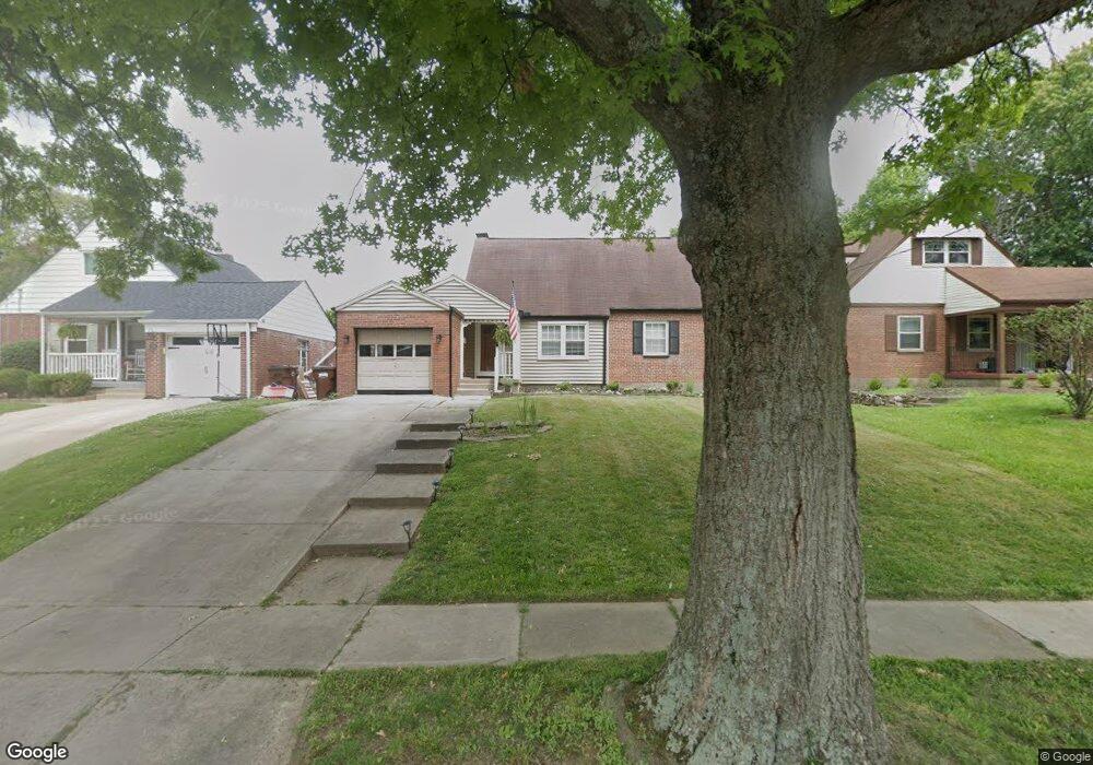
8388 Wicklow Ave Cincinnati, OH 45236
Estimated Value: $254,513 - $315,000
4
Beds
2
Baths
1,225
Sq Ft
$226/Sq Ft
Est. Value
About This Home
This home is located at 8388 Wicklow Ave, Cincinnati, OH 45236 and is currently estimated at $276,628, approximately $225 per square foot. 8388 Wicklow Ave is a home located in Hamilton County with nearby schools including Amity Elementary School, Deer Park Jr/Sr High School, and Ohr Torah Cincinnati.
Ownership History
Date
Name
Owned For
Owner Type
Purchase Details
Closed on
Mar 2, 2005
Sold by
Skoog Donald R and Skoog Gloria L
Bought by
Bowling Gary and Bowling Charlotte
Current Estimated Value
Home Financials for this Owner
Home Financials are based on the most recent Mortgage that was taken out on this home.
Original Mortgage
$102,400
Interest Rate
4.25%
Mortgage Type
Fannie Mae Freddie Mac
Create a Home Valuation Report for This Property
The Home Valuation Report is an in-depth analysis detailing your home's value as well as a comparison with similar homes in the area
Home Values in the Area
Average Home Value in this Area
Purchase History
| Date | Buyer | Sale Price | Title Company |
|---|---|---|---|
| Bowling Gary | $128,000 | None Available |
Source: Public Records
Mortgage History
| Date | Status | Borrower | Loan Amount |
|---|---|---|---|
| Closed | Bowling Gary | $102,400 |
Source: Public Records
Tax History
| Year | Tax Paid | Tax Assessment Tax Assessment Total Assessment is a certain percentage of the fair market value that is determined by local assessors to be the total taxable value of land and additions on the property. | Land | Improvement |
|---|---|---|---|---|
| 2025 | $4,261 | $67,134 | $10,850 | $56,284 |
| 2023 | $3,808 | $67,134 | $10,850 | $56,284 |
| 2022 | $3,613 | $49,168 | $9,478 | $39,690 |
| 2021 | $3,595 | $49,168 | $9,478 | $39,690 |
| 2020 | $3,219 | $49,168 | $9,478 | $39,690 |
| 2019 | $3,157 | $43,128 | $8,313 | $34,815 |
| 2018 | $3,145 | $43,128 | $8,313 | $34,815 |
| 2017 | $3,014 | $43,128 | $8,313 | $34,815 |
| 2016 | $3,148 | $44,023 | $8,575 | $35,448 |
| 2015 | $2,894 | $44,023 | $8,575 | $35,448 |
| 2014 | $2,892 | $44,023 | $8,575 | $35,448 |
| 2013 | $2,984 | $44,923 | $8,750 | $36,173 |
Source: Public Records
Map
Nearby Homes
- 8494 Wexford Ave
- 3683 Mantell Ave
- 8474 Donna Ln
- 4104 Estermarie Dr
- 7905 Plainfield Rd
- 8608 Dundalk Ct
- 8468 Plainfield Rd
- 4208 Linden Ave
- 4009 Saint Johns Terrace
- 8622 Plainfield Ln
- 4053 Belfast Ave
- 4215 Matson Ave
- 3737 O'Leary Ave
- 4304 Kugler Mill Rd
- 7651 Sagamore Dr
- 3982 Superior Ave
- 4073 Mantell Ave
- 42 Wentworth Ln
- 34 Wentworth Ln
- 8312 York St
- 8380 Wicklow Ave
- 8396 Wicklow Ave
- 8372 Wicklow Ave
- 8377 Wexford Ave
- 8364 Wicklow Ave
- 8400 Wicklow Ave
- 8369 Wexford Ave
- 8385 Wexford Ave
- 8389 Wicklow Ave
- 8355 Wexford Ave
- 8356 Wicklow Ave
- 8406 Wicklow Ave
- 8381 Wicklow Ave
- 8373 Wicklow Ave
- 8347 Wexford Ave
- 8401 Wexford Ave
- 8412 Wicklow Ave
- 8401 Wicklow Ave
- 8365 Wicklow Ave
- 8348 Wicklow Ave
Your Personal Tour Guide
Ask me questions while you tour the home.