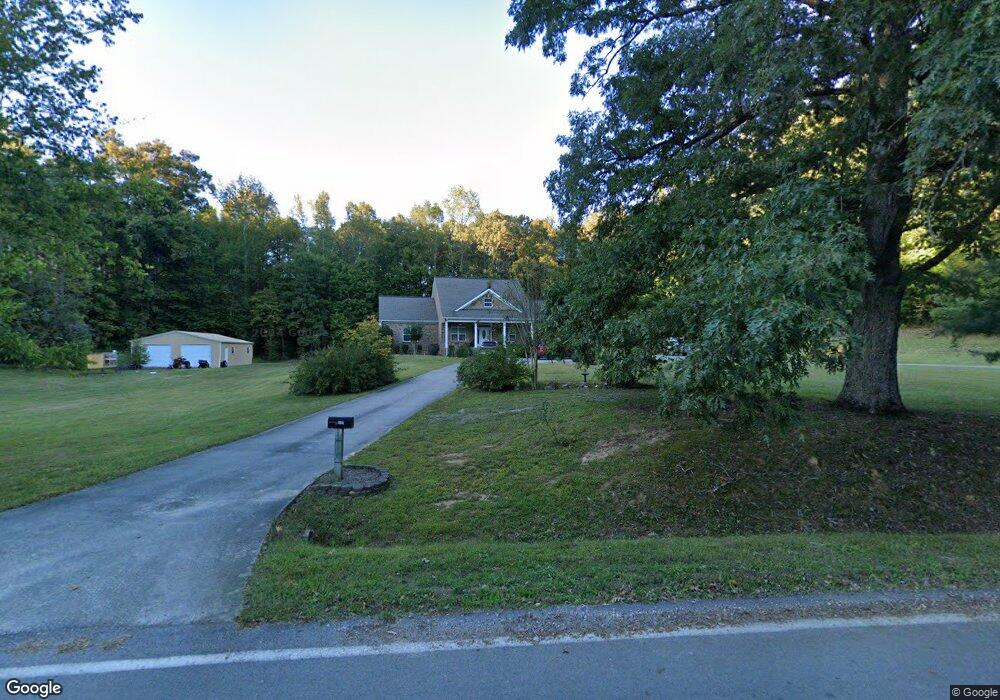
839 Brushtown Rd Cisco, GA 30708
Cisco NeighborhoodEstimated Value: $261,000 - $518,000
--
Bed
3
Baths
2,665
Sq Ft
$158/Sq Ft
Est. Value
About This Home
This home is located at 839 Brushtown Rd, Cisco, GA 30708 and is currently estimated at $422,173, approximately $158 per square foot. 839 Brushtown Rd is a home located in Murray County with nearby schools including Eton Elementary School, Bagley Middle School, and North Murray High School.
Ownership History
Date
Name
Owned For
Owner Type
Purchase Details
Closed on
Aug 15, 2007
Sold by
Long Isaac Paul
Bought by
Long Isaac Paul
Current Estimated Value
Home Financials for this Owner
Home Financials are based on the most recent Mortgage that was taken out on this home.
Original Mortgage
$200,000
Outstanding Balance
$117,321
Interest Rate
6.13%
Mortgage Type
New Conventional
Estimated Equity
$304,852
Purchase Details
Closed on
Jan 28, 1997
Sold by
Long Bertha Trula
Bought by
Long Isaac Paul
Purchase Details
Closed on
Dec 10, 1996
Sold by
Long Morgan W and Long Bertha
Bought by
Long Bertha Trula
Create a Home Valuation Report for This Property
The Home Valuation Report is an in-depth analysis detailing your home's value as well as a comparison with similar homes in the area
Home Values in the Area
Average Home Value in this Area
Purchase History
| Date | Buyer | Sale Price | Title Company |
|---|---|---|---|
| Long Isaac Paul | -- | -- | |
| Long Isaac Paul | -- | -- | |
| Long Bertha Trula | -- | -- |
Source: Public Records
Mortgage History
| Date | Status | Borrower | Loan Amount |
|---|---|---|---|
| Open | Long Isaac Paul | $200,000 |
Source: Public Records
Tax History Compared to Growth
Tax History
| Year | Tax Paid | Tax Assessment Tax Assessment Total Assessment is a certain percentage of the fair market value that is determined by local assessors to be the total taxable value of land and additions on the property. | Land | Improvement |
|---|---|---|---|---|
| 2024 | $2,136 | $196,948 | $5,280 | $191,668 |
| 2023 | $2,176 | $181,680 | $5,280 | $176,400 |
| 2022 | $2,176 | $144,160 | $5,000 | $139,160 |
| 2021 | $2,232 | $116,560 | $5,000 | $111,560 |
| 2020 | $2,232 | $103,560 | $4,760 | $98,800 |
| 2019 | $2,240 | $99,240 | $4,760 | $94,480 |
| 2018 | $2,451 | $99,240 | $4,760 | $94,480 |
| 2016 | $1,789 | $80,840 | $6,680 | $74,160 |
| 2015 | -- | $80,840 | $6,680 | $74,160 |
| 2014 | -- | $77,800 | $6,680 | $71,120 |
| 2013 | -- | $77,800 | $6,680 | $71,120 |
Source: Public Records
Map
Nearby Homes
- 44 Brush Town Rd
- 910 Brushtown Rd
- 1141 Brush Town Rd
- 19 Highway 411
- 1339 Richard Bennett Rd
- Landlot 19 Highway 411
- 396 Doctor Johnson Rd
- 0 Doctor Johnson Rd
- 9338 Hwy 255n
- 1371 Halls Chapel Rd
- 10104 Georgia 225 Unit 4
- 160 Fairy Valley Dr
- 00 Halls Chapel Rd
- 0 Baxter Rd
- 247 Ac Maddron Rd
- 242 AC Maddron Rd
- 205+ Ac Maddron Rd
- 1639 Tennga Gregory Rd
- 00 Georgia 2
- 0 Georgia 2
- 745 Brushtown Rd
- 844 Brushtown Rd
- 856 Brush Town Rd
- 939 Brushtown Rd
- 95 Brushtown Road Spur
- 65 Brushtown Road Spur
- 15 Brushtown Rd
- 594 Brushtown Rd
- 980 Brushtown Rd
- 601 Brushtown Rd
- 45 Brushtown Road Spur
- 609 Brushtown Rd
- 498 Brushtown Rd
- 537 Brushtown Rd
- 11537 Highway 411 N
- 11475 Highway 411 N
- 11567 Highway 411 N
- 11583 Highway 411 N
- 11599 Highway 411 N
- 12745 Hwy 411n