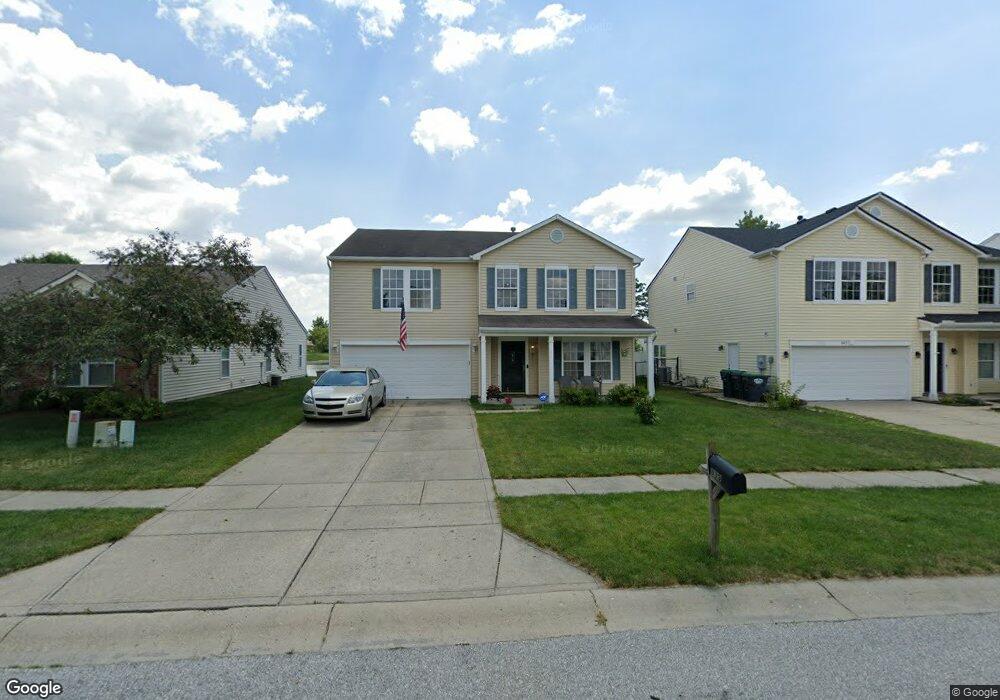
839 Sylvan St Whiteland, IN 46184
Estimated Value: $301,000 - $310,415
3
Beds
3
Baths
2,606
Sq Ft
$117/Sq Ft
Est. Value
About This Home
This home is located at 839 Sylvan St, Whiteland, IN 46184 and is currently estimated at $304,854, approximately $116 per square foot. 839 Sylvan St is a home located in Johnson County with nearby schools including Pleasant Crossing Elementary School, Clark-Pleasant Middle School, and Whiteland Community High School.
Ownership History
Date
Name
Owned For
Owner Type
Purchase Details
Closed on
Aug 4, 2005
Sold by
C P Morgan Communities L P
Bought by
Collins Darrell L and Collins Yvonne
Current Estimated Value
Home Financials for this Owner
Home Financials are based on the most recent Mortgage that was taken out on this home.
Original Mortgage
$167,516
Outstanding Balance
$88,168
Interest Rate
5.69%
Estimated Equity
$216,686
Create a Home Valuation Report for This Property
The Home Valuation Report is an in-depth analysis detailing your home's value as well as a comparison with similar homes in the area
Home Values in the Area
Average Home Value in this Area
Purchase History
| Date | Buyer | Sale Price | Title Company |
|---|---|---|---|
| Collins Darrell L | -- | None Available |
Source: Public Records
Mortgage History
| Date | Status | Borrower | Loan Amount |
|---|---|---|---|
| Open | Collins Darrell L | $167,516 |
Source: Public Records
Tax History Compared to Growth
Tax History
| Year | Tax Paid | Tax Assessment Tax Assessment Total Assessment is a certain percentage of the fair market value that is determined by local assessors to be the total taxable value of land and additions on the property. | Land | Improvement |
|---|---|---|---|---|
| 2025 | $2,931 | $282,800 | $56,000 | $226,800 |
| 2024 | $2,931 | $280,200 | $56,000 | $224,200 |
| 2023 | $2,769 | $265,700 | $56,000 | $209,700 |
| 2022 | $2,388 | $229,500 | $29,900 | $199,600 |
| 2021 | $2,031 | $195,000 | $29,900 | $165,100 |
| 2020 | $1,786 | $170,800 | $29,900 | $140,900 |
| 2019 | $1,678 | $160,600 | $29,900 | $130,700 |
| 2018 | $1,553 | $155,000 | $16,100 | $138,900 |
| 2017 | $1,497 | $148,700 | $16,100 | $132,600 |
| 2016 | $1,462 | $146,200 | $16,100 | $130,100 |
| 2014 | $1,379 | $136,600 | $19,700 | $116,900 |
| 2013 | $1,379 | $137,900 | $19,700 | $118,200 |
Source: Public Records
Map
Nearby Homes
- 577 Stobus Dr
- 3142 Hurst St
- 2916 Lodgepole Dr
- 2545 Wildflower Ln
- 3196 Underwood Dr
- 2489 Wildflower Ln
- 767 Mountain Pine Dr
- 2400 Grand Fir Dr
- 700 Mountain Pine Dr
- 2357 Grand Fir Dr
- 2418 Ashton Ln
- 2284 Blossom Dr
- 814 Cherry Tree Ln
- 2277 Maple Stone Ln
- 389 Springfield Cir
- 0 W Worthsville Rd
- 955 Garrison Dr
- 1986 Mccormick Dr
- 920 Talbert Rd
- 1059 Cherry Tree Ln