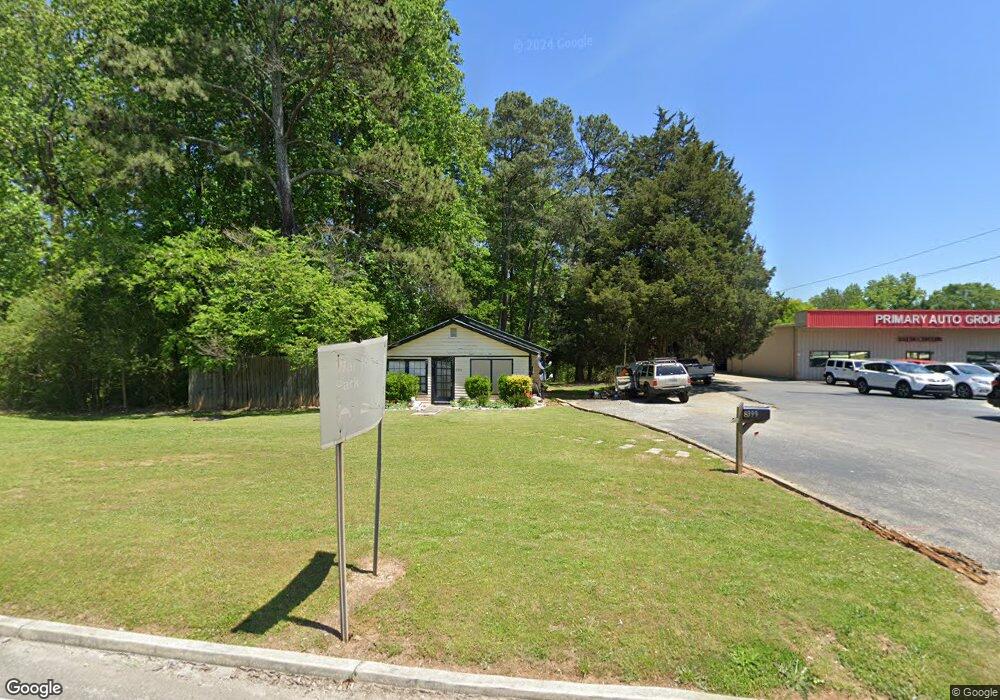
8399 Highway 53 E Dawsonville, GA 30534
Estimated Value: $343,000 - $516,000
3
Beds
1
Bath
1,640
Sq Ft
$239/Sq Ft
Est. Value
About This Home
This home is located at 8399 Highway 53 E, Dawsonville, GA 30534 and is currently estimated at $392,170, approximately $239 per square foot. 8399 Highway 53 E is a home located in Dawson County with nearby schools including Lumpkin County High School.
Ownership History
Date
Name
Owned For
Owner Type
Purchase Details
Closed on
Aug 14, 2018
Sold by
Husty Richard M
Bought by
Dipi Properties Llc
Current Estimated Value
Home Financials for this Owner
Home Financials are based on the most recent Mortgage that was taken out on this home.
Original Mortgage
$50,000
Interest Rate
4.5%
Mortgage Type
New Conventional
Purchase Details
Closed on
Nov 30, 2004
Sold by
Husty Richard M
Bought by
Husty Richard M and Husty Karen P
Purchase Details
Closed on
Nov 26, 1996
Sold by
Auld Land Syne Inc
Bought by
Husty Richard M
Purchase Details
Closed on
Jan 26, 1988
Sold by
Wilson Odell
Bought by
Auld Land Syne Inc
Purchase Details
Closed on
Jul 19, 1985
Sold by
Bennett Royce
Bought by
Wilson Odell
Purchase Details
Closed on
Sep 20, 1982
Bought by
Bennett Royce
Create a Home Valuation Report for This Property
The Home Valuation Report is an in-depth analysis detailing your home's value as well as a comparison with similar homes in the area
Home Values in the Area
Average Home Value in this Area
Purchase History
| Date | Buyer | Sale Price | Title Company |
|---|---|---|---|
| Dipi Properties Llc | $150,000 | -- | |
| Husty Richard M | -- | -- | |
| Husty Richard M | $97,500 | -- | |
| Auld Land Syne Inc | $58,000 | -- | |
| Wilson Odell | $40,000 | -- | |
| Bennett Royce | $16,000 | -- |
Source: Public Records
Mortgage History
| Date | Status | Borrower | Loan Amount |
|---|---|---|---|
| Closed | Dipi Properties Llc | $50,000 |
Source: Public Records
Tax History Compared to Growth
Tax History
| Year | Tax Paid | Tax Assessment Tax Assessment Total Assessment is a certain percentage of the fair market value that is determined by local assessors to be the total taxable value of land and additions on the property. | Land | Improvement |
|---|---|---|---|---|
| 2024 | $2,151 | $130,928 | $34,960 | $95,968 |
| 2023 | $2,129 | $131,848 | $33,800 | $98,048 |
| 2022 | $1,723 | $80,448 | $33,800 | $46,648 |
| 2021 | $1,644 | $72,648 | $33,800 | $38,848 |
| 2020 | $1,711 | $72,288 | $33,800 | $38,488 |
| 2019 | $1,432 | $68,659 | $33,800 | $34,859 |
| 2018 | $1,594 | $66,653 | $33,800 | $32,853 |
| 2017 | $1,594 | $66,653 | $33,800 | $32,853 |
| 2016 | $1,539 | $64,330 | $33,800 | $30,530 |
| 2015 | $1,392 | $56,387 | $31,096 | $25,291 |
| 2014 | $1,308 | $51,344 | $28,730 | $22,614 |
| 2013 | -- | $42,636 | $23,660 | $18,976 |
Source: Public Records
Map
Nearby Homes
- 0 Rider Rd Unit 10408283
- 0 Rider Rd Unit 7481902
- 120 Kings Crossing Dr
- 382 Candler Ln
- 27 Bryn Ct
- 771 Rattlesnake Ridge
- 50 Hannahs Ct
- 23 Morgan Ln
- 3050 Burt Creek Rd
- 114 Morgan Ln
- 136 Morgan Ln
- 174 Morgan Ln
- 437 Morgan Ln
- 460 Morgan Ln
- 0x Pink Williams Rd Unit 124AC
- 0x Pink Williams Rd
- 387 Gold Bullion Dr E
- 66 Patriot Trail
- 8399 Dawsonville Hwy Unit 5
- 8399 Dawsonville Hwy
- 8397 Dawsonville Hwy Unit 4
- 8397 Dawsonville Hwy
- 8493 Dawsonville Hwy
- 8359 Dawsonville Hwy
- 8495 Dawsonville Hwy
- 8497 Dawsonville Hwy
- 8327 Dawsonville Hwy
- 8262 Dawsonville Hwy
- 18 Blueberry Ln
- 37 Burtsboro Path
- 0 C G Dr
- 17 Blueberry Ln
- 0 Blueberry Ln Unit 3263472
- 0 Blueberry Ln
- 69 Blueberry Ln
- 44 Burtsboro Path
- 8514 Dawsonville Hwy
- 99 Blueberry Ln