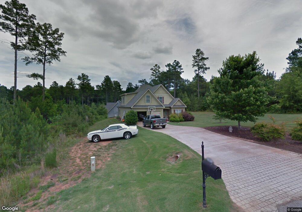
84 Coyote Dr Danielsville, GA 30633
Estimated Value: $321,510 - $365,000
3
Beds
3
Baths
1,846
Sq Ft
$188/Sq Ft
Est. Value
About This Home
This home is located at 84 Coyote Dr, Danielsville, GA 30633 and is currently estimated at $347,628, approximately $188 per square foot. 84 Coyote Dr is a home located in Madison County with nearby schools including Madison County High School and Union Christian Academy.
Ownership History
Date
Name
Owned For
Owner Type
Purchase Details
Closed on
Feb 26, 2010
Sold by
Couch Construction Inc
Bought by
Barber Joley Christal
Current Estimated Value
Home Financials for this Owner
Home Financials are based on the most recent Mortgage that was taken out on this home.
Original Mortgage
$125,681
Outstanding Balance
$84,415
Interest Rate
5.25%
Mortgage Type
FHA
Estimated Equity
$263,213
Create a Home Valuation Report for This Property
The Home Valuation Report is an in-depth analysis detailing your home's value as well as a comparison with similar homes in the area
Home Values in the Area
Average Home Value in this Area
Purchase History
| Date | Buyer | Sale Price | Title Company |
|---|---|---|---|
| Barber Joley Christal | $128,000 | -- |
Source: Public Records
Mortgage History
| Date | Status | Borrower | Loan Amount |
|---|---|---|---|
| Open | Barber Joley Christal | $125,681 |
Source: Public Records
Tax History Compared to Growth
Tax History
| Year | Tax Paid | Tax Assessment Tax Assessment Total Assessment is a certain percentage of the fair market value that is determined by local assessors to be the total taxable value of land and additions on the property. | Land | Improvement |
|---|---|---|---|---|
| 2024 | $2,706 | $105,986 | $15,200 | $90,786 |
| 2023 | $3,054 | $100,052 | $15,200 | $84,852 |
| 2022 | $2,413 | $89,488 | $15,200 | $74,288 |
| 2021 | $2,362 | $79,360 | $16,000 | $63,360 |
| 2020 | $2,378 | $79,360 | $16,000 | $63,360 |
| 2019 | $2,254 | $74,470 | $4,000 | $70,470 |
| 2018 | $2,186 | $72,103 | $4,000 | $68,103 |
| 2017 | $2,111 | $73,312 | $4,000 | $69,312 |
| 2016 | $1,741 | $62,637 | $4,000 | $58,637 |
| 2015 | $1,489 | $53,841 | $4,000 | $49,841 |
| 2014 | $1,499 | $53,874 | $4,000 | $49,874 |
| 2013 | -- | $54,006 | $10,000 | $44,006 |
Source: Public Records
Map
Nearby Homes
- 135 Woodpecker Point
- 135 Woodpecker Pte
- 0 Highway 29 N Unit 10525658
- 0 Brewer Phillips Rd Unit 10462348
- 0 New Haven Church Rd Unit CL334534
- 0 New Haven Church Rd Unit 10566118
- 0 New Haven Church Rd Unit CL334526
- 0 New Haven Church Rd Unit 10566119
- 28 Acres Irvin Kirk Rd
- 4274 Highway 98 W
- 155 Mulberry Ln
- 170 Northridge Dr
- 112 Northridge Dr Unit 8
- 112 Northridge Dr
- 150 Northridge Dr Unit 3
- 150 Northridge Dr
- 140 Northridge Dr
- 140 Northridge Dr Unit 6
- 96 Northridge Dr Unit 10
- 96 Northridge Dr
- 84 Woodpecker Point
- 84 Woodpecker Point
- 390 Woodpecker Point
- 0 Coyote River Unit 8194329
- 0 Coyote River Unit 8102800
- 390 Woodpecker Pointe
- 335 Woodpecker Point
- 145 Woodpecker Point
- 165 Woodpecker Point
- 95 Coyote Dr
- 303 Woodpecker Point
- 355 Woodpecker Point
- 355 Woodpecker Point
- 1 Coyote Dr
- 83 Coyote Dr
- 386 Rogers Mill Rd
- 398 Woodpecker Point
- 398 Woodpecker Point
- 373 Woodpecker Point
- 373 Woodpecker Point