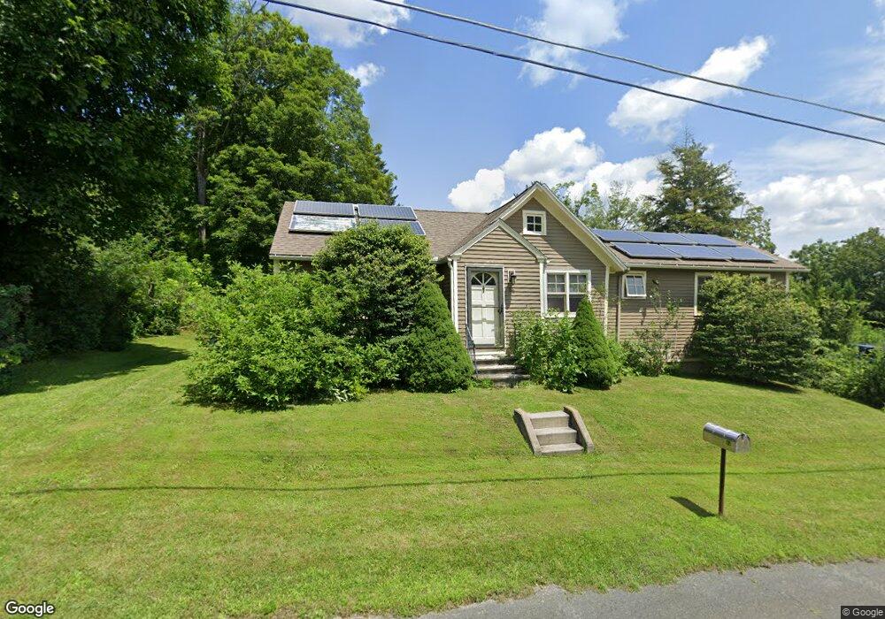
84 Cummings Ave Pittsfield, MA 01201
Estimated Value: $330,000 - $420,000
3
Beds
2
Baths
1,832
Sq Ft
$204/Sq Ft
Est. Value
About This Home
This home is located at 84 Cummings Ave, Pittsfield, MA 01201 and is currently estimated at $374,179, approximately $204 per square foot. 84 Cummings Ave is a home located in Berkshire County with nearby schools including Williams Elementary School, Theodore Herberg Middle School, and Pittsfield High School.
Ownership History
Date
Name
Owned For
Owner Type
Purchase Details
Closed on
Jul 28, 2000
Sold by
Maturevi Carol Ann Col and Maturevic Carol Colaba
Bought by
Webster Matthew C and Fitzpatrick Lynn A
Current Estimated Value
Home Financials for this Owner
Home Financials are based on the most recent Mortgage that was taken out on this home.
Original Mortgage
$34,800
Interest Rate
8.18%
Mortgage Type
Purchase Money Mortgage
Create a Home Valuation Report for This Property
The Home Valuation Report is an in-depth analysis detailing your home's value as well as a comparison with similar homes in the area
Home Values in the Area
Average Home Value in this Area
Purchase History
| Date | Buyer | Sale Price | Title Company |
|---|---|---|---|
| Webster Matthew C | $43,500 | -- | |
| Webster Matthew C | $43,500 | -- |
Source: Public Records
Mortgage History
| Date | Status | Borrower | Loan Amount |
|---|---|---|---|
| Open | Webster Matthew C | $96,000 | |
| Closed | Webster Matthew C | $33,000 | |
| Closed | Webster Matthew C | $34,800 |
Source: Public Records
Tax History
| Year | Tax Paid | Tax Assessment Tax Assessment Total Assessment is a certain percentage of the fair market value that is determined by local assessors to be the total taxable value of land and additions on the property. | Land | Improvement |
|---|---|---|---|---|
| 2025 | $4,637 | $258,500 | $81,400 | $177,100 |
| 2024 | $4,336 | $235,000 | $81,400 | $153,600 |
| 2023 | $4,052 | $221,200 | $81,400 | $139,800 |
| 2022 | $3,582 | $193,000 | $71,400 | $121,600 |
| 2021 | $3,367 | $174,900 | $71,400 | $103,500 |
| 2020 | $3,022 | $153,300 | $53,400 | $99,900 |
| 2019 | $2,909 | $149,800 | $53,400 | $96,400 |
| 2018 | $2,925 | $146,200 | $53,400 | $92,800 |
| 2017 | $2,764 | $140,800 | $51,400 | $89,400 |
| 2016 | $2,647 | $141,100 | $51,400 | $89,700 |
| 2015 | $2,548 | $141,100 | $51,400 | $89,700 |
Source: Public Records
Map
Nearby Homes
- 6 Vine St
- 1070 Holmes Rd
- 35 Chapman Rd
- 874 East St
- 103 Alpine Trail
- 405 Pittsfield Rd Unit A-6
- 25 Alpine Trail Unit 6-A
- 2 New Lenox Rd
- 82 Quirico Dr
- 7 Rolling Hills Unit 7-1
- 612 E New Lenox Rd
- 349 New Lenox Rd
- 514 South St
- 551 Tamarack Rd
- 249 Pittsfield Rd
- 103 Gravesleigh Terrace
- 93 Gravesleigh Terrace
- 221 Holmes Rd
- 117 Lime Kiln Rd
- 261 Pomeroy Ave
Your Personal Tour Guide
Ask me questions while you tour the home.