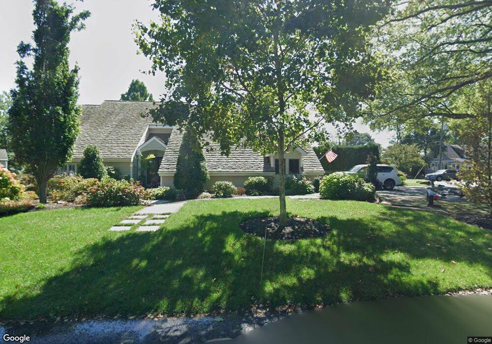
84 Elinore Place Oceanport, NJ 07757
Estimated Value: $968,000 - $1,141,111
4
Beds
3
Baths
2,386
Sq Ft
$444/Sq Ft
Est. Value
About This Home
This home is located at 84 Elinore Place, Oceanport, NJ 07757 and is currently estimated at $1,060,028, approximately $444 per square foot. 84 Elinore Place is a home located in Monmouth County with nearby schools including Wolf Hill Elementary School, Maple Place Elementary and Middle School, and Shore Regional High School.
Ownership History
Date
Name
Owned For
Owner Type
Purchase Details
Closed on
Jan 22, 2001
Sold by
Bankers Trust
Bought by
Cole Lisa and Michael Cole
Current Estimated Value
Create a Home Valuation Report for This Property
The Home Valuation Report is an in-depth analysis detailing your home's value as well as a comparison with similar homes in the area
Home Values in the Area
Average Home Value in this Area
Purchase History
| Date | Buyer | Sale Price | Title Company |
|---|---|---|---|
| Cole Lisa | $202,841 | -- |
Source: Public Records
Tax History Compared to Growth
Tax History
| Year | Tax Paid | Tax Assessment Tax Assessment Total Assessment is a certain percentage of the fair market value that is determined by local assessors to be the total taxable value of land and additions on the property. | Land | Improvement |
|---|---|---|---|---|
| 2025 | $12,659 | $856,000 | $394,200 | $461,800 |
| 2024 | $12,898 | $801,700 | $360,000 | $441,700 |
| 2023 | $12,898 | $775,100 | $355,500 | $419,600 |
| 2022 | $12,095 | $679,900 | $310,500 | $369,400 |
| 2021 | $12,095 | $634,900 | $283,500 | $351,400 |
| 2020 | $11,215 | $613,500 | $268,200 | $345,300 |
| 2019 | $10,671 | $592,500 | $259,200 | $333,300 |
| 2018 | $10,528 | $588,500 | $259,200 | $329,300 |
| 2017 | $10,927 | $506,600 | $154,400 | $352,200 |
| 2016 | $10,848 | $506,200 | $160,700 | $345,500 |
| 2015 | $10,314 | $497,300 | $160,700 | $336,600 |
| 2014 | $9,579 | $468,400 | $169,700 | $298,700 |
Source: Public Records
Map
Nearby Homes
- 15 Signal Ave
- 24 Baruch Dr
- 580 Patten Ave Unit 47
- 580 Patten Ave Unit 48
- 580 Patten Ave Unit 62
- 580 Patten Ave Unit 86
- 177 Kingsley St
- 392 Florence Ave
- 165 Kingsley St
- 13 Bayview Ct
- 164 Airsdale Ave
- 16 Shore Dr
- 13 Morris Place
- 27 Ithaca Ave
- 154 Atlantic Ave
- 323 Florence Ave
- 222 Coleman Ave
- 190 Spruce St Unit 4
- 165 Riddle Ave Unit 7
- 211 Rockwell Ave
- 92 Herbert Place
- 90 Werah Place
- 87 Elinore Place
- 36 Winhar Place
- 93 Elinore Place
- 92 Werah Place
- 89 Herbert Place
- 84 Comanche Dr
- 23 Winhar Place
- 88 Comanche Dr
- 93 Herbert Place
- 76 Werah Place
- 96 Werah Place
- 98 Herbert Place
- 77 Werah Place
- 78 Comanche Dr
- 81 Manitto Place
- 15 Winhar Place
- 83 Herbert Place
- 107 Smith St