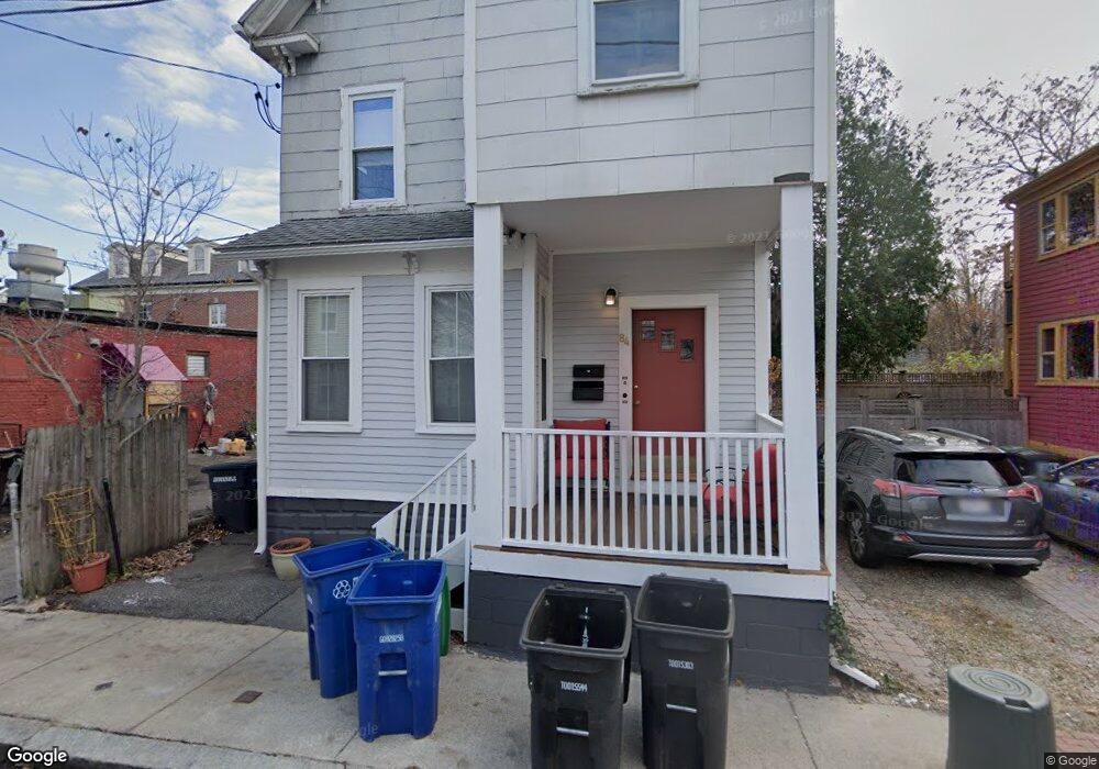
84 Eustis St Somerville, MA 02143
Porter Square NeighborhoodEstimated Value: $1,012,000 - $1,190,767
3
Beds
2
Baths
1,471
Sq Ft
$747/Sq Ft
Est. Value
About This Home
This home is located at 84 Eustis St, Somerville, MA 02143 and is currently estimated at $1,099,192, approximately $747 per square foot. 84 Eustis St is a home located in Middlesex County with nearby schools including Somerville High School, Saint Theresa School, and St Peter School.
Ownership History
Date
Name
Owned For
Owner Type
Purchase Details
Closed on
Apr 3, 2018
Sold by
August David and Wilson Amy B
Bought by
84 Eustis Llc
Current Estimated Value
Purchase Details
Closed on
Nov 5, 1997
Sold by
August William and August Barbara L
Bought by
August David and Wilson Amy B
Purchase Details
Closed on
Nov 4, 1987
Sold by
Jones Eleanor
Bought by
August William
Home Financials for this Owner
Home Financials are based on the most recent Mortgage that was taken out on this home.
Original Mortgage
$100,000
Interest Rate
10.97%
Mortgage Type
Purchase Money Mortgage
Create a Home Valuation Report for This Property
The Home Valuation Report is an in-depth analysis detailing your home's value as well as a comparison with similar homes in the area
Home Values in the Area
Average Home Value in this Area
Purchase History
| Date | Buyer | Sale Price | Title Company |
|---|---|---|---|
| 84 Eustis Llc | -- | -- | |
| August David | $83,500 | -- | |
| August William | $127,500 | -- |
Source: Public Records
Mortgage History
| Date | Status | Borrower | Loan Amount |
|---|---|---|---|
| Previous Owner | August William | $126,000 | |
| Previous Owner | August William | $100,000 |
Source: Public Records
Tax History
| Year | Tax Paid | Tax Assessment Tax Assessment Total Assessment is a certain percentage of the fair market value that is determined by local assessors to be the total taxable value of land and additions on the property. | Land | Improvement |
|---|---|---|---|---|
| 2025 | $9,528 | $873,300 | $594,600 | $278,700 |
| 2024 | $9,136 | $868,400 | $594,600 | $273,800 |
| 2023 | $8,786 | $849,700 | $594,600 | $255,100 |
| 2022 | $8,261 | $811,500 | $566,300 | $245,200 |
| 2021 | $7,854 | $770,800 | $539,300 | $231,500 |
| 2020 | $7,430 | $736,400 | $518,600 | $217,800 |
| 2019 | $6,601 | $613,500 | $440,400 | $173,100 |
| 2018 | $6,037 | $533,800 | $400,400 | $133,400 |
| 2017 | $5,655 | $484,600 | $362,600 | $122,000 |
| 2016 | $6,081 | $485,300 | $356,400 | $128,900 |
| 2015 | $5,741 | $455,300 | $328,700 | $126,600 |
Source: Public Records
Map
Nearby Homes
- 309 Beacon St
- 260 Beacon St Unit 201
- 334 Beacon St Unit B
- 57 Gorham St Unit 1
- 8 Craigie St
- 35 Ibbetson St
- 74 Oxford St
- 74 Oxford St Unit 3
- 72 Oxford St Unit 72
- 72 Oxford St
- 42 Belmont St
- 555 Somerville Ave Unit 2
- 43 Park St Unit 18
- 33 Everett St
- 20 Mossland St
- 17 Monmouth St
- 1619 Massachusetts Ave Unit 37
- 3 Arlington St Unit 44
- 125 Lowell St Unit 603
- 125 Lowell St Unit 3B
- 84 Eustis St Unit 2
- 80 Eustis St
- 292 Beacon St Unit 292
- 292 Beacon St Unit 1
- 292 Beacon St Unit 2
- 292 Beacon St Unit 4
- 292 Beacon St Unit B
- 292 Beacon St
- 292 Beacon St Unit 1,2
- 292 Beacon St
- 296-298 Beacon St
- 296-298 Beacon St Unit 1
- 81 Eustis St
- 294 Beacon St Unit 4
- 294 Beacon St Unit 5
- 294 Beacon St Unit 3
- 294 Beacon St Unit PH4
- 294 Beacon St Unit PH5
- 294 Beacon St Unit 2
- 294 Beacon St Unit 1A
Your Personal Tour Guide
Ask me questions while you tour the home.