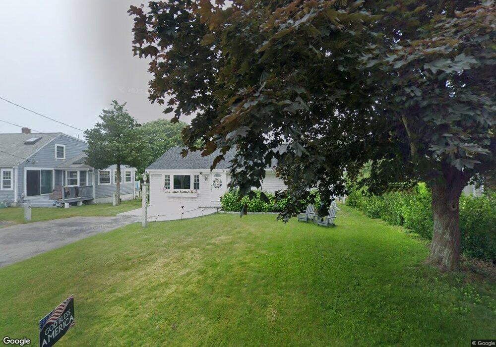
84 Gilder Rd Buzzards Bay, MA 02532
Estimated Value: $609,000 - $956,000
3
Beds
2
Baths
1,042
Sq Ft
$751/Sq Ft
Est. Value
About This Home
This home is located at 84 Gilder Rd, Buzzards Bay, MA 02532 and is currently estimated at $782,185, approximately $750 per square foot. 84 Gilder Rd is a home located in Barnstable County with nearby schools including Bourne High School, St Margaret Regional School, and Cadence Academy Preschool - Bourne.
Ownership History
Date
Name
Owned For
Owner Type
Purchase Details
Closed on
Oct 19, 2015
Sold by
Winters Edward F and Winters Pamela J
Bought by
Lubao Barry and Lubao Barbara
Current Estimated Value
Purchase Details
Closed on
Mar 13, 2009
Sold by
Walton Marie T and Mackay Robert Kenneth
Bought by
Winters Pamela J and Winters Edward F
Home Financials for this Owner
Home Financials are based on the most recent Mortgage that was taken out on this home.
Original Mortgage
$312,000
Interest Rate
5.18%
Mortgage Type
Purchase Money Mortgage
Purchase Details
Closed on
Dec 22, 1993
Sold by
Gaines Viva P
Bought by
Mackay Robert K
Create a Home Valuation Report for This Property
The Home Valuation Report is an in-depth analysis detailing your home's value as well as a comparison with similar homes in the area
Purchase History
We collect this data history from publicly available records. To have your information removed, we recommend requesting removal directly through your county’s website.
| Date | Buyer | Sale Price | Title Company |
|---|---|---|---|
| Lubao Barry | $398,000 | -- | |
| Lubao Barry | $398,000 | -- | |
| Winters Pamela J | -- | -- | |
| Winters Pamela J | $390,000 | -- | |
| Winters Pamela J | -- | -- | |
| Mackay Robert K | $137,500 | -- | |
| Mackay Robert K | $137,500 | -- |
Source: Public Records
Mortgage History
We collect this data history from publicly available records. To have your information removed, we recommend requesting removal directly through your county’s website.
| Date | Status | Borrower | Loan Amount |
|---|---|---|---|
| Previous Owner | Mackay Robert K | $305,000 | |
| Previous Owner | Mackay Robert K | $310,000 | |
| Previous Owner | Winters Pamela J | $312,000 | |
| Previous Owner | Mackay Robert K | $0 |
Source: Public Records
Tax History
| Year | Tax Paid | Tax Assessment Tax Assessment Total Assessment is a certain percentage of the fair market value that is determined by local assessors to be the total taxable value of land and additions on the property. | Land | Improvement |
|---|---|---|---|---|
| 2025 | $4,867 | $623,200 | $381,300 | $241,900 |
| 2024 | $4,759 | $593,400 | $363,100 | $230,300 |
| 2023 | $4,464 | $506,700 | $321,400 | $185,300 |
| 2022 | $4,353 | $431,400 | $284,400 | $147,000 |
| 2021 | $4,229 | $392,700 | $258,800 | $133,900 |
| 2020 | $4,122 | $383,800 | $256,400 | $127,400 |
| 2019 | $3,959 | $376,700 | $256,400 | $120,300 |
| 2018 | $3,719 | $352,800 | $244,200 | $108,600 |
| 2017 | $3,939 | $382,400 | $274,900 | $107,500 |
| 2016 | $3,530 | $347,400 | $274,900 | $72,500 |
| 2015 | $3,498 | $347,400 | $274,900 | $72,500 |
Source: Public Records
Map
Nearby Homes
- 4 Cross Rd
- 35 Benedict Rd
- 5 Bell Rd
- 151 - 153 Main St
- 34 Washington Ave
- 26 Wilson Ave
- 0 Holt Rd
- 46 Holt Rd Unit A
- 4 Van Bummel Rd
- 13 Harrison Ave
- 8 Pine Tree Dr
- 10 Harrison Ave Unit 2
- 10 Harrison Ave Unit 3
- 10 Harrison Ave Unit 4
- 10 Harrison Ave Unit 1
- 56 Rip Van Winkle Way
- 69 County Rd
- 49 Onset Ave
- 57 Onset Ave
- 17 Old Colony Ave
Your Personal Tour Guide
Ask me questions while you tour the home.