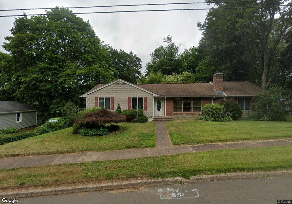
84 Hampton Rd Hamden, CT 06518
Estimated Value: $411,000 - $474,000
3
Beds
3
Baths
1,798
Sq Ft
$242/Sq Ft
Est. Value
About This Home
This home is located at 84 Hampton Rd, Hamden, CT 06518 and is currently estimated at $435,379, approximately $242 per square foot. 84 Hampton Rd is a home located in New Haven County with nearby schools including Hamden Middle School, Hamden High School, and Alphabet Academy - Hamden North Campus.
Ownership History
Date
Name
Owned For
Owner Type
Purchase Details
Closed on
Jun 4, 1999
Sold by
Amato Carl S
Bought by
Pate David K
Current Estimated Value
Home Financials for this Owner
Home Financials are based on the most recent Mortgage that was taken out on this home.
Original Mortgage
$152,000
Interest Rate
6.85%
Mortgage Type
Purchase Money Mortgage
Purchase Details
Closed on
Jan 19, 1993
Sold by
Vennero Joseph S and Vennero Norine
Bought by
Amato Carl S
Create a Home Valuation Report for This Property
The Home Valuation Report is an in-depth analysis detailing your home's value as well as a comparison with similar homes in the area
Home Values in the Area
Average Home Value in this Area
Purchase History
| Date | Buyer | Sale Price | Title Company |
|---|---|---|---|
| Pate David K | $160,000 | -- | |
| Amato Carl S | $131,000 | -- |
Source: Public Records
Mortgage History
| Date | Status | Borrower | Loan Amount |
|---|---|---|---|
| Closed | Amato Carl S | $232,000 | |
| Closed | Amato Carl S | $35,000 | |
| Closed | Amato Carl S | $202,500 | |
| Closed | Amato Carl S | $152,000 |
Source: Public Records
Tax History
| Year | Tax Paid | Tax Assessment Tax Assessment Total Assessment is a certain percentage of the fair market value that is determined by local assessors to be the total taxable value of land and additions on the property. | Land | Improvement |
|---|---|---|---|---|
| 2025 | $13,553 | $261,240 | $68,950 | $192,290 |
| 2024 | $9,934 | $178,640 | $47,600 | $131,040 |
| 2023 | $10,072 | $178,640 | $47,600 | $131,040 |
| 2022 | $9,911 | $178,640 | $47,600 | $131,040 |
| 2021 | $9,368 | $178,640 | $47,600 | $131,040 |
| 2020 | $8,620 | $165,830 | $73,220 | $92,610 |
| 2019 | $8,102 | $165,830 | $73,220 | $92,610 |
| 2018 | $7,953 | $165,830 | $73,220 | $92,610 |
| 2017 | $7,505 | $165,830 | $73,220 | $92,610 |
| 2016 | $7,522 | $165,830 | $73,220 | $92,610 |
| 2015 | $7,338 | $179,550 | $74,620 | $104,930 |
| 2014 | $7,169 | $179,550 | $74,620 | $104,930 |
Source: Public Records
Map
Nearby Homes
- 25 Hamden Hills Dr Unit 69
- 18 Day Spring Ave
- 51 Evergreen Ave
- 142 Washington Ave
- 55 Forest St
- 2831 Dixwell Ave
- 114 Colony St
- 75 Washington Ave Unit 7-106
- 75 Washington Ave Unit 2-402
- 75 Washington Ave Unit 6-406
- 75 Washington Ave Unit 5-104
- 75 Washington Ave Unit 8-403
- 46 Forest Ct N
- 80 Flower Dr
- 93 Cannon St
- 18 Anns Farm Rd
- 175 Mill Pond Rd Unit 106
- 2838 Whitney Ave Unit 2
- 93 Centerbrook Rd
- 147 Centerbrook Rd
- 72 Hampton Rd
- 96 Hampton Rd
- 20 Brenton Terrace
- 154 Brentwood Dr
- 164 Brentwood Dr
- 146 Brentwood Dr
- 79 Hampton Rd
- 4 Brenton Terrace
- 89 Hampton Rd
- 138 Brentwood Dr
- 69 Hampton Rd
- 130 Vernon St
- 25 Brenton Terrace
- 15 Brenton Terrace
- 33 Brenton Terrace
- 98 Hampton Rd
- 59 Hampton Rd
- 5 Brenton Terrace
- 165 Brentwood Dr
- 112 Highland Ave
Your Personal Tour Guide
Ask me questions while you tour the home.