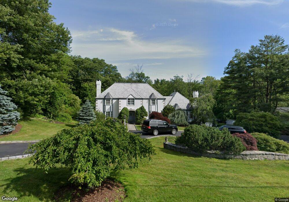
84 Lynam Rd Stamford, CT 06903
North Stamford NeighborhoodEstimated Value: $1,776,000 - $1,998,000
5
Beds
4
Baths
5,926
Sq Ft
$312/Sq Ft
Est. Value
About This Home
This home is located at 84 Lynam Rd, Stamford, CT 06903 and is currently estimated at $1,850,347, approximately $312 per square foot. 84 Lynam Rd is a home located in Fairfield County with nearby schools including Roxbury School, Cloonan School, and Westhill High School.
Ownership History
Date
Name
Owned For
Owner Type
Purchase Details
Closed on
Jan 22, 2008
Sold by
Matura Robert J
Bought by
Danc Jaroslav and Ondicova Daniela
Current Estimated Value
Home Financials for this Owner
Home Financials are based on the most recent Mortgage that was taken out on this home.
Original Mortgage
$949,000
Outstanding Balance
$594,643
Interest Rate
6.02%
Estimated Equity
$1,255,704
Create a Home Valuation Report for This Property
The Home Valuation Report is an in-depth analysis detailing your home's value as well as a comparison with similar homes in the area
Home Values in the Area
Average Home Value in this Area
Purchase History
| Date | Buyer | Sale Price | Title Company |
|---|---|---|---|
| Danc Jaroslav | $1,460,000 | -- |
Source: Public Records
Mortgage History
| Date | Status | Borrower | Loan Amount |
|---|---|---|---|
| Open | Danc Jaroslav | $949,000 | |
| Previous Owner | Danc Jaroslav | $141,660 | |
| Previous Owner | Danc Jaroslav | $150,000 |
Source: Public Records
Tax History Compared to Growth
Tax History
| Year | Tax Paid | Tax Assessment Tax Assessment Total Assessment is a certain percentage of the fair market value that is determined by local assessors to be the total taxable value of land and additions on the property. | Land | Improvement |
|---|---|---|---|---|
| 2025 | $22,398 | $962,530 | $267,060 | $695,470 |
| 2024 | $21,907 | $962,530 | $267,060 | $695,470 |
| 2023 | $23,543 | $962,530 | $267,060 | $695,470 |
| 2022 | $20,550 | $780,470 | $201,940 | $578,530 |
| 2021 | $20,269 | $780,470 | $201,940 | $578,530 |
| 2020 | $19,769 | $780,470 | $201,940 | $578,530 |
| 2019 | $19,769 | $780,470 | $201,940 | $578,530 |
| 2018 | $19,082 | $780,470 | $201,940 | $578,530 |
| 2017 | $19,130 | $747,540 | $185,110 | $562,430 |
| 2016 | $18,554 | $747,540 | $185,110 | $562,430 |
| 2015 | $18,046 | $747,540 | $185,110 | $562,430 |
| 2014 | $17,425 | $747,540 | $185,110 | $562,430 |
Source: Public Records
Map
Nearby Homes
- 107 Deepwood Rd
- 164 Janes Ln
- 210 Red Fox Rd
- 400 Wire Mill Rd
- 65 Malibu Rd
- 30 Partridge Rd
- 60 Redmont Rd
- 160 Wire Mill Rd
- 88 Rockridge Ln
- 368 Den Rd
- 494 Sawmill Rd
- 185 Haviland Rd
- 25 Mill Stone Cir
- 38 Lancaster Place
- 7 the Reserve at Sterling Ridge
- 271 Hunting Ridge Rd
- 180 Riverbank Rd
- 27 Wellington Dr
- 295 Haviland Rd
- 56 Bradley Place