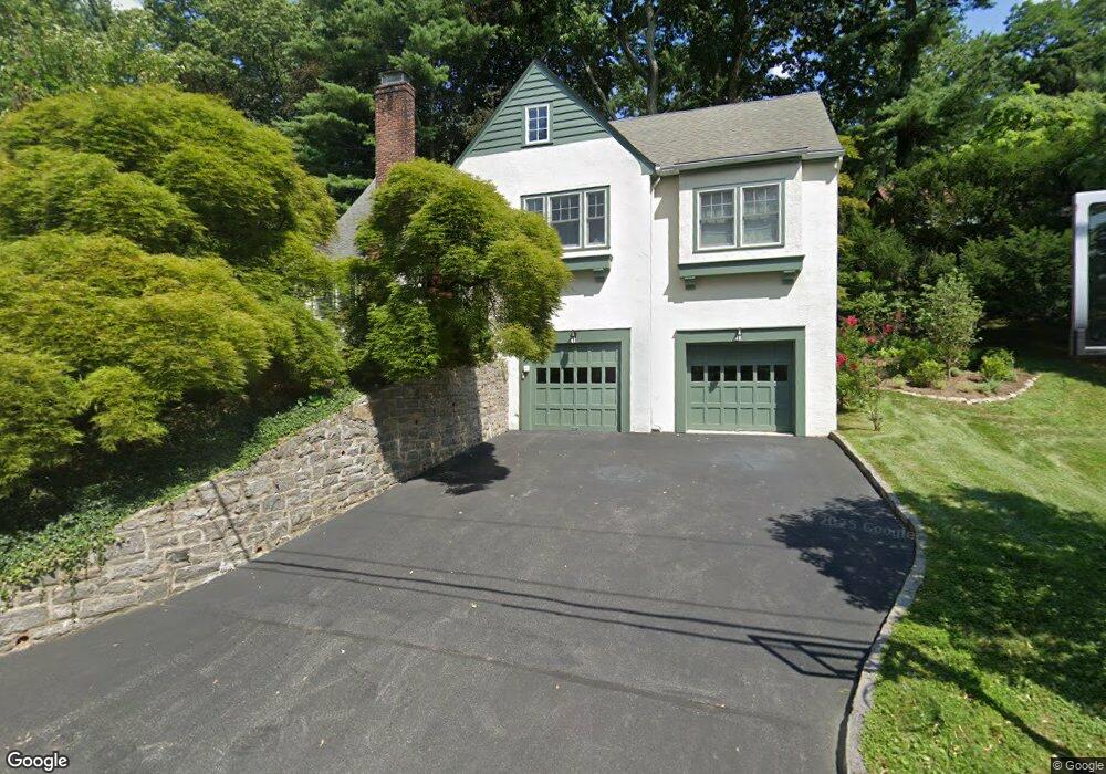
84 Magnolia Dr Dobbs Ferry, NY 10522
Estimated Value: $1,390,000 - $1,548,000
4
Beds
2
Baths
1,980
Sq Ft
$748/Sq Ft
Est. Value
About This Home
This home is located at 84 Magnolia Dr, Dobbs Ferry, NY 10522 and is currently estimated at $1,480,810, approximately $747 per square foot. 84 Magnolia Dr is a home located in Westchester County with nearby schools including Springhurst Elementary School, Dobbs Ferry High School, and The Masters School.
Ownership History
Date
Name
Owned For
Owner Type
Purchase Details
Closed on
Jan 11, 2006
Sold by
Dorne Richard and Dorne Margery R
Bought by
Rosenberg Matthew and Coolman Marie
Current Estimated Value
Home Financials for this Owner
Home Financials are based on the most recent Mortgage that was taken out on this home.
Original Mortgage
$250,000
Interest Rate
6.34%
Mortgage Type
Fannie Mae Freddie Mac
Create a Home Valuation Report for This Property
The Home Valuation Report is an in-depth analysis detailing your home's value as well as a comparison with similar homes in the area
Home Values in the Area
Average Home Value in this Area
Purchase History
| Date | Buyer | Sale Price | Title Company |
|---|---|---|---|
| Rosenberg Matthew | $855,000 | Fidelity National Title Insu |
Source: Public Records
Mortgage History
| Date | Status | Borrower | Loan Amount |
|---|---|---|---|
| Previous Owner | Rosenberg Matthew | $250,000 |
Source: Public Records
Tax History Compared to Growth
Tax History
| Year | Tax Paid | Tax Assessment Tax Assessment Total Assessment is a certain percentage of the fair market value that is determined by local assessors to be the total taxable value of land and additions on the property. | Land | Improvement |
|---|---|---|---|---|
| 2024 | $37,347 | $1,251,600 | $758,400 | $493,200 |
| 2023 | $36,016 | $1,192,300 | $632,000 | $560,300 |
| 2022 | $34,097 | $1,140,500 | $632,000 | $508,500 |
| 2021 | $36,630 | $1,036,800 | $632,000 | $404,800 |
| 2020 | $36,003 | $1,076,600 | $641,900 | $434,700 |
| 2019 | $34,679 | $1,076,600 | $641,900 | $434,700 |
| 2018 | $40,333 | $1,046,400 | $641,900 | $404,500 |
| 2017 | $4,571 | $1,046,400 | $641,900 | $404,500 |
| 2016 | $823,200 | $1,006,200 | $641,900 | $364,300 |
| 2015 | -- | $23,900 | $3,700 | $20,200 |
| 2014 | -- | $23,900 | $3,700 | $20,200 |
| 2013 | $20,005 | $23,900 | $3,700 | $20,200 |
Source: Public Records
Map
Nearby Homes
- 254 Palisade Ave
- 102 Broadway
- 78 Oliphant Ave
- 7 Ravine Dr
- 177 Clinton Ave
- 132 Edgars Ln
- 11 Fairlawn Ave
- 737 N Broadway Unit 2D
- 66 Summit Dr
- 38 Oliphant Ave Unit 6
- 33 Livingston Ave
- 15 Rayson Ln
- 40 Floral Dr
- 40 Main St
- 89 Main St
- 50 Chestnut St Unit 1
- 555 Broadway Unit 1H
- 84 Bellewood Ave
- 45 Main St Unit 2A
- 24 School St
- 72 Magnolia Dr
- 101 Bellair Dr
- 91 Bellair Dr
- 92 Magnolia Dr
- 248 Palisade Ave
- 111 Bellair Dr
- 260 Palisade Ave
- 9 Porter Place
- 268 Palisade Ave
- 96 Magnolia Dr
- 117 Bellair Dr
- 244 Palisade Ave
- 60 Magnolia Dr
- 96 Bellair Dr
- 108 Bellair Dr
- 276 Palisade Ave
- 80 Bellair Dr
- 234 Palisade Ave
- 43 N Driveway
- 114 Bellair Dr