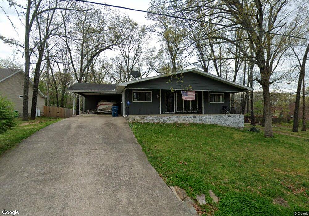
84 Melanie Dr Bella Vista, AR 72714
Estimated Value: $328,220 - $418,000
3
Beds
2
Baths
1,784
Sq Ft
$201/Sq Ft
Est. Value
About This Home
This home is located at 84 Melanie Dr, Bella Vista, AR 72714 and is currently estimated at $358,555, approximately $200 per square foot. 84 Melanie Dr is a home located in Benton County with nearby schools including Cooper Elementary School, Ruth Barker Middle School, and Washington Junior High School.
Ownership History
Date
Name
Owned For
Owner Type
Purchase Details
Closed on
Apr 22, 2025
Sold by
Entwisle Mark Todd
Bought by
Mark Todd Entwisle Living Trust and Entwisle
Current Estimated Value
Purchase Details
Closed on
Mar 2, 2009
Sold by
Regions Bank and Gasper Brigit
Bought by
Entwisle Mark T
Home Financials for this Owner
Home Financials are based on the most recent Mortgage that was taken out on this home.
Original Mortgage
$91,290
Interest Rate
5.06%
Mortgage Type
Purchase Money Mortgage
Purchase Details
Closed on
Sep 10, 2003
Bought by
Regions Bank
Purchase Details
Closed on
Aug 28, 2003
Bought by
Regions Bank
Purchase Details
Closed on
Sep 12, 1994
Bought by
Bethel Owens
Purchase Details
Closed on
Mar 19, 1994
Bought by
Dod 03-19-1994
Purchase Details
Closed on
Feb 12, 1993
Bought by
Owens Trust
Create a Home Valuation Report for This Property
The Home Valuation Report is an in-depth analysis detailing your home's value as well as a comparison with similar homes in the area
Home Values in the Area
Average Home Value in this Area
Purchase History
| Date | Buyer | Sale Price | Title Company |
|---|---|---|---|
| Mark Todd Entwisle Living Trust | -- | None Listed On Document | |
| Entwisle Mark T | $85,000 | None Available | |
| Regions Bank | -- | -- | |
| Regions Bank | -- | -- | |
| Bethel Owens | -- | -- | |
| Dod 03-19-1994 | -- | -- | |
| Owens Trust | -- | -- | |
| N | -- | -- |
Source: Public Records
Mortgage History
| Date | Status | Borrower | Loan Amount |
|---|---|---|---|
| Previous Owner | Entwisle Mark T | $91,290 |
Source: Public Records
Tax History Compared to Growth
Tax History
| Year | Tax Paid | Tax Assessment Tax Assessment Total Assessment is a certain percentage of the fair market value that is determined by local assessors to be the total taxable value of land and additions on the property. | Land | Improvement |
|---|---|---|---|---|
| 2025 | $1,945 | $54,130 | $1,600 | $52,530 |
| 2024 | $1,838 | $54,130 | $1,600 | $52,530 |
| 2023 | $1,750 | $34,940 | $800 | $34,140 |
| 2022 | $1,353 | $34,940 | $800 | $34,140 |
| 2021 | $1,271 | $34,940 | $800 | $34,140 |
| 2020 | $1,207 | $24,830 | $600 | $24,230 |
| 2019 | $1,207 | $24,830 | $600 | $24,230 |
| 2018 | $1,232 | $24,830 | $600 | $24,230 |
| 2017 | $1,133 | $24,830 | $600 | $24,230 |
| 2016 | $1,133 | $24,830 | $600 | $24,230 |
| 2015 | $1,389 | $23,040 | $1,000 | $22,040 |
| 2014 | $1,039 | $23,040 | $1,000 | $22,040 |
Source: Public Records
Map
Nearby Homes
- 75 Melanie Dr
- 40 Merritt Dr
- 41 Melanie Dr
- 63 Merritt Dr
- 20 Melanie Cir
- 10 Dillow Ln
- 14 Constance Cir
- 0 Nettle Ln
- 0 Rettendon Ln
- 16 Witherby Dr
- 127 Rillington Dr
- 22 Dillow Cir
- 3 Brougham Ln
- 29 Lunsford Ln
- 0 Allendale Dr
- 17 Duxford Cir
- Lot 10 of Block 6 Rillington Dr
- 0 Rillington Dr Unit 1316259
- 36 Headley Dr
- 9 Lunsford Ln