Estimated Value: $114,797 - $150,000
Studio
2
Baths
1,092
Sq Ft
$125/Sq Ft
Est. Value
About This Home
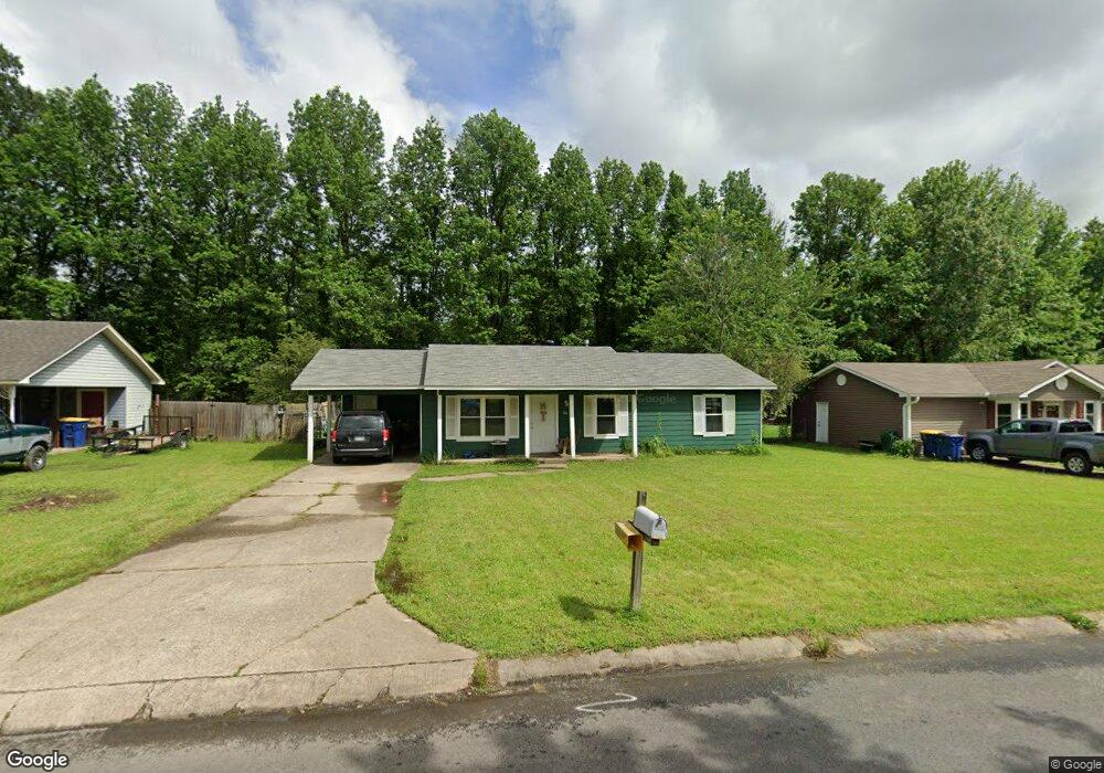
This home is located at 84 Pheasant Run Dr, Cabot, AR 72023 and is currently estimated at $136,199, approximately $124 per square foot. 84 Pheasant Run Dr is a home located in Lonoke County with nearby schools including Westside Elementary School, Cabot Junior High South, and Cabot Middle School South.
Ownership History
Date
Name
Owned For
Owner Type
Purchase Details
Closed on
Oct 16, 2007
Sold by
Deutsche Bank National Trust Company
Bought by
Rogers Sharon and Rogers Larry
Current Estimated Value
Purchase Details
Closed on
Sep 2, 2005
Bought by
Barnes
Purchase Details
Closed on
Nov 2, 2004
Bought by
Pickard Lynanne
Purchase Details
Closed on
Oct 4, 2004
Bought by
Pickard Lynanne
Purchase Details
Closed on
Jan 6, 2004
Bought by
Correct Legal
Purchase Details
Closed on
Sep 9, 2003
Bought by
Pickard and Pickard Wf
Purchase Details
Closed on
Aug 2, 1991
Bought by
Bryant and Wife Becky
Purchase Details
Closed on
Oct 8, 1987
Bought by
Westmoreland
Purchase Details
Closed on
Jun 12, 1987
Bought by
Camp
Create a Home Valuation Report for This Property
The Home Valuation Report is an in-depth analysis detailing your home's value as well as a comparison with similar homes in the area
Purchase History
| Date | Buyer | Sale Price | Title Company |
|---|---|---|---|
| Rogers Sharon | -- | -- | |
| Barnes | $80,000 | -- | |
| Pickard Lynanne | -- | -- | |
| Pickard Lynanne | -- | -- | |
| Correct Legal | $69,000 | -- | |
| Pickard | $69,000 | -- | |
| Bryant | $51,000 | -- | |
| Rogers | $50,000 | -- | |
| Westmoreland | $50,000 | -- | |
| Camp | $4,800 | -- |
Source: Public Records
Tax History
| Year | Tax Paid | Tax Assessment Tax Assessment Total Assessment is a certain percentage of the fair market value that is determined by local assessors to be the total taxable value of land and additions on the property. | Land | Improvement |
|---|---|---|---|---|
| 2025 | $660 | $12,960 | $2,000 | $10,960 |
| 2024 | $660 | $12,960 | $2,000 | $10,960 |
| 2023 | $660 | $12,960 | $2,000 | $10,960 |
| 2022 | $660 | $12,960 | $2,000 | $10,960 |
| 2021 | $660 | $12,960 | $2,000 | $10,960 |
| 2020 | $622 | $12,220 | $2,000 | $10,220 |
| 2019 | $622 | $12,220 | $2,000 | $10,220 |
| 2018 | $604 | $12,220 | $2,000 | $10,220 |
| 2017 | $561 | $12,220 | $2,000 | $10,220 |
| 2016 | $604 | $12,220 | $2,000 | $10,220 |
| 2015 | $695 | $14,060 | $2,000 | $12,060 |
| 2014 | $695 | $14,060 | $2,000 | $12,060 |
Source: Public Records
Map
Nearby Homes
- 20 Paige Ave
- 28 Pheasant Run Dr
- 92 Sycamore Cir
- 49 Oak Meadows Dr
- 00 Kerr Station Rd
- 37 Saint John St
- 34 Bent Tree Dr
- 51 Meadowlark Dr
- 12 Bellaire Dr
- 38 S 10th St
- 30 Mcarthur Dr
- 16 Meadowlark Dr
- 22 Century Cir
- 64 Saint John St
- 115 Rodney Guthrie Dr
- 19 Trinity Dr
- 2213 S 2nd St
- 37 Pond St
- 30 Park Cir
- 39 Nevada Ln
- 86 Pheasant Run Dr
- 82 Pheasant Run Dr
- 88 Pheasant Run Dr
- 80 Pheasant Run Dr
- 73 Pheasant Run Dr
- 75 Pheasant Run Dr
- 71 Pheasant Run Dr
- 77 Pheasant Run Dr
- 90 Pheasant Run Dr
- 69 Pheasant Run Dr
- 79 Pheasant Run Dr
- 78 Pheasant Run Dr
- 42 Paige Ave
- 40 Paige Ave
- 67 Pheasant Run Dr
- 92 Pheasant Run Dr
- 76 Pheasant Run Dr
- 44 Paige Ave
- 36 Paige Ave
- 46 Paige Ave
Your Personal Tour Guide
Ask me questions while you tour the home.