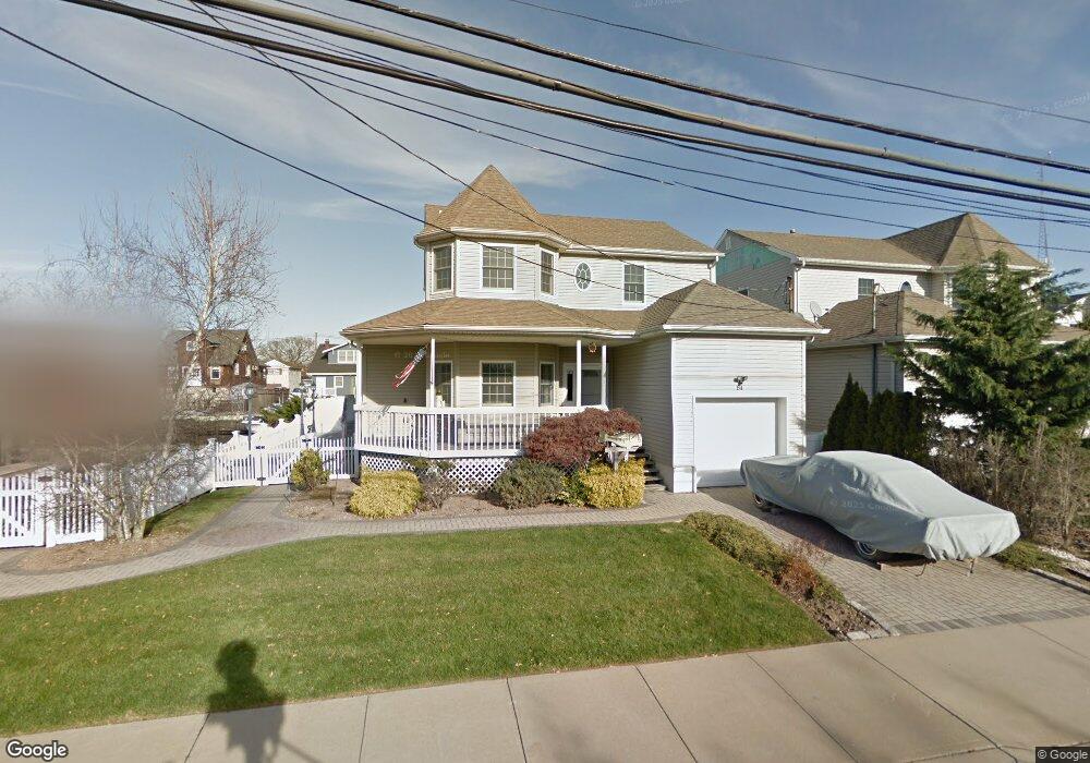
84 President St Freeport, NY 11520
Estimated Value: $746,927 - $823,000
--
Bed
3
Baths
1,792
Sq Ft
$438/Sq Ft
Est. Value
About This Home
This home is located at 84 President St, Freeport, NY 11520 and is currently estimated at $784,964, approximately $438 per square foot. 84 President St is a home located in Nassau County with nearby schools including Columbus Avenue School, Caroline G. Atkinson Intermediate School, and John W Dodd Middle School.
Ownership History
Date
Name
Owned For
Owner Type
Purchase Details
Closed on
May 27, 2008
Sold by
Joseph Lup0
Bought by
Amber John
Current Estimated Value
Purchase Details
Closed on
Aug 31, 2006
Sold by
Harris Glenn
Bought by
Lupo Joseph
Purchase Details
Closed on
Apr 28, 2004
Sold by
Yander Michael
Bought by
Harris Glenn
Purchase Details
Closed on
Sep 10, 2001
Sold by
H & W Building Corp
Bought by
Yander Michael W
Create a Home Valuation Report for This Property
The Home Valuation Report is an in-depth analysis detailing your home's value as well as a comparison with similar homes in the area
Home Values in the Area
Average Home Value in this Area
Purchase History
| Date | Buyer | Sale Price | Title Company |
|---|---|---|---|
| Amber John | $700,000 | -- | |
| Lupo Joseph | $650,000 | -- | |
| Harris Glenn | $425,000 | -- | |
| Yander Michael W | $355,000 | Richard Martin |
Source: Public Records
Tax History Compared to Growth
Tax History
| Year | Tax Paid | Tax Assessment Tax Assessment Total Assessment is a certain percentage of the fair market value that is determined by local assessors to be the total taxable value of land and additions on the property. | Land | Improvement |
|---|---|---|---|---|
| 2025 | $9,432 | $479 | $162 | $317 |
| 2024 | $971 | $467 | $158 | $309 |
| 2023 | $7,035 | $456 | $154 | $302 |
| 2022 | $7,035 | $508 | $172 | $336 |
| 2021 | $11,171 | $541 | $176 | $365 |
| 2020 | $7,807 | $602 | $522 | $80 |
| 2019 | $7,521 | $645 | $524 | $121 |
| 2018 | $7,903 | $688 | $0 | $0 |
| 2017 | $7,975 | $779 | $559 | $220 |
| 2016 | $9,144 | $779 | $455 | $324 |
| 2015 | $1,188 | $822 | $480 | $342 |
| 2014 | $1,188 | $822 | $480 | $342 |
| 2013 | $1,308 | $958 | $559 | $399 |
Source: Public Records
Map
Nearby Homes
- 125 Garfield St
- 121 Garfield St
- 142 Gordon Place
- 252 Arthur St
- 308 Bedell St
- 177 Sportsmans Ave
- 193 Sportsmans Ave
- 120 Sportsmans Ave
- 51 Atlantic Ave
- 208 Sportsmans Ave
- 356 Arthur St
- 121a Garfield St
- 335 Arthur St
- 243 Sportsmans Ave
- 21 Stillwell Place
- 34 W 2nd St
- 159 Southside Ave
- 30 E Bedell St
- 494 S Ocean Ave Unit 1H
- 494 S Ocean Ave Unit 3A
- 82 President St
- 86 President St
- 88 Gordon Place
- 88 President St
- 28 Garfield St
- 115 Garfield St
- 110 Gordon Place
- 79 Ray St
- 90 President St
- 85 Ray St
- 82 Gordon Place
- 64 President St
- 119 Garfield St
- 87 Ray St
- 103 Gordon Place
- 118 Gordon Place
- 92 President St
- 115 Gordon Place
- 60 President St
- 110 Garfield St