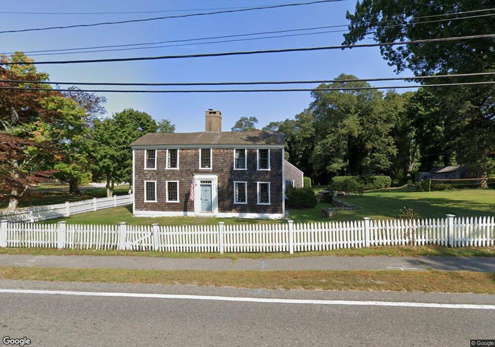
84 Route 6a Yarmouth Port, MA 02675
Yarmouth Port NeighborhoodEstimated Value: $1,385,000 - $1,427,000
4
Beds
2
Baths
3,136
Sq Ft
$449/Sq Ft
Est. Value
About This Home
This home is located at 84 Route 6a, Yarmouth Port, MA 02675 and is currently estimated at $1,406,824, approximately $448 per square foot. 84 Route 6a is a home located in Barnstable County with nearby schools including Dennis-Yarmouth Regional High School, Sturgis Charter Public School, and Trinity Christian Academy of Cape Cod.
Ownership History
Date
Name
Owned For
Owner Type
Purchase Details
Closed on
Mar 26, 2020
Sold by
Bodamer Benton B
Bought by
Balboni Brianna and Schmidt Casey
Current Estimated Value
Purchase Details
Closed on
Feb 1, 2016
Sold by
Bodamer Jessica and Bodamer Benton B
Bought by
Bodamer Benton B
Home Financials for this Owner
Home Financials are based on the most recent Mortgage that was taken out on this home.
Original Mortgage
$520,000
Interest Rate
3.97%
Mortgage Type
Purchase Money Mortgage
Purchase Details
Closed on
Dec 3, 2012
Sold by
Elizabeth M Slayter T
Bought by
Bodamer Jessica and Bodamer Benton B
Purchase Details
Closed on
Jun 20, 1988
Sold by
Sousa Joseph J
Bought by
M V Rt
Home Financials for this Owner
Home Financials are based on the most recent Mortgage that was taken out on this home.
Original Mortgage
$490,000
Interest Rate
10.24%
Mortgage Type
Purchase Money Mortgage
Create a Home Valuation Report for This Property
The Home Valuation Report is an in-depth analysis detailing your home's value as well as a comparison with similar homes in the area
Home Values in the Area
Average Home Value in this Area
Purchase History
| Date | Buyer | Sale Price | Title Company |
|---|---|---|---|
| Balboni Brianna | $767,500 | None Available | |
| Bodamer Benton B | -- | -- | |
| Bodamer Jessica | $359,105 | -- | |
| M V Rt | $250,000 | -- |
Source: Public Records
Mortgage History
| Date | Status | Borrower | Loan Amount |
|---|---|---|---|
| Previous Owner | Bodamer Benton B | $520,000 | |
| Previous Owner | M V Rt | $490,000 | |
| Closed | Bodamer Jessica | -- |
Source: Public Records
Tax History Compared to Growth
Tax History
| Year | Tax Paid | Tax Assessment Tax Assessment Total Assessment is a certain percentage of the fair market value that is determined by local assessors to be the total taxable value of land and additions on the property. | Land | Improvement |
|---|---|---|---|---|
| 2025 | $7,314 | $1,033,100 | $344,100 | $689,000 |
| 2024 | $6,784 | $919,200 | $300,200 | $619,000 |
| 2023 | $7,078 | $872,800 | $253,800 | $619,000 |
| 2022 | $6,731 | $733,200 | $228,400 | $504,800 |
| 2021 | $5,343 | $558,900 | $214,500 | $344,400 |
| 2020 | $5,919 | $591,900 | $207,200 | $384,700 |
| 2019 | $5,978 | $591,900 | $207,200 | $384,700 |
| 2018 | $5,094 | $581,600 | $196,900 | $384,700 |
| 2017 | $5,828 | $581,600 | $196,900 | $384,700 |
| 2016 | $5,769 | $578,100 | $196,900 | $381,200 |
| 2015 | $6,277 | $625,200 | $196,900 | $428,300 |
Source: Public Records
Map
Nearby Homes
- 112 Main St
- 116 Route 6a
- 116 Main St
- 56 Wharf Ln
- 162 Route 6a
- 40 Thacher Shore Rd
- 186 Route 6a
- 4390 Main St
- 4323 Main St
- 105 Old Hyannis Rd
- 86 Doral Dr
- 81 Desert Sands Ln
- 67 Spy Glass Hill Rd
- 9 Wingfoot Dr
- 100 Spyglass Hill Rd
- 35 Wingfoot Dr
- 83 Sisters Cir
- 83 Sisters Cir
- 99 Old Hyannis Rd
- 19 Phoebes Ln
- 84 Old King's Hwy
- 0 Wharf Ln
- 83 Main St
- 1, 2, 4 Nick-Em Way
- 1 Nick-Em Way
- 2 Nick-Em Way
- 83 Route 6a Unit 2
- 83 Route 6a Unit 1
- 83 Route 6a Unit B
- 83 Route 6a Unit A
- 83 Route 6a
- 95 Route 6a
- 92 Route 6a
- 100 Route 6a
- 72 Route 6a
- 100 Hallett St
- 77 Main St
- 101 Route 6a
- 101 Route 6a Unit 1
- 101 Route 6a Unit 101