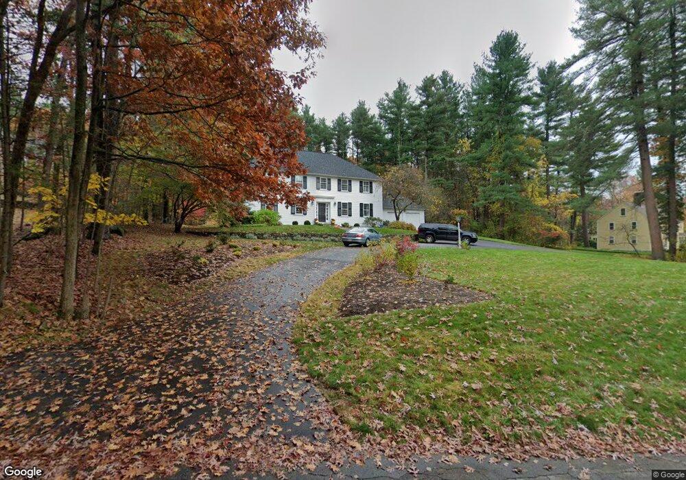
84 Ruddock Rd Sudbury, MA 01776
Estimated Value: $1,409,000 - $1,580,000
4
Beds
3
Baths
3,529
Sq Ft
$427/Sq Ft
Est. Value
About This Home
This home is located at 84 Ruddock Rd, Sudbury, MA 01776 and is currently estimated at $1,507,324, approximately $427 per square foot. 84 Ruddock Rd is a home located in Middlesex County with nearby schools including Josiah Haynes Elementary School, Ephraim Curtis Middle School, and Lincoln-Sudbury Regional High School.
Ownership History
Date
Name
Owned For
Owner Type
Purchase Details
Closed on
Jun 15, 2007
Sold by
Dommermuth Michael F and Dommermuth Veronica Ym
Bought by
Guzi Gretchen S and Guzi Timothy J
Current Estimated Value
Home Financials for this Owner
Home Financials are based on the most recent Mortgage that was taken out on this home.
Original Mortgage
$540,000
Outstanding Balance
$330,423
Interest Rate
6.19%
Mortgage Type
Purchase Money Mortgage
Estimated Equity
$1,176,901
Purchase Details
Closed on
May 1, 2002
Sold by
Est Ginsburg Sidney G and Ginsburg Sandra R
Bought by
Dommermuth Michael F and Dommermuth Veronica
Home Financials for this Owner
Home Financials are based on the most recent Mortgage that was taken out on this home.
Original Mortgage
$475,000
Interest Rate
7.13%
Mortgage Type
Purchase Money Mortgage
Create a Home Valuation Report for This Property
The Home Valuation Report is an in-depth analysis detailing your home's value as well as a comparison with similar homes in the area
Home Values in the Area
Average Home Value in this Area
Purchase History
| Date | Buyer | Sale Price | Title Company |
|---|---|---|---|
| Guzi Gretchen S | $1,120,000 | -- | |
| Dommermuth Michael F | $875,000 | -- |
Source: Public Records
Mortgage History
| Date | Status | Borrower | Loan Amount |
|---|---|---|---|
| Open | Guzi Gretchen S | $540,000 | |
| Previous Owner | Dommermuth Michael F | $475,000 |
Source: Public Records
Tax History Compared to Growth
Tax History
| Year | Tax Paid | Tax Assessment Tax Assessment Total Assessment is a certain percentage of the fair market value that is determined by local assessors to be the total taxable value of land and additions on the property. | Land | Improvement |
|---|---|---|---|---|
| 2025 | $21,528 | $1,470,500 | $510,400 | $960,100 |
| 2024 | $20,723 | $1,418,400 | $496,000 | $922,400 |
| 2023 | $19,157 | $1,214,800 | $444,000 | $770,800 |
| 2022 | $18,434 | $1,021,300 | $408,000 | $613,300 |
| 2021 | $17,557 | $932,400 | $408,000 | $524,400 |
| 2020 | $17,203 | $932,400 | $408,000 | $524,400 |
| 2019 | $16,699 | $932,400 | $408,000 | $524,400 |
| 2018 | $16,332 | $910,900 | $433,600 | $477,300 |
| 2017 | $16,012 | $902,600 | $430,000 | $472,600 |
| 2016 | $15,531 | $872,500 | $414,000 | $458,500 |
| 2015 | $14,986 | $851,500 | $402,400 | $449,100 |
| 2014 | $14,974 | $830,500 | $390,800 | $439,700 |
Source: Public Records
Map
Nearby Homes
- 5 Taintor Dr
- 55 Widow Rites Ln
- 45 Widow Rites Ln
- 57 Longfellow Rd
- 166 Parker St Unit 4
- 54 Phillips Rd
- 63 Canterbury Dr
- 589 North Rd
- 67 Powder Mill Rd
- 10 Oak Ridge Dr Unit 5
- 250 Great Rd
- 12 Camperdown Ln
- 16 Blacksmith Dr
- 5 Oak Ridge Dr Unit 7
- 42 Dakin Rd
- 36 Old Forge Ln
- 47 Fairbank Rd
- 11 Barnet Rd
- 24 Goodnow Rd
- 14 Frost Ln
- 90 Ruddock Rd
- 74 Ruddock Rd
- 50 Silver Hill Rd
- 81 Ruddock Rd
- 89 Ruddock Rd
- 98 Ruddock Rd
- 75 Ruddock Rd
- 97 Ruddock Rd
- 56 Silver Hill Rd
- 44 Silver Hill Rd
- 65 Ruddock Rd
- 105 Ruddock Rd
- 51 Silver Hill Rd
- 54 Ruddock Rd
- 106 Ruddock Rd
- 290 Willis Rd
- 284 Willis Rd
- 57 Ruddock Rd
- 298 Willis Rd
- 64 Silver Hill Rd