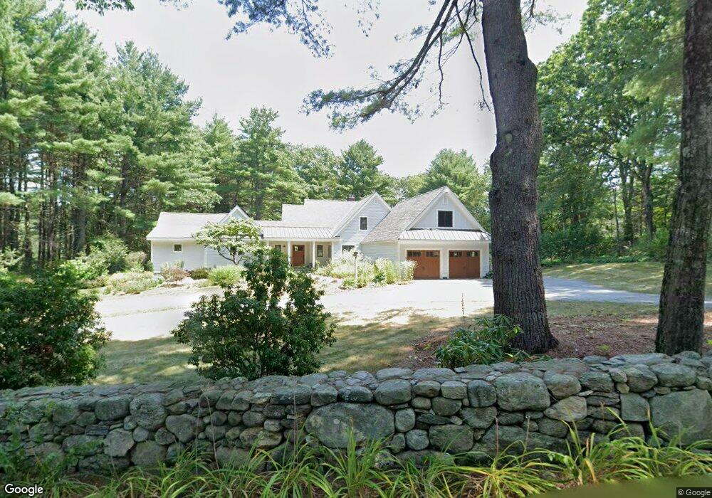
84 Shady Brook Ln Carlisle, MA 01741
Estimated Value: $1,551,000 - $1,827,000
3
Beds
4
Baths
2,948
Sq Ft
$588/Sq Ft
Est. Value
About This Home
This home is located at 84 Shady Brook Ln, Carlisle, MA 01741 and is currently estimated at $1,733,377, approximately $587 per square foot. 84 Shady Brook Ln is a home located in Middlesex County with nearby schools including Carlisle School and Middlesex School.
Ownership History
Date
Name
Owned For
Owner Type
Purchase Details
Closed on
Apr 5, 1999
Sold by
Gumley Graham J and Gumley Suzanne
Bought by
Sellew Paul and Sellew Bonnie
Current Estimated Value
Home Financials for this Owner
Home Financials are based on the most recent Mortgage that was taken out on this home.
Original Mortgage
$250,000
Outstanding Balance
$61,937
Interest Rate
6.78%
Mortgage Type
Purchase Money Mortgage
Estimated Equity
$1,671,440
Purchase Details
Closed on
Aug 9, 1994
Sold by
E A Lindsay Trust No 1 and Lindsay Elizabeth
Bought by
Gumley Graham J and Gumley Suzanne
Home Financials for this Owner
Home Financials are based on the most recent Mortgage that was taken out on this home.
Original Mortgage
$360,800
Interest Rate
8.4%
Mortgage Type
Purchase Money Mortgage
Create a Home Valuation Report for This Property
The Home Valuation Report is an in-depth analysis detailing your home's value as well as a comparison with similar homes in the area
Home Values in the Area
Average Home Value in this Area
Purchase History
| Date | Buyer | Sale Price | Title Company |
|---|---|---|---|
| Sellew Paul | $495,000 | -- | |
| Gumley Graham J | $451,000 | -- |
Source: Public Records
Mortgage History
| Date | Status | Borrower | Loan Amount |
|---|---|---|---|
| Open | Gumley Graham J | $250,000 | |
| Previous Owner | Gumley Graham J | $360,800 |
Source: Public Records
Tax History Compared to Growth
Tax History
| Year | Tax Paid | Tax Assessment Tax Assessment Total Assessment is a certain percentage of the fair market value that is determined by local assessors to be the total taxable value of land and additions on the property. | Land | Improvement |
|---|---|---|---|---|
| 2025 | $21,453 | $1,627,700 | $606,500 | $1,021,200 |
| 2024 | $17,921 | $1,344,400 | $562,900 | $781,500 |
| 2023 | $16,517 | $1,167,300 | $527,700 | $639,600 |
| 2022 | $16,284 | $986,900 | $472,100 | $514,800 |
| 2021 | $16,067 | $986,900 | $472,100 | $514,800 |
| 2020 | $15,947 | $868,600 | $367,500 | $501,100 |
| 2019 | $15,671 | $856,800 | $367,500 | $489,300 |
| 2018 | $15,065 | $829,100 | $367,500 | $461,600 |
| 2017 | $14,411 | $817,900 | $367,500 | $450,400 |
| 2016 | $13,911 | $808,800 | $367,500 | $441,300 |
| 2015 | $13,264 | $698,100 | $367,500 | $330,600 |
| 2014 | $13,013 | $698,100 | $367,500 | $330,600 |
Source: Public Records
Map
Nearby Homes
- 282 Brook St
- 373 E Riding Dr
- 125 Maple St
- 383 E Riding Dr
- 11 Kay's Walk
- 7 School St
- 232 Baldwin Rd
- 225 Lowell St
- 3 Kay's Walk
- 15 Kay's Walk
- 1 Kay's Walk Unit 1
- 1 Kay's Walk
- 13 Kay's Walk
- 15 Kay's Walk Unit 4
- 3 Kay's Walk Unit 3
- 8 Kay's Walk Unit 13
- 14 Kay's Walk
- 6 Kay's Walk Unit 6
- 6 Kay's Walk
- 2 Kay's Walk Unit 18
- 41 Shady Brook Ln
- 453 Bedford Rd
- 439 Bedford Rd
- 100 Shady Brook Ln
- 487 Bedford Rd
- Lot-1 Stearns St
- 1 Stearns St
- 393 Bedford Rd
- 523 Bedford Rd
- 15 Stearns St
- 517 Bedford Rd
- 20 Red Pine Dr
- 516 Bedford Rd
- 39 Stearns St
- 531 Bedford Rd
- 51 Stearns St
- 46 Stearns St
- 549 Bedford Rd
- 33 Red Pine Dr
- 343 Bedford Rd