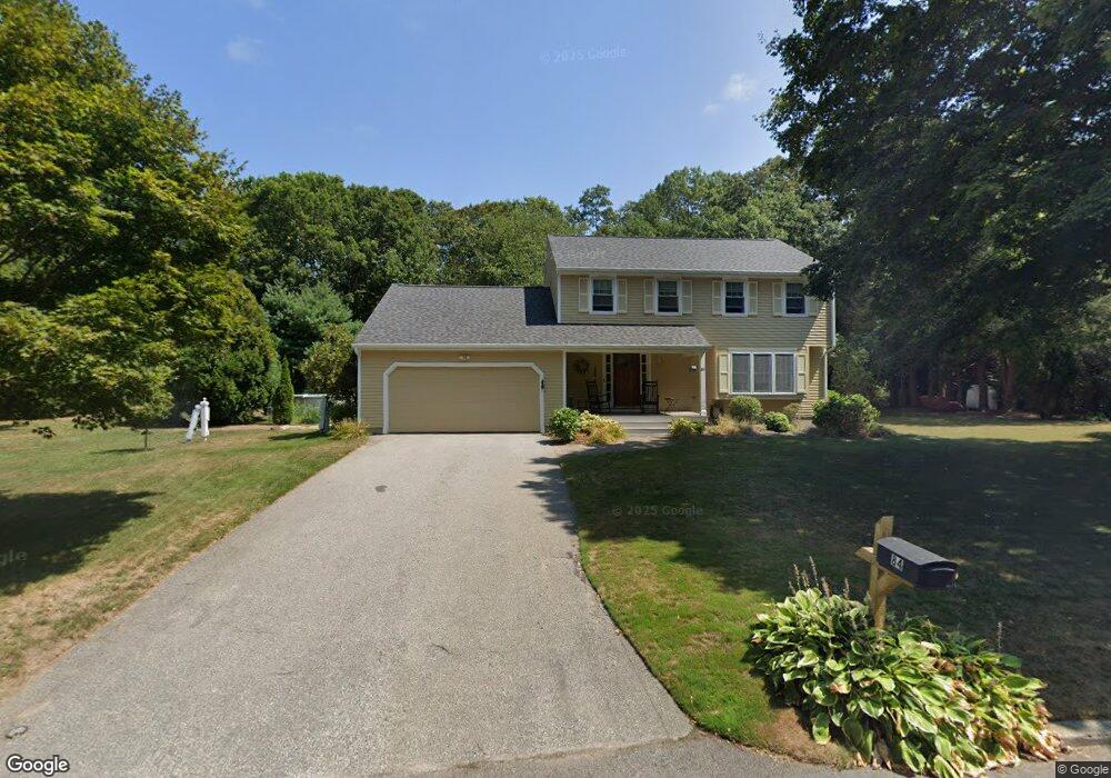
84 Tomahawk Cir Saunderstown, RI 02874
Saunderstown NeighborhoodEstimated Value: $679,115 - $900,000
4
Beds
3
Baths
2,204
Sq Ft
$348/Sq Ft
Est. Value
About This Home
This home is located at 84 Tomahawk Cir, Saunderstown, RI 02874 and is currently estimated at $768,029, approximately $348 per square foot. 84 Tomahawk Cir is a home located in Washington County with nearby schools including Stony Lane Elementary School, Wickford Middle School, and North Kingstown Sr. High School.
Ownership History
Date
Name
Owned For
Owner Type
Purchase Details
Closed on
Mar 14, 2024
Sold by
Paquette Cludian M and Paquette Philip J
Bought by
Philip & C M Paquette Lt and Paquette
Current Estimated Value
Purchase Details
Closed on
Oct 17, 2007
Sold by
Sabatino Faust and Sabatino Judy
Bought by
Paquette Philip and Paquette Claudia
Home Financials for this Owner
Home Financials are based on the most recent Mortgage that was taken out on this home.
Original Mortgage
$150,000
Interest Rate
6.51%
Mortgage Type
Purchase Money Mortgage
Create a Home Valuation Report for This Property
The Home Valuation Report is an in-depth analysis detailing your home's value as well as a comparison with similar homes in the area
Home Values in the Area
Average Home Value in this Area
Purchase History
| Date | Buyer | Sale Price | Title Company |
|---|---|---|---|
| Philip & C M Paquette Lt | -- | None Available | |
| Philip & C M Paquette Lt | -- | None Available | |
| Paquette Philip | $460,000 | -- | |
| Paquette Philip | $460,000 | -- |
Source: Public Records
Mortgage History
| Date | Status | Borrower | Loan Amount |
|---|---|---|---|
| Previous Owner | Paquette Philip | $150,000 | |
| Previous Owner | Paquette Philip | $28,000 |
Source: Public Records
Tax History Compared to Growth
Tax History
| Year | Tax Paid | Tax Assessment Tax Assessment Total Assessment is a certain percentage of the fair market value that is determined by local assessors to be the total taxable value of land and additions on the property. | Land | Improvement |
|---|---|---|---|---|
| 2025 | $6,482 | $587,100 | $250,400 | $336,700 |
| 2024 | $6,649 | $463,700 | $217,500 | $246,200 |
| 2023 | $6,649 | $463,700 | $217,500 | $246,200 |
| 2022 | $6,520 | $463,700 | $217,500 | $246,200 |
| 2021 | $5,770 | $329,700 | $118,500 | $211,200 |
| 2020 | $5,635 | $329,700 | $118,500 | $211,200 |
| 2019 | $5,635 | $329,700 | $118,500 | $211,200 |
| 2018 | $5,767 | $304,000 | $118,500 | $185,500 |
| 2017 | $5,651 | $304,000 | $118,500 | $185,500 |
| 2016 | $5,490 | $304,000 | $118,500 | $185,500 |
| 2015 | $5,473 | $283,600 | $114,800 | $168,800 |
| 2014 | $5,247 | $283,600 | $114,800 | $168,800 |
Source: Public Records
Map
Nearby Homes
- 55 Whisper Ln
- 210 Explorer Dr
- 202 Explorer Dr
- 158 Explorer Dr
- 168 Explorer Dr
- 0 W Allenton Rd
- 247 Glen Hill Dr
- 620 Dry Bridge Rd
- 47 Shady Lea Rd
- 449 Sylvan Ct
- 470 Sylvan Ct
- 150 Delta Dr
- 65 Village Hill Ln
- 53 Morgan Ct
- 67 Daniel Dr
- 527 Hatchery Rd
- 35 Collation Cir
- 159 Ten Rod Rd
- 25 Advent St
- 750 Ten Rod Rd
- 88 Tomahawk Cir
- 76 Tomahawk Cir
- 96 Tomahawk Cir
- 108 Tomahawk Cir
- 68 Tomahawk Cir
- 52 Tomahawk Cir
- 62 Tomahawk Cir
- 35 Tomahawk Cir
- 30 Tomahawk Cir
- 85 Woodmist Way
- 93 Woodmist Way
- 71 Woodmist Way
- 59 Woodmist Way
- 103 Woodmist Way
- 15 Tomahawk Cir
- 47 Woodmist Way
- 185 Indian Corner Rd
- 30 Field Ct
- 111 Woodmist Way
- 31 Field Ct