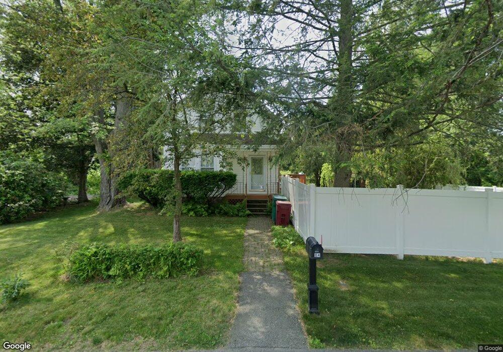
84 Townsend Ave Lowell, MA 01854
Pawtucketville NeighborhoodEstimated Value: $500,000 - $646,498
--
Bed
--
Bath
--
Sq Ft
0.41
Acres
About This Home
This home is located at 84 Townsend Ave, Lowell, MA 01854 and is currently estimated at $566,875. 84 Townsend Ave is a home located in Middlesex County with nearby schools including Joseph McAvinnue Elementary School, Charles W. Morey Elementary School, and Charlotte M. Murkland Elementary School.
Ownership History
Date
Name
Owned For
Owner Type
Purchase Details
Closed on
Apr 24, 2025
Sold by
Sullivan Ivan P and Sullivan Barbara M
Bought by
Ivan and Ivan B S
Current Estimated Value
Purchase Details
Closed on
Apr 29, 1998
Sold by
Banacos Florence T Est and Betty
Bought by
Sullivan Barbara M and Sullivan P I
Create a Home Valuation Report for This Property
The Home Valuation Report is an in-depth analysis detailing your home's value as well as a comparison with similar homes in the area
Home Values in the Area
Average Home Value in this Area
Purchase History
| Date | Buyer | Sale Price | Title Company |
|---|---|---|---|
| Ivan | -- | None Available | |
| Ivan | -- | None Available | |
| Sullivan Barbara M | $75,000 | -- | |
| Sullivan Barbara M | $75,000 | -- |
Source: Public Records
Tax History Compared to Growth
Tax History
| Year | Tax Paid | Tax Assessment Tax Assessment Total Assessment is a certain percentage of the fair market value that is determined by local assessors to be the total taxable value of land and additions on the property. | Land | Improvement |
|---|---|---|---|---|
| 2025 | $5,382 | $468,800 | $138,600 | $330,200 |
| 2024 | $5,371 | $451,000 | $138,600 | $312,400 |
| 2023 | $5,293 | $426,200 | $138,600 | $287,600 |
| 2022 | $0 | $397,900 | $127,000 | $270,900 |
| 2021 | $0 | $368,800 | $127,000 | $241,800 |
| 2020 | $4,798 | $359,100 | $127,000 | $232,100 |
| 2019 | $0 | $331,200 | $124,700 | $206,500 |
| 2018 | $0 | $323,300 | $124,700 | $198,600 |
| 2017 | $0 | $314,300 | $127,000 | $187,300 |
| 2016 | -- | $295,800 | $127,000 | $168,800 |
| 2015 | -- | $285,000 | $125,400 | $159,600 |
| 2013 | $4,383 | $265,600 | $126,600 | $139,000 |
Source: Public Records
Map
Nearby Homes
- 527 Pawtucket Blvd Unit 304
- 101 Laurie Ln
- 6 Louis Farm Rd Unit 6
- 3 Louis Farm Rd Unit 3
- 69 Coburn Dr
- 1975 Middlesex St Unit 51
- 1975 Middlesex St Unit 10
- 49 Coburn Dr
- 311 Pawtucket Blvd Unit 9
- 307 Pawtucket Blvd Unit 13
- 24 Brouilette St Unit A
- 20 Sandy Ln
- 4 Tamarack St
- 770 Princeton Blvd
- 70 Pawtucket Dr
- 1820 Skyline Dr Unit 18
- 977 Westford St Unit 4
- 1311 Middlesex St
- 14 Muirfield Way
- 149 Woodward Ave
- 92 Townsend Ave
- 100 Townsend Ave
- 66 Townsend Ave
- 71 Malden Ave
- 75 Townsend Ave
- 97 Townsend Ave
- 59 Townsend Ave
- 181 Malden Ave
- 57 Townsend Ave
- 109 Townsend Ave
- 48 Townsend Ave
- 66 Shirley Ave
- 128 Townsend Ave
- 51 Townsend Ave
- 54 Shirley Ave
- 45 Townsend Ave
- 44 Malden Ave
- 39 Townsend Ave
- 65 Shirley Ave
- 46 Shirley Ave