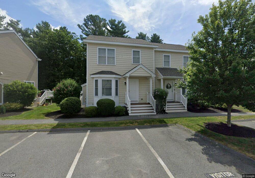
84 Turtle Brook Rd Canton, MA 02021
Estimated Value: $621,000 - $669,000
2
Beds
2
Baths
1,201
Sq Ft
$534/Sq Ft
Est. Value
About This Home
This home is located at 84 Turtle Brook Rd, Canton, MA 02021 and is currently estimated at $640,948, approximately $533 per square foot. 84 Turtle Brook Rd is a home located in Norfolk County with nearby schools including Canton High School.
Ownership History
Date
Name
Owned For
Owner Type
Purchase Details
Closed on
Sep 26, 2019
Sold by
Landry Evan and Landry Emilee
Bought by
Apazidis Elham M
Current Estimated Value
Home Financials for this Owner
Home Financials are based on the most recent Mortgage that was taken out on this home.
Original Mortgage
$235,000
Outstanding Balance
$206,291
Interest Rate
3.6%
Mortgage Type
New Conventional
Estimated Equity
$434,657
Purchase Details
Closed on
Jun 28, 2016
Sold by
Pequit View Condominiu
Bought by
Landry Evan and Flaherty Emilee
Home Financials for this Owner
Home Financials are based on the most recent Mortgage that was taken out on this home.
Original Mortgage
$369,000
Interest Rate
3.57%
Mortgage Type
New Conventional
Create a Home Valuation Report for This Property
The Home Valuation Report is an in-depth analysis detailing your home's value as well as a comparison with similar homes in the area
Home Values in the Area
Average Home Value in this Area
Purchase History
| Date | Buyer | Sale Price | Title Company |
|---|---|---|---|
| Apazidis Elham M | $435,000 | -- | |
| Landry Evan | $395,000 | -- |
Source: Public Records
Mortgage History
| Date | Status | Borrower | Loan Amount |
|---|---|---|---|
| Open | Apazidis Elham M | $235,000 | |
| Previous Owner | Landry Evan | $369,000 |
Source: Public Records
Tax History
| Year | Tax Paid | Tax Assessment Tax Assessment Total Assessment is a certain percentage of the fair market value that is determined by local assessors to be the total taxable value of land and additions on the property. | Land | Improvement |
|---|---|---|---|---|
| 2025 | $5,476 | $553,700 | $0 | $553,700 |
| 2024 | $5,311 | $532,700 | $0 | $532,700 |
| 2023 | $5,223 | $494,100 | $0 | $494,100 |
| 2022 | $5,197 | $457,900 | $0 | $457,900 |
| 2021 | $5,226 | $428,400 | $0 | $428,400 |
| 2020 | $5,091 | $416,300 | $0 | $416,300 |
| 2019 | $4,909 | $395,900 | $0 | $395,900 |
| 2018 | $4,746 | $382,100 | $0 | $382,100 |
| 2017 | $4,746 | $371,100 | $0 | $371,100 |
| 2016 | $92 | $7,200 | $0 | $7,200 |
| 2015 | $90 | $7,000 | $0 | $7,000 |
Source: Public Records
Map
Nearby Homes
- 140 York St
- 25 Edward St
- 65 Foundry Ln
- 888 Turnpike St
- 106 Indian Ln
- 448 York St
- 30 Manitou Rd
- 6 Washington Dr
- 0 Washington St Unit 72888098
- 0 Washington St Unit 71897113
- 35 Turnpike St
- 630 Pleasant St
- 4 Jeffrey Rd
- 611 Pleasant St
- 1 William Morrison Dr
- 1 Sassamon St
- 1831 Turnpike St
- 79 Gold St
- Lot 43 Pondview Ln
- Lot 2 Pondview Ln
- 82 Turtle Brook Rd
- 24 Turtle Brook Rd
- 22 Turtle Brook Rd
- 20 Turtle Brook Rd
- 82 Turtle Brook Rd Unit 18-1
- 84 Turtle Brook Rd Unit 18-2
- 24 Turtle Brook Rd Unit 24
- 22 Turtle Brook Rd Unit 4-2
- 22 Turtle Brook Rd Unit 22
- 22 Turtle Brook Rd Unit Type C
- 28 Turtle Brook
- 24 Turtle Brook
- 24 Turtle Brook Rd Unit Type B
- 26 Turtle Brook
- 84 Turtle Brook Rd Unit 84
- 27 Turtle Brook Rd Unit 27
- 27 Turtle Brook Rd Unit A
- 31 Turtle Brook Rd
- 29 Turtle Brook Rd
- 27 Turtle Brook Rd
Your Personal Tour Guide
Ask me questions while you tour the home.