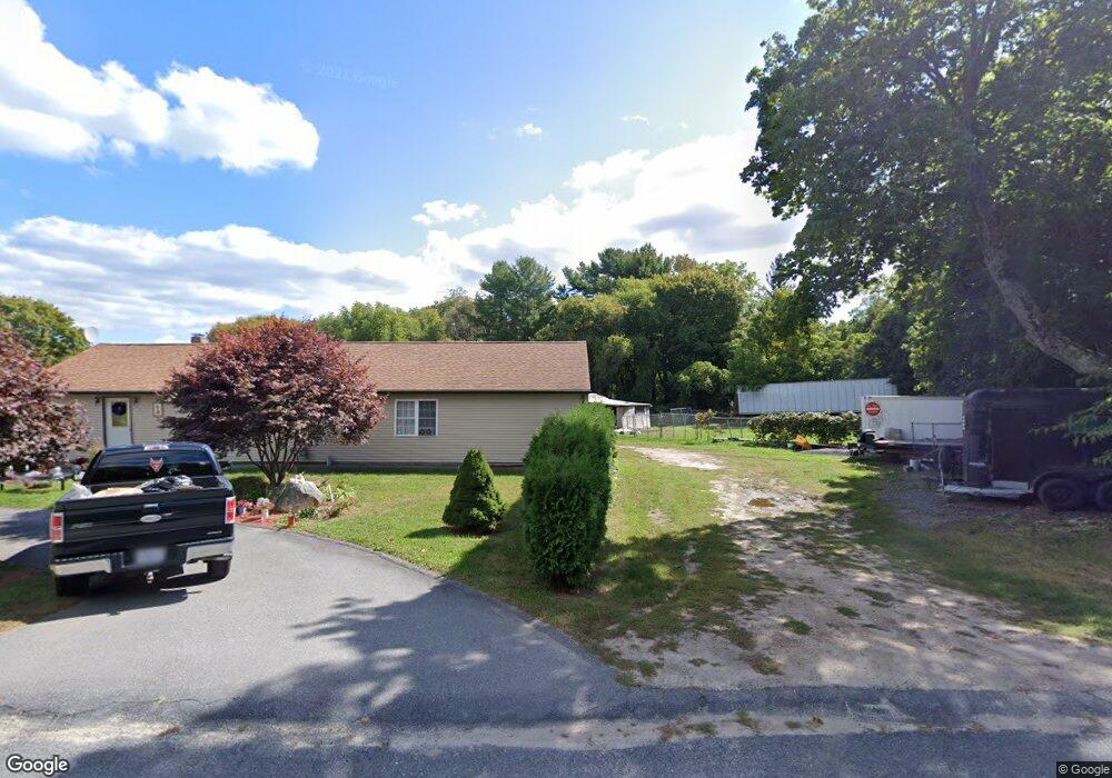
84 Union Ave Westport, MA 02790
North Westport NeighborhoodEstimated Value: $509,318 - $541,000
3
Beds
--
Bath
1,608
Sq Ft
$330/Sq Ft
Est. Value
About This Home
This home is located at 84 Union Ave, Westport, MA 02790 and is currently estimated at $531,330, approximately $330 per square foot. 84 Union Ave is a home located in Bristol County with nearby schools including Alice A. Macomber Primary School, Westport Elementary School, and Bishop Stang High School.
Ownership History
Date
Name
Owned For
Owner Type
Purchase Details
Closed on
Aug 30, 2024
Sold by
Pacheco Jose M and Pacheco Maria H
Bought by
Pacheco Irt and Pacheco
Current Estimated Value
Purchase Details
Closed on
Jun 8, 1998
Sold by
Wisely' Michael J and Wisely Donna L
Bought by
Pacheco Jose and Pacheco Maria
Purchase Details
Closed on
Jan 27, 1997
Sold by
Whalon Clarence R and Griffin Nancy A
Bought by
Wisely Michael J and Wisely Donna L
Create a Home Valuation Report for This Property
The Home Valuation Report is an in-depth analysis detailing your home's value as well as a comparison with similar homes in the area
Home Values in the Area
Average Home Value in this Area
Purchase History
| Date | Buyer | Sale Price | Title Company |
|---|---|---|---|
| Pacheco Irt | -- | None Available | |
| Pacheco Irt | -- | None Available | |
| Pacheco Jose | $119,000 | -- | |
| Wisely Michael J | $114,000 | -- | |
| Pacheco Jose | $119,000 | -- | |
| Wisely Michael J | $114,000 | -- |
Source: Public Records
Mortgage History
| Date | Status | Borrower | Loan Amount |
|---|---|---|---|
| Previous Owner | Wisely Michael J | $223,850 | |
| Previous Owner | Wisely Michael J | $219,000 |
Source: Public Records
Tax History Compared to Growth
Tax History
| Year | Tax Paid | Tax Assessment Tax Assessment Total Assessment is a certain percentage of the fair market value that is determined by local assessors to be the total taxable value of land and additions on the property. | Land | Improvement |
|---|---|---|---|---|
| 2025 | $3,053 | $409,800 | $166,400 | $243,400 |
| 2024 | $3,049 | $394,500 | $154,400 | $240,100 |
| 2023 | $3,009 | $368,800 | $140,200 | $228,600 |
| 2022 | $2,777 | $327,500 | $133,200 | $194,300 |
| 2021 | $2,720 | $315,600 | $121,300 | $194,300 |
| 2020 | $2,569 | $304,700 | $110,400 | $194,300 |
| 2019 | $2,500 | $302,300 | $110,400 | $191,900 |
| 2018 | $1,986 | $243,100 | $120,300 | $122,800 |
| 2017 | $1,884 | $236,400 | $116,500 | $119,900 |
| 2016 | $1,810 | $228,800 | $112,800 | $116,000 |
| 2015 | $1,747 | $220,300 | $115,300 | $105,000 |
Source: Public Records
Map
Nearby Homes
- 29 Union Ave
- 3 Roller Coaster Way Unit Lot 1
- 79 Center St
- 461 Reed Rd
- 16 S Berryman St
- 380 Gifford Rd
- 735 Reed Rd
- 15 S Breault St
- 56 Lakeside Ave
- 55 Lakeside Ave
- 818 Reed Rd
- 565 Highland Ave
- 4 Main Rd
- 47 Fallon Dr
- 116 Gifford Rd
- 318 Old Westport Rd
- 310 Old Westport Rd
- 53 Morton Ave
- 23 Donna St
- 2 Mackady Ct
- 74 Union Ave
- 150 Forge Rd
- 93 Union Ave
- 79 Union Ave
- 149 Forge Rd
- 149 Forge Rd Unit 1
- 73 Union Ave
- 141 Forge Rd
- 147 Forge Rd Unit 149
- 1180 American Legion Hwy
- 69 Union Ave
- 69 Union Ave Unit 1
- 64 Union Ave
- 1134 American Legion Hwy Unit B
- 1134 American Legion Hwy Unit A
- 1134 American Legion Hwy
- 1134 American Legion Hwy Unit D
- 1134 American Legion Hwy Unit 4
- 1134 American Legion Hwy Unit E
- 131 Forge Rd