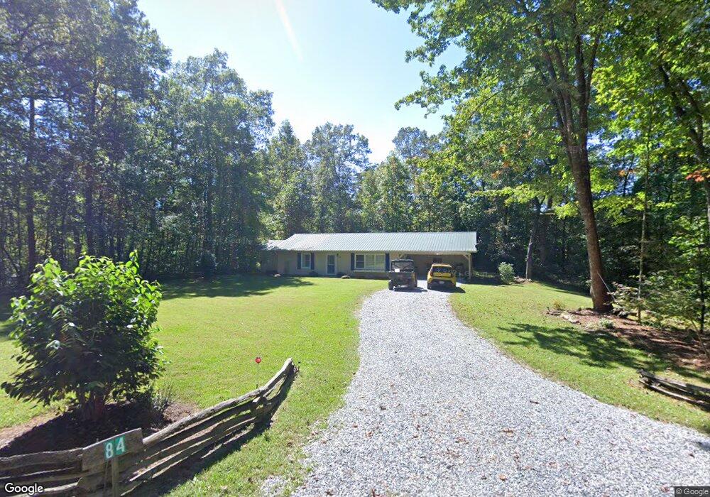
84 Weatherly Rd Clarkesville, GA 30523
Estimated Value: $463,000 - $1,274,000
2
Beds
2
Baths
1,640
Sq Ft
$422/Sq Ft
Est. Value
About This Home
This home is located at 84 Weatherly Rd, Clarkesville, GA 30523 and is currently estimated at $691,431, approximately $421 per square foot. 84 Weatherly Rd is a home located in Rabun County with nearby schools including Rabun County Primary School and Rabun County High School.
Ownership History
Date
Name
Owned For
Owner Type
Purchase Details
Closed on
Jul 16, 2020
Sold by
Clarke William A
Bought by
Ohara Patricia Carolyn
Current Estimated Value
Purchase Details
Closed on
Nov 18, 2010
Sold by
Moore James Don
Bought by
Clarke William A
Purchase Details
Closed on
Mar 1, 2002
Bought by
Moore James Don
Create a Home Valuation Report for This Property
The Home Valuation Report is an in-depth analysis detailing your home's value as well as a comparison with similar homes in the area
Home Values in the Area
Average Home Value in this Area
Purchase History
| Date | Buyer | Sale Price | Title Company |
|---|---|---|---|
| Ohara Patricia Carolyn | $5,436 | -- | |
| Ohara Patricia Carolyn | $5,436 | -- | |
| Clarke William A | $60,000 | -- | |
| Clarke William A | $60,000 | -- | |
| Clarke William A | $60,000 | -- | |
| Moore James Don | -- | -- | |
| Moore James Don | -- | -- |
Source: Public Records
Tax History
| Year | Tax Paid | Tax Assessment Tax Assessment Total Assessment is a certain percentage of the fair market value that is determined by local assessors to be the total taxable value of land and additions on the property. | Land | Improvement |
|---|---|---|---|---|
| 2025 | $1,355 | $84,446 | $0 | $84,446 |
| 2024 | $966 | $60,165 | $0 | $60,165 |
| 2023 | $766 | $41,834 | $0 | $41,834 |
| 2022 | $737 | $40,258 | $0 | $40,258 |
| 2021 | $659 | $35,127 | $0 | $35,127 |
| 2020 | $595 | $30,682 | $0 | $30,682 |
| 2019 | $599 | $30,682 | $0 | $30,682 |
| 2018 | $601 | $30,682 | $0 | $30,682 |
| 2017 | $577 | $30,682 | $0 | $30,682 |
| 2016 | $578 | $30,682 | $0 | $30,682 |
| 2015 | $621 | $32,243 | $0 | $32,243 |
| 2014 | $624 | $32,243 | $0 | $32,243 |
Source: Public Records
Map
Nearby Homes
- 4960 Laurel Lodge #41 Rd
- 4960 Laurel Lodge Rd Unit 40
- 4960 Laurel Lodge Rd Unit LOT 3
- 4960 Laurel Lodge Rd
- 4960 Laurel Lodge Rd Unit LOT 21
- 4960 Laurel Lodge Rd Unit LOT 2
- 4960 Laurel Lodge Rd Unit LOT 29
- 43 Seasons View Ct
- 33 Mcnabb Ln
- 15756 N Hwy 197
- 106 Brookwood Ln
- 341 Brookwood Ln
- 1006 Perrin Cove Rd
- 336 Fulton Rd
- 326 Fulton Rd
- 254 & 238 Fulton Rd
- 188 Fulton Rd
- 9406 Bridge Creek Rd
- 0 Benfield Ln Unit 10705560
- 89 Arkansas Ln
- 4 Uncle Dons Trail
- 50 Uncle Don's Trail
- 50 Uncle Dons Trail
- 5 Uncle Dons Trail
- 4671 Laurel Lodge Rd
- 4671 Laurel Lodge Rd Unit 1080
- 0 Laurel Lodge Rd Unit 8403030
- 0 Laurel Lodge Restaurant and Campground Unit 8558669
- 282 Weatherly Rd
- 137 Weatherly Rd
- 107 Point Dr
- 199 Point Dr
- 314 Weatherly Rd
- 22 Lynchburg Ln
- 0 Lynchburg Ln Unit 3258031
- 87 Lynchburg Ln
- 164 Point Dr
- 198 Point Dr
- 322 Albany Ln
- 140 Lynchburg Ln
Your Personal Tour Guide
Ask me questions while you tour the home.