C
Seller's Agent in 2025
Chris Veach
Windermere Trails End R.E.
(541) 841-2854
18 Total Sales
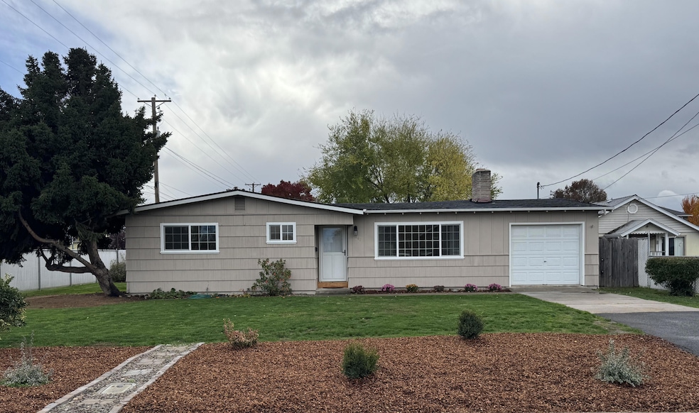
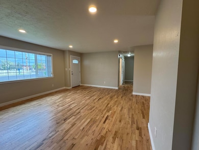
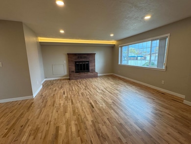
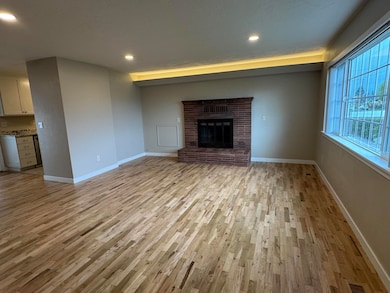
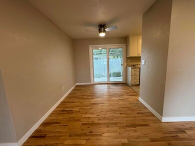
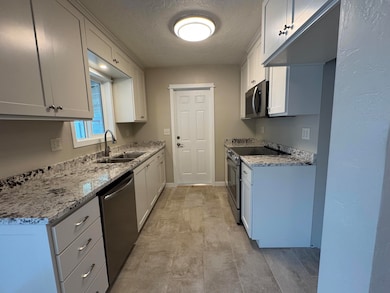
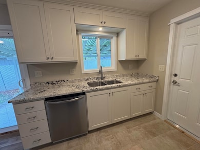
Beautifully Updated Central Point Home - Move-In Ready! Welcome to this charming and fully updated 3-bedroom, 1.5-bath home in the heart of Central Point. Every detail has been thoughtfully refreshed from top to bottom, offering the perfect blend of modern comfort and timeless character. Inside you will find fresh interior paint, refinished hardwood floors, new energy efficient vinyl windows, and a bright, open layout. The new custom kitchen cabinets, new appliances, and stylish tile flooring make the kitchen a standout space—perfect for both everyday living and entertaining. Enjoy the freshly landscaped yard that's ready for gatherings, gardening, or quiet relaxation. Ideally located in a great neighborhood, this home offers easy access to schools, parks, shopping & all that Central Point has to offer. Whether you're a first-time buyer or searching to downsize, this property is the perfect place to call home. Don't miss this beautifully renewed gem—schedule your private tour today!
Last Agent to Sell the Property
Windermere Trails End R.E. Brokerage Email: cveach@windermere.com License #201220825 Listed on: 11/06/2025

| Date | Type | Sale Price | Title Company |
|---|---|---|---|
| Warranty Deed | $352,000 | First American Title | |
| Bargain Sale Deed | -- | -- |
| Date | Status | Loan Amount | Loan Type |
|---|---|---|---|
| Open | $345,624 | FHA | |
| Previous Owner | $30,000 | Credit Line Revolving |
| Date | Event | Price | List to Sale | Price per Sq Ft |
|---|---|---|---|---|
| 12/15/2025 12/15/25 | Sold | $352,000 | +0.6% | $333 / Sq Ft |
| 11/10/2025 11/10/25 | Pending | -- | -- | -- |
| 11/06/2025 11/06/25 | For Sale | $349,900 | -- | $331 / Sq Ft |
| Year | Tax Paid | Tax Assessment Tax Assessment Total Assessment is a certain percentage of the fair market value that is determined by local assessors to be the total taxable value of land and additions on the property. | Land | Improvement |
|---|---|---|---|---|
| 2026 | $2,469 | $149,200 | -- | -- |
| 2025 | $2,409 | $144,860 | $61,540 | $83,320 |
| 2024 | $2,409 | $140,650 | $59,750 | $80,900 |
| 2023 | $2,331 | $136,560 | $58,020 | $78,540 |
| 2022 | $2,277 | $136,560 | $58,020 | $78,540 |
| 2021 | $2,212 | $132,590 | $56,330 | $76,260 |
| 2020 | $2,147 | $128,730 | $54,690 | $74,040 |
| 2019 | $2,094 | $121,350 | $51,550 | $69,800 |
| 2018 | $2,031 | $117,820 | $50,050 | $67,770 |
| 2017 | $1,980 | $117,820 | $50,050 | $67,770 |
| 2016 | $1,909 | $111,060 | $47,170 | $63,890 |
| 2015 | $1,739 | $105,950 | $45,800 | $60,150 |
| 2014 | $1,647 | $100,710 | $42,410 | $58,300 |
C
Seller's Agent in 2025
Chris Veach
Windermere Trails End R.E.
(541) 841-2854
18 Total Sales
A
Buyer's Agent in 2025
Angela Holmes
Windermere Van Vleet & Assoc2
(541) 621-5203
75 Total Sales
Source: Oregon Datashare
MLS Number: 220211689
APN: 10145149
Disclaimer: Certain information contained herein is derived from information provided by parties other than Homes.com. All information provided is deemed reliable, but is not guaranteed to be accurate and should be independently verified.
![]() © 2026 Oregon Datashare (KCAR | MLSCO | SOMLS). All rights reserved. The data relating to real estate for sale on this web site comes in part from the Internet Data Exchange Program of the Oregon Datashare. Real estate listings held by IDX Brokerage firms other than Ten-X are marked with the Internet Data Exchange logo or the Internet Data Exchange thumbnail logo and detailed information about them includes the name of the listing Brokers. Information provided is for consumers' personal, non-commercial use and may not be used for any purpose other than to identify prospective properties the viewer may be interested in purchasing. The consumer will not copy, retransmit nor redistribute any of the content from this website. Information provided is deemed reliable, but not guaranteed.
© 2026 Oregon Datashare (KCAR | MLSCO | SOMLS). All rights reserved. The data relating to real estate for sale on this web site comes in part from the Internet Data Exchange Program of the Oregon Datashare. Real estate listings held by IDX Brokerage firms other than Ten-X are marked with the Internet Data Exchange logo or the Internet Data Exchange thumbnail logo and detailed information about them includes the name of the listing Brokers. Information provided is for consumers' personal, non-commercial use and may not be used for any purpose other than to identify prospective properties the viewer may be interested in purchasing. The consumer will not copy, retransmit nor redistribute any of the content from this website. Information provided is deemed reliable, but not guaranteed.
Ask me questions while you tour the home.