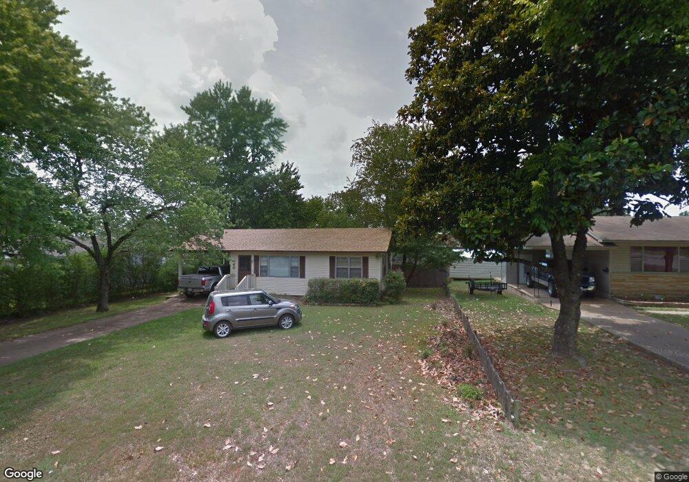
840 Bryant St Batesville, AR 72501
Estimated Value: $64,000 - $103,000
--
Bed
1
Bath
832
Sq Ft
$98/Sq Ft
Est. Value
About This Home
This home is located at 840 Bryant St, Batesville, AR 72501 and is currently estimated at $81,440, approximately $97 per square foot. 840 Bryant St is a home located in Independence County with nearby schools including Batesville Junior High School, Batesville High School, and Community School.
Ownership History
Date
Name
Owned For
Owner Type
Purchase Details
Closed on
May 24, 2024
Sold by
Cone Davina and Thomas Anthony
Bought by
Long Jacob Robert
Current Estimated Value
Home Financials for this Owner
Home Financials are based on the most recent Mortgage that was taken out on this home.
Original Mortgage
$48,000
Outstanding Balance
$47,327
Interest Rate
6.88%
Mortgage Type
New Conventional
Estimated Equity
$34,113
Purchase Details
Closed on
Apr 19, 2000
Bought by
Adams David E and Beverly Adams
Purchase Details
Closed on
Apr 18, 1997
Bought by
Adams Davina
Purchase Details
Closed on
Apr 13, 1993
Bought by
Matlock Paul W
Purchase Details
Closed on
Nov 13, 1979
Bought by
Brumitt Mike A
Create a Home Valuation Report for This Property
The Home Valuation Report is an in-depth analysis detailing your home's value as well as a comparison with similar homes in the area
Home Values in the Area
Average Home Value in this Area
Purchase History
| Date | Buyer | Sale Price | Title Company |
|---|---|---|---|
| Long Jacob Robert | $60,000 | None Listed On Document | |
| Long Jacob Robert | $60,000 | None Listed On Document | |
| Adams David E | -- | -- | |
| Adams Davina | $51,000 | -- | |
| Matlock Paul W | $34,000 | -- | |
| Brumitt Mike A | $20,000 | -- |
Source: Public Records
Mortgage History
| Date | Status | Borrower | Loan Amount |
|---|---|---|---|
| Open | Long Jacob Robert | $48,000 | |
| Closed | Long Jacob Robert | $48,000 |
Source: Public Records
Tax History Compared to Growth
Tax History
| Year | Tax Paid | Tax Assessment Tax Assessment Total Assessment is a certain percentage of the fair market value that is determined by local assessors to be the total taxable value of land and additions on the property. | Land | Improvement |
|---|---|---|---|---|
| 2024 | $523 | $9,810 | $2,620 | $7,190 |
| 2023 | $523 | $9,810 | $2,620 | $7,190 |
| 2022 | $523 | $9,810 | $2,620 | $7,190 |
| 2021 | $523 | $9,810 | $2,620 | $7,190 |
| 2020 | $523 | $9,810 | $2,620 | $7,190 |
| 2019 | $497 | $9,310 | $2,240 | $7,070 |
| 2018 | $497 | $9,310 | $2,240 | $7,070 |
| 2017 | $491 | $9,310 | $2,240 | $7,070 |
| 2016 | $491 | $9,310 | $2,240 | $7,070 |
| 2015 | $487 | $9,310 | $2,240 | $7,070 |
| 2014 | $455 | $8,620 | $1,630 | $6,990 |
Source: Public Records
Map
Nearby Homes
- 895 25th St
- 2380 Case St
- 500 College Heights Dr
- 2050 Neeley St
- 380 22nd St
- 685 Josephine Dr
- 2980 Harrison St
- 415 Bluff View Dr
- 1350 Dogwood Dr
- 0 Harrison St Property
- 1410 Dogwood Dr
- 3290 Harrison St
- 2925 Shade Tree Dr
- 1580 Betty Jean St
- 1735 E College St
- 1550 Byers St
- 2125 Duffer Ln
- 125 Mill Run Trail
- 1423 Bates St
- 3335 Timberland Dr