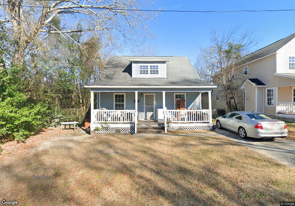
840 Mitchell St Macon, GA 31217
Fort Hill Historic District NeighborhoodEstimated Value: $96,690 - $138,000
3
Beds
2
Baths
1,008
Sq Ft
$110/Sq Ft
Est. Value
About This Home
This home is located at 840 Mitchell St, Macon, GA 31217 and is currently estimated at $111,173, approximately $110 per square foot. 840 Mitchell St is a home located in Bibb County with nearby schools including Burdell Elementary School, Appling Middle School, and Northeast High School.
Ownership History
Date
Name
Owned For
Owner Type
Purchase Details
Closed on
Jan 11, 2008
Sold by
Macon Bibb County Economic Opportunity C
Bought by
Jones Patricia A
Current Estimated Value
Home Financials for this Owner
Home Financials are based on the most recent Mortgage that was taken out on this home.
Original Mortgage
$74,105
Interest Rate
8.25%
Purchase Details
Closed on
Dec 6, 2005
Bought by
Macon-Bibb Co Eoc
Create a Home Valuation Report for This Property
The Home Valuation Report is an in-depth analysis detailing your home's value as well as a comparison with similar homes in the area
Home Values in the Area
Average Home Value in this Area
Purchase History
| Date | Buyer | Sale Price | Title Company |
|---|---|---|---|
| Jones Patricia A | $93,000 | None Available | |
| Macon-Bibb Co Eoc | -- | -- |
Source: Public Records
Mortgage History
| Date | Status | Borrower | Loan Amount |
|---|---|---|---|
| Previous Owner | Jones Patricia A | $74,105 |
Source: Public Records
Tax History
| Year | Tax Paid | Tax Assessment Tax Assessment Total Assessment is a certain percentage of the fair market value that is determined by local assessors to be the total taxable value of land and additions on the property. | Land | Improvement |
|---|---|---|---|---|
| 2025 | $756 | $37,761 | $2,640 | $35,121 |
| 2024 | $662 | $33,049 | $1,440 | $31,609 |
| 2023 | $198 | $32,809 | $1,200 | $31,609 |
| 2022 | $536 | $22,485 | $1,766 | $20,719 |
| 2021 | $322 | $15,461 | $662 | $14,799 |
| 2020 | $271 | $13,981 | $662 | $13,319 |
| 2019 | $215 | $12,502 | $662 | $11,840 |
| 2018 | $510 | $12,502 | $662 | $11,840 |
| 2017 | $206 | $12,502 | $662 | $11,840 |
| 2016 | $190 | $12,502 | $662 | $11,840 |
| 2015 | $270 | $12,502 | $662 | $11,840 |
| 2014 | $531 | $15,506 | $706 | $14,799 |
Source: Public Records
Map
Nearby Homes
- 725 Schaeffer Place
- 857 Mitchell St
- 972 Norris St
- 751 Mitchell St
- 722 Mitchell St
- 1059 Fort Hill St
- 774 Maynard St
- 845 Norris St
- 760 Cowan St
- 1024 Clarks Ln
- 768 Maynard St
- 735 Maynard St
- 658 Pringle St
- 734 Fort Hill St
- 1392 Fort Hill St
- 990 Center St
- 970 Center St
- 866 Stewart St
- 661 Coleman Ln
- 856 Center St
- 846 Mitchell St
- 1015 Maynard St
- 850 Mitchell St
- 715 Schaeffer Place
- 860 Mitchell St
- 971 Maynard St
- 995 Maynard St
- 1054 Schaeffer Place
- 1059 Schaeffer Place
- 886 Mitchell St
- 1082 Schaeffer Place
- 870 Mitchell St
- 1016 Maynard St
- 1020 Maynard St
- 945 Maynard St
- 1081 Maynard St
- 1042 Maynard St
- 831 Taylor St
- 845 Taylor St
- 855 Taylor St