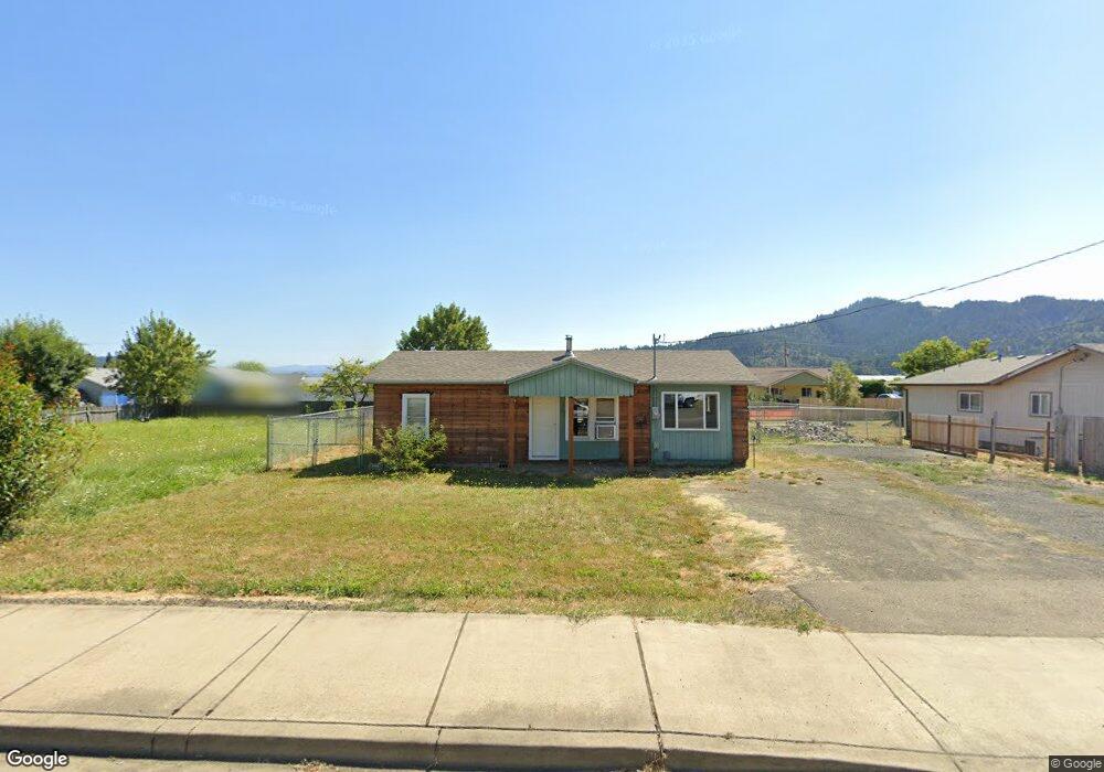
840 S Comstock Ave Sutherlin, OR 97479
Estimated Value: $214,000 - $275,233
3
Beds
1
Bath
1,045
Sq Ft
$240/Sq Ft
Est. Value
About This Home
This home is located at 840 S Comstock Ave, Sutherlin, OR 97479 and is currently estimated at $251,308, approximately $240 per square foot. 840 S Comstock Ave is a home located in Douglas County with nearby schools including East Sutherlin Primary School, West Sutherlin Intermediate School, and Sutherlin Middle School.
Ownership History
Date
Name
Owned For
Owner Type
Purchase Details
Closed on
Dec 13, 2021
Sold by
Allen Hough Debra Ann and Orval R Allen Living Trust
Bought by
Sutherland Jeremiah and Sutherland Jessica
Current Estimated Value
Purchase Details
Closed on
Jan 22, 2013
Sold by
Zander Mark and Zander Elena
Bought by
Allen Orval R and Orval R Allen Living Trust
Purchase Details
Closed on
Feb 10, 2006
Sold by
Allen Orval R
Bought by
Allen Orval R and The Orval R Allen Living Trust
Create a Home Valuation Report for This Property
The Home Valuation Report is an in-depth analysis detailing your home's value as well as a comparison with similar homes in the area
Home Values in the Area
Average Home Value in this Area
Purchase History
| Date | Buyer | Sale Price | Title Company |
|---|---|---|---|
| Sutherland Jeremiah | $65,000 | Amerititle | |
| Allen Orval R | -- | None Available | |
| Allen Orval R | -- | None Available |
Source: Public Records
Tax History Compared to Growth
Tax History
| Year | Tax Paid | Tax Assessment Tax Assessment Total Assessment is a certain percentage of the fair market value that is determined by local assessors to be the total taxable value of land and additions on the property. | Land | Improvement |
|---|---|---|---|---|
| 2024 | $1,619 | $129,796 | -- | -- |
| 2023 | $1,300 | $104,211 | $0 | $0 |
| 2022 | $1,063 | $85,155 | $0 | $0 |
| 2021 | $1,032 | $82,675 | $0 | $0 |
| 2020 | $1,002 | $80,267 | $0 | $0 |
| 2019 | $973 | $77,930 | $0 | $0 |
| 2018 | $944 | $75,661 | $0 | $0 |
| 2017 | $966 | $73,458 | $0 | $0 |
| 2016 | $938 | $71,319 | $0 | $0 |
| 2015 | $913 | $69,242 | $0 | $0 |
| 2014 | $886 | $67,226 | $0 | $0 |
| 2013 | -- | $65,268 | $0 | $0 |
Source: Public Records
Map
Nearby Homes
- 1386 Airway Ave
- 819 S Comstock Ave Unit 13
- 851 S Comstock Rd
- 1223 Duke Ave
- 892 Fir Grove Ln
- 908 Fir Grove Ln
- 181 SW Hutchins St
- 1688 W Central Ave
- 1878 Trails End Ln
- 0 Dakota St Unit B 500248401
- 165 Robinson St
- 226 Miller St
- 220 Miller St
- 279 Grant St
- 420 Backwater Loop
- 126 Coles Valley St
- 154 Coles Valley St
- 336 Schudeiske Rd
- 149 Coles Valley St
- 1660 Scardi Blvd
- 840 S Comstock Rd
- 852 S Comstock Ave
- 841 Landing St
- 813 Landing St
- 849 Landing St
- 1392 Airway Ave
- 864 S Comstock Ave
- 859 Landing St
- 801 Landing St
- 863 Landing St
- 863 S Comstock Ave
- 819 S Comstock Rd
- 819 S Comstock Rd Unit 65
- 819 S Comstock Rd Unit 73
- 819 S Comstock Rd Unit 44
- 819 S Comstock Rd Unit 1
- 819 S Comstock Rd Unit 67
- 819 S Comstock Ave
- 819 S Comstock Rd Unit SP 6
- 819 S Comstock Rd Unit 5