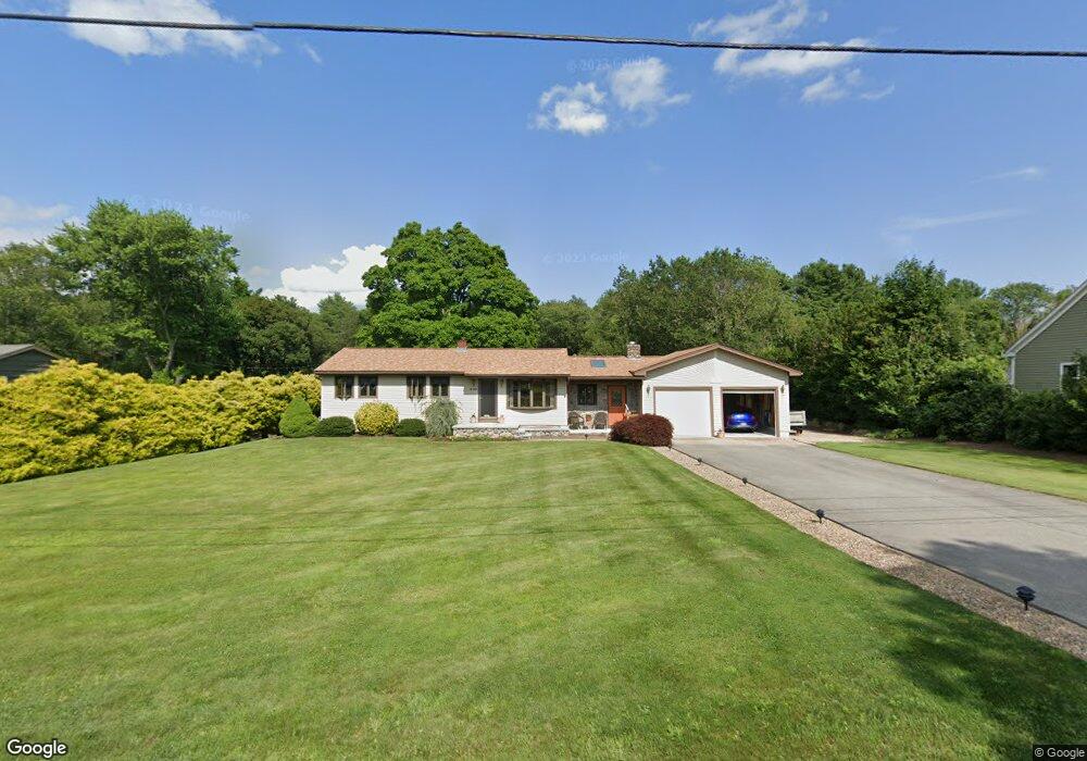
840 Sanford Rd Westport, MA 02790
North Westport NeighborhoodEstimated Value: $485,000 - $548,000
2
Beds
--
Bath
1,236
Sq Ft
$424/Sq Ft
Est. Value
About This Home
This home is located at 840 Sanford Rd, Westport, MA 02790 and is currently estimated at $524,086, approximately $424 per square foot. 840 Sanford Rd is a home located in Bristol County with nearby schools including Alice A. Macomber Primary School, Westport Elementary School, and Westport Middle-High School.
Ownership History
Date
Name
Owned For
Owner Type
Purchase Details
Closed on
Sep 18, 1990
Sold by
Dolbec Lucille E
Bought by
Dolbec Wilfrid A
Current Estimated Value
Home Financials for this Owner
Home Financials are based on the most recent Mortgage that was taken out on this home.
Original Mortgage
$38,000
Interest Rate
9.76%
Mortgage Type
Purchase Money Mortgage
Create a Home Valuation Report for This Property
The Home Valuation Report is an in-depth analysis detailing your home's value as well as a comparison with similar homes in the area
Home Values in the Area
Average Home Value in this Area
Purchase History
| Date | Buyer | Sale Price | Title Company |
|---|---|---|---|
| Dolbec Wilfrid A | $90,000 | -- |
Source: Public Records
Mortgage History
| Date | Status | Borrower | Loan Amount |
|---|---|---|---|
| Open | Dolbec Wilfrid A | $155,000 | |
| Closed | Dolbec Wilfrid A | $100,000 | |
| Closed | Dolbec Wilfrid A | $38,000 |
Source: Public Records
Tax History Compared to Growth
Tax History
| Year | Tax Paid | Tax Assessment Tax Assessment Total Assessment is a certain percentage of the fair market value that is determined by local assessors to be the total taxable value of land and additions on the property. | Land | Improvement |
|---|---|---|---|---|
| 2025 | $3,346 | $449,100 | $174,700 | $274,400 |
| 2024 | $3,090 | $399,700 | $155,100 | $244,600 |
| 2023 | $3,000 | $367,700 | $141,300 | $226,400 |
| 2022 | $2,235 | $334,000 | $141,300 | $192,700 |
| 2021 | $2,235 | $259,300 | $116,800 | $142,500 |
| 2020 | $2,146 | $254,600 | $112,100 | $142,500 |
| 2019 | $2,068 | $250,100 | $112,100 | $138,000 |
| 2018 | $2,006 | $245,500 | $112,900 | $132,600 |
| 2017 | $1,908 | $239,400 | $109,300 | $130,100 |
| 2016 | $1,773 | $224,200 | $105,700 | $118,500 |
| 2015 | $1,694 | $213,600 | $108,100 | $105,500 |
Source: Public Records
Map
Nearby Homes
- 836 Sanford Rd
- 837 Sanford Rd
- 830 Sanford Rd
- 829 Sanford Rd
- 864 Sanford Rd
- Lot 3 Brightwood Path
- 849 Sanford Rd
- 821 Sanford Rd
- 868 Sanford Rd
- 859 Sanford Rd
- 859 Sanford Rd Unit 2 Rear
- 812 Sanford Rd
- 817 Sanford Rd
- 872 Sanford Rd
- 2 Bright Rd
- 806 Sanford Rd
- 811 Sanford Rd
- 6 Bright Rd
- 874 Sanford Rd
- 873 Sanford Rd