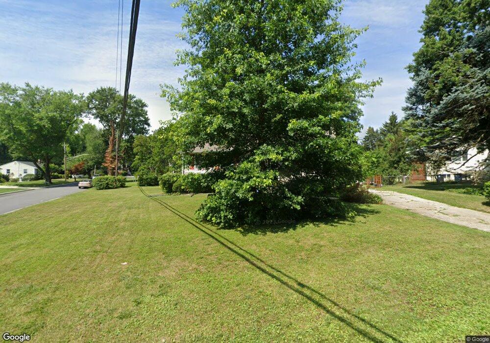
Estimated Value: $438,136 - $469,000
--
Bed
2
Baths
1,130
Sq Ft
$397/Sq Ft
Est. Value
About This Home
This home is located at 8400 Cowan Ave, Bowie, MD 20720 and is currently estimated at $449,034, approximately $397 per square foot. 8400 Cowan Ave is a home located in Prince George's County with nearby schools including Rockledge Elementary School, Samuel Ogle Middle School, and Bowie High School.
Ownership History
Date
Name
Owned For
Owner Type
Purchase Details
Closed on
Aug 5, 2004
Sold by
Anthony Robert T and Anthony Carolyn L
Bought by
Flynn James P and Flynn Carolyn A
Current Estimated Value
Purchase Details
Closed on
Sep 14, 1993
Sold by
Delgado J B
Bought by
Anthony Robert T
Home Financials for this Owner
Home Financials are based on the most recent Mortgage that was taken out on this home.
Original Mortgage
$115,900
Interest Rate
7.21%
Purchase Details
Closed on
Oct 24, 1974
Sold by
Chambers James R
Bought by
Delgado John B and Delgado Jacqueline S
Create a Home Valuation Report for This Property
The Home Valuation Report is an in-depth analysis detailing your home's value as well as a comparison with similar homes in the area
Home Values in the Area
Average Home Value in this Area
Purchase History
| Date | Buyer | Sale Price | Title Company |
|---|---|---|---|
| Flynn James P | $255,000 | -- | |
| Anthony Robert T | $122,000 | -- | |
| Delgado John B | $37,500 | -- |
Source: Public Records
Mortgage History
| Date | Status | Borrower | Loan Amount |
|---|---|---|---|
| Previous Owner | Anthony Robert T | $115,900 |
Source: Public Records
Tax History Compared to Growth
Tax History
| Year | Tax Paid | Tax Assessment Tax Assessment Total Assessment is a certain percentage of the fair market value that is determined by local assessors to be the total taxable value of land and additions on the property. | Land | Improvement |
|---|---|---|---|---|
| 2024 | $4,894 | $391,267 | $0 | $0 |
| 2023 | $4,645 | $355,533 | $0 | $0 |
| 2022 | $4,367 | $319,800 | $101,600 | $218,200 |
| 2021 | $4,136 | $295,833 | $0 | $0 |
| 2020 | $3,996 | $271,867 | $0 | $0 |
| 2019 | $3,835 | $247,900 | $100,800 | $147,100 |
| 2018 | $3,748 | $243,233 | $0 | $0 |
| 2017 | $3,682 | $238,567 | $0 | $0 |
| 2016 | -- | $233,900 | $0 | $0 |
| 2015 | $3,203 | $228,533 | $0 | $0 |
| 2014 | $3,203 | $223,167 | $0 | $0 |
Source: Public Records
Map
Nearby Homes
- 8405 Spruill Dr
- 12338 Lanham Severn Rd
- 12605 Lanham Severn Rd
- 12203 Lanham Severn Rd
- 11911 Frost Dr
- 0 Duckettown Rd
- 12707 Duckettown Rd
- 8244 Quill Point Dr
- 11708 Moriarty Ct
- 11718 Backus Dr
- 11710 Moriarty Way
- 11701 Duckettown Rd
- The Jenkins Plan at Mill Branch Crossing - Townhomes
- Lugano Plan at Glenn Dale Estates
- Belina Plan at Glenn Dale Estates
- Razzano Plan at Glenn Dale Estates
- Palermo Plan at Glenn Dale Estates
- Sorrento 2.0 Plan at Glenn Dale Estates
- 8114 Chestnut Ave
- 11701 Moriarty Ct
- 8402 Cowan Ave
- 8400 Spruill Dr
- 8319 Cowan Ave
- 8401 Cowan Ave
- 8404 Cowan Ave
- 8407 Spruill Dr
- 8411 Spruill Dr
- 8403 Cowan Ave
- 8402 Spruill Dr
- 8317 Cowan Ave
- 8413 Spruill Dr
- 8405 Cowan Ave
- 8406 Cowan Ave
- 8404 Spruill Dr
- 8415 Spruill Dr
- 8407 Cowan Ave
- 8312 Cowan Ave
- 8313 Cowan Ave
- 8408 Cowan Ave
- 8417 Church Ln
