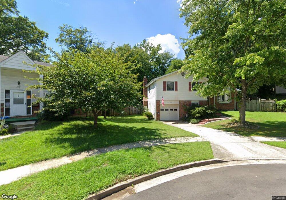
8400 Snowden Loop Ct Laurel, MD 20708
South Laurel NeighborhoodEstimated Value: $401,000 - $572,000
Studio
3
Baths
2,288
Sq Ft
$216/Sq Ft
Est. Value
About This Home
This home is located at 8400 Snowden Loop Ct, Laurel, MD 20708 and is currently estimated at $493,861, approximately $215 per square foot. 8400 Snowden Loop Ct is a home located in Prince George's County with nearby schools including Montpelier Elementary School, Dwight D. Eisenhower Middle School, and Laurel High School.
Ownership History
Date
Name
Owned For
Owner Type
Purchase Details
Closed on
Sep 10, 1998
Sold by
Sperty Joseph P
Bought by
Peggins John W and Peggins Pamela S
Current Estimated Value
Purchase Details
Closed on
Nov 5, 1973
Sold by
Kehm Homes Inc
Bought by
Sperty Joseph P and Sperty Emily B
Create a Home Valuation Report for This Property
The Home Valuation Report is an in-depth analysis detailing your home's value as well as a comparison with similar homes in the area
Home Values in the Area
Average Home Value in this Area
Purchase History
| Date | Buyer | Sale Price | Title Company |
|---|---|---|---|
| Peggins John W | $167,500 | -- | |
| Sperty Joseph P | $36,900 | -- |
Source: Public Records
Tax History
| Year | Tax Paid | Tax Assessment Tax Assessment Total Assessment is a certain percentage of the fair market value that is determined by local assessors to be the total taxable value of land and additions on the property. | Land | Improvement |
|---|---|---|---|---|
| 2025 | $5,116 | $441,300 | $127,100 | $314,200 |
| 2024 | $5,116 | $416,633 | -- | -- |
| 2023 | $4,917 | $391,967 | $0 | $0 |
| 2022 | $4,672 | $367,300 | $102,100 | $265,200 |
| 2021 | $4,453 | $346,500 | $0 | $0 |
| 2020 | $4,328 | $325,700 | $0 | $0 |
| 2019 | $4,181 | $304,900 | $101,000 | $203,900 |
| 2018 | $4,040 | $289,633 | $0 | $0 |
| 2017 | $3,922 | $274,367 | $0 | $0 |
| 2016 | -- | $259,100 | $0 | $0 |
| 2015 | $3,386 | $254,300 | $0 | $0 |
| 2014 | $3,386 | $249,500 | $0 | $0 |
Source: Public Records
Map
Nearby Homes
- 8415 Snowden Oaks Place
- 8307 Snowden Oaks Place
- 8479 Imperial Dr
- 8904 Royal Ridge Ln
- 8714 Granite Ln
- 8908 Eastbourne Ln
- 12600 Cedarbrook Ln
- 13400 Oaklands Manor Dr
- 12201 Mount Pleasant Dr
- 11905 Ellington Dr
- 12927 Brickyard Blvd
- 12918 Rustic Rock Ln
- 7205 Barrberry Ln
- 11819 Ellington Dr
- 12613 Rustic Rock Ln
- 7338 Calico Rock Lndg Rd
- 9303 Ispahan Loop
- 7202 Silver Thorn Way
- 7225 Silver Thorn Way
- 13120 Winding Trail Rd
- 8401 Snowden Loop Ct
- 8403 N Point Ct
- 8402 Snowden Loop Ct
- 12607 N Point Ln
- 12609 N Point Ln
- 8404 Snowden Loop Ct
- 8404 N Point Ct
- 8403 Snowden Loop Ct
- 12605 N Point Ln
- 8401 N Point Ct
- 8405 Snowden Loop Ct
- 12603 N Point Ln
- 8406 Snowden Loop Ct
- 8407 Snowden Loop Ct
- 8402 Montpelier Dr
- 8408 Snowden Loop Ct
- 12601 N Point Ln
- 8402 N Point Ct
- 8404 Montpelier Dr
- 8463 Snowden Oaks Place
Your Personal Tour Guide
Ask me questions while you tour the home.