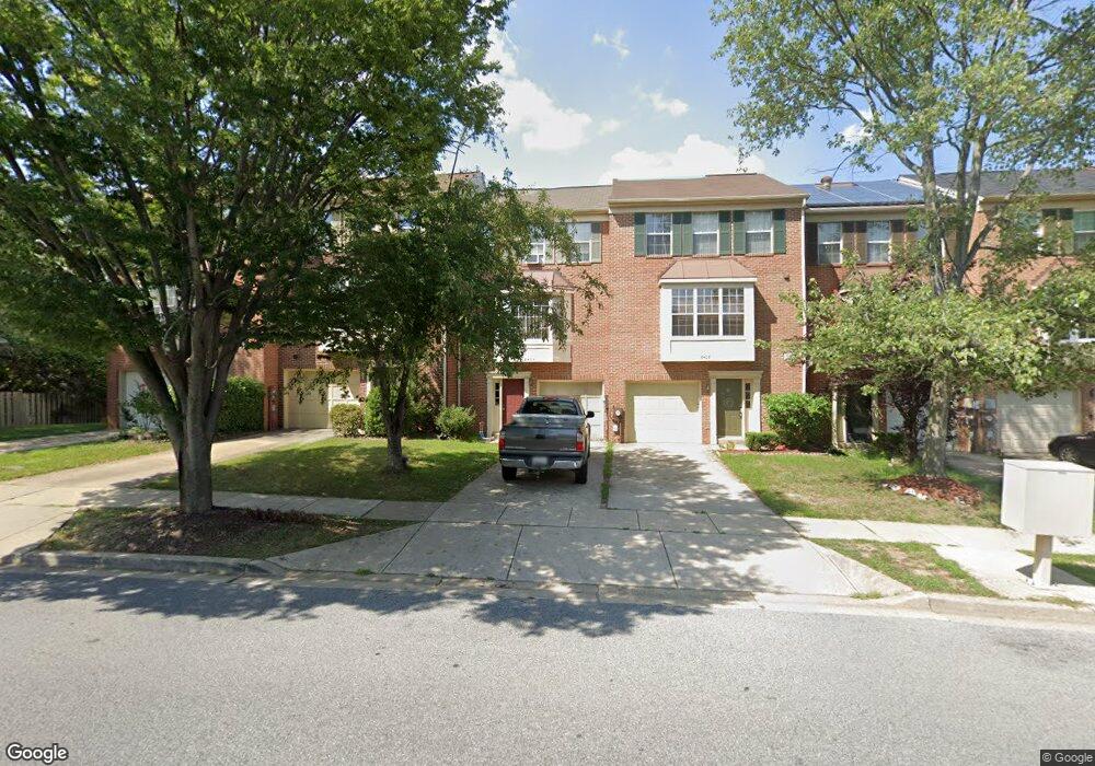
8406 Ashford Blvd Laurel, MD 20707
Estimated Value: $410,000 - $437,000
--
Bed
3
Baths
2,052
Sq Ft
$207/Sq Ft
Est. Value
About This Home
This home is located at 8406 Ashford Blvd, Laurel, MD 20707 and is currently estimated at $425,687, approximately $207 per square foot. 8406 Ashford Blvd is a home located in Prince George's County with nearby schools including Scotchtown Hills Elementary School, Laurel High School, and Christian Academy of Laurel.
Ownership History
Date
Name
Owned For
Owner Type
Purchase Details
Closed on
Feb 23, 2006
Sold by
Hiler Thomas S
Bought by
Duran Fernando D
Current Estimated Value
Home Financials for this Owner
Home Financials are based on the most recent Mortgage that was taken out on this home.
Original Mortgage
$308,880
Outstanding Balance
$174,607
Interest Rate
6.27%
Mortgage Type
Purchase Money Mortgage
Estimated Equity
$251,080
Purchase Details
Closed on
Jan 26, 2006
Sold by
Hiler Thomas S
Bought by
Duran Fernando D
Home Financials for this Owner
Home Financials are based on the most recent Mortgage that was taken out on this home.
Original Mortgage
$308,880
Outstanding Balance
$174,607
Interest Rate
6.27%
Mortgage Type
Purchase Money Mortgage
Estimated Equity
$251,080
Purchase Details
Closed on
May 20, 1987
Sold by
Richmond American
Bought by
Hiler Thomas S
Create a Home Valuation Report for This Property
The Home Valuation Report is an in-depth analysis detailing your home's value as well as a comparison with similar homes in the area
Home Values in the Area
Average Home Value in this Area
Purchase History
| Date | Buyer | Sale Price | Title Company |
|---|---|---|---|
| Duran Fernando D | $325,144 | -- | |
| Duran Fernando D | $325,144 | -- | |
| Hiler Thomas S | $108,700 | -- |
Source: Public Records
Mortgage History
| Date | Status | Borrower | Loan Amount |
|---|---|---|---|
| Open | Duran Fernando D | $308,880 | |
| Closed | Duran Fernando D | $308,880 |
Source: Public Records
Tax History Compared to Growth
Tax History
| Year | Tax Paid | Tax Assessment Tax Assessment Total Assessment is a certain percentage of the fair market value that is determined by local assessors to be the total taxable value of land and additions on the property. | Land | Improvement |
|---|---|---|---|---|
| 2025 | $5,486 | $362,600 | $90,000 | $272,600 |
| 2024 | $5,486 | $338,500 | $0 | $0 |
| 2023 | $5,161 | $314,400 | $0 | $0 |
| 2022 | $4,791 | $290,300 | $75,000 | $215,300 |
| 2021 | $4,526 | $275,033 | $0 | $0 |
| 2020 | $4,357 | $259,767 | $0 | $0 |
| 2019 | $4,179 | $244,500 | $75,000 | $169,500 |
| 2018 | $4,044 | $235,367 | $0 | $0 |
| 2017 | $3,932 | $226,233 | $0 | $0 |
| 2016 | -- | $217,100 | $0 | $0 |
| 2015 | $3,644 | $208,067 | $0 | $0 |
| 2014 | $3,644 | $199,033 | $0 | $0 |
Source: Public Records
Map
Nearby Homes
- 1002 7th St
- 1000 8th St
- 1004 Marton St
- 8112 Fenwick Ct
- 1003 Ward St
- 612 9th St
- 1002 West Ct
- 14811 Belle Ami Dr
- 7914 Chapel Cove Dr
- 410 Carroll Ave
- 15443 Arbory Way
- 7610 Woodruff Ct
- 7681 E Arbory Ct
- 14229 Bowsprit Ln Unit 501
- 14226 Yardarm Way Unit 107
- 14119 Bowsprit Ln Unit 312
- 7631 S Arbory Ln
- 1210 Westview Terrace
- 1106 Snowden Place
- 15116 Laurel Oaks Ln
- 8404 Ashford Blvd
- 8408 Ashford Blvd
- 8410 Ashford Blvd
- 8402 Ashford Blvd
- 8412 Ashford Blvd
- 8414 Ashford Blvd
- 15010 Wheatland Place
- 15003 Courtland Place
- 15001 Courtland Place
- 8416 Ashford Blvd
- 15005 Courtland Place
- 15012 Wheatland Place
- 15007 Courtland Place
- 15014 Wheatland Place
- 15011 Courtland Place
- 15016 Wheatland Place
- 15013 Courtland Place
- 15015 Courtland Place
- 15018 Wheatland Place
- 15017 Courtland Place