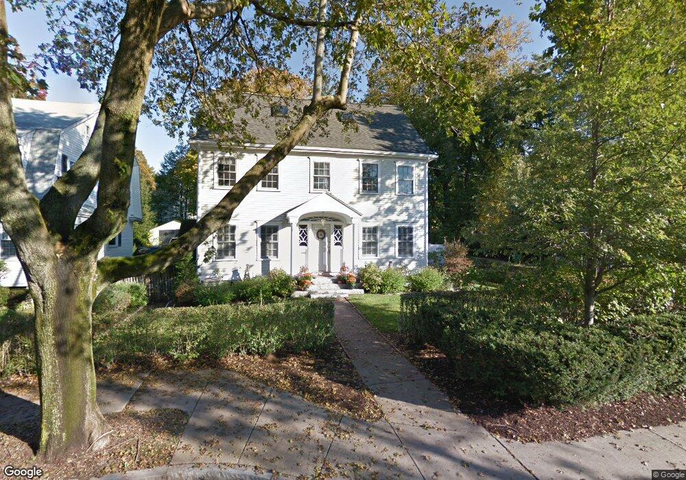
841 Commonwealth Ave Newton Center, MA 02459
Newton Centre NeighborhoodEstimated Value: $1,736,000 - $2,382,000
4
Beds
4
Baths
2,217
Sq Ft
$908/Sq Ft
Est. Value
About This Home
This home is located at 841 Commonwealth Ave, Newton Center, MA 02459 and is currently estimated at $2,013,268, approximately $908 per square foot. 841 Commonwealth Ave is a home located in Middlesex County with nearby schools including Mason Rice Elementary School, Charles E Brown Middle School, and Newton North High School.
Ownership History
Date
Name
Owned For
Owner Type
Purchase Details
Closed on
Apr 22, 1987
Sold by
Jarvis Peter G
Bought by
Lytle Robert A
Current Estimated Value
Create a Home Valuation Report for This Property
The Home Valuation Report is an in-depth analysis detailing your home's value as well as a comparison with similar homes in the area
Home Values in the Area
Average Home Value in this Area
Purchase History
| Date | Buyer | Sale Price | Title Company |
|---|---|---|---|
| Lytle Robert A | $310,000 | -- |
Source: Public Records
Mortgage History
| Date | Status | Borrower | Loan Amount |
|---|---|---|---|
| Open | Lytle Robert A | $404,850 | |
| Closed | Lytle Robert A | $417,000 |
Source: Public Records
Tax History Compared to Growth
Tax History
| Year | Tax Paid | Tax Assessment Tax Assessment Total Assessment is a certain percentage of the fair market value that is determined by local assessors to be the total taxable value of land and additions on the property. | Land | Improvement |
|---|---|---|---|---|
| 2025 | $15,248 | $1,555,900 | $1,213,600 | $342,300 |
| 2024 | $14,743 | $1,510,600 | $1,178,300 | $332,300 |
| 2023 | $14,048 | $1,380,000 | $899,300 | $480,700 |
| 2022 | $13,442 | $1,277,800 | $832,700 | $445,100 |
| 2021 | $12,971 | $1,205,500 | $785,600 | $419,900 |
| 2020 | $12,585 | $1,205,500 | $785,600 | $419,900 |
| 2019 | $12,231 | $1,170,400 | $762,700 | $407,700 |
| 2018 | $11,753 | $1,086,200 | $687,500 | $398,700 |
| 2017 | $11,395 | $1,024,700 | $648,600 | $376,100 |
| 2016 | $10,899 | $957,700 | $606,200 | $351,500 |
| 2015 | $10,391 | $895,000 | $566,500 | $328,500 |
Source: Public Records
Map
Nearby Homes
- 887 Commonwealth Ave
- 34 Morton Rd
- 3 Cedar St
- 73 Elmore St
- Lots 2 & 3 Chapin Rd
- Lot 3 Chapin Rd
- Lot 2 Chapin Rd
- 61 Lakeview Ave
- 1004 Centre St
- 54 Garland Rd
- 127-129 Withington Rd Unit 1
- 44 Blake St Unit 2
- 44 Irving St
- 1114 Beacon St Unit 106
- 1114 Beacon St Unit 203
- 1114 Beacon St Unit 111
- 1114 Beacon St Unit 206
- 1114 Beacon St Unit 104
- 1114 Beacon St Unit 207
- 21 Francis St Unit 21A
- 849 Commonwealth Ave Unit 849
- 849 Commonwealth Ave
- 849 Commonwealth Ave
- 849 Commonwealth Ave Unit 1
- 855 Commonwealth Ave
- 833 Commonwealth Ave
- 105 Morton St
- 108 Morton St
- 861 Commonwealth Ave
- 97 Merton St
- 825 Commonwealth Ave
- 42 Vineyard Rd
- 15 Hazelton Rd
- 842 Commonwealth Ave
- 863 Commonwealth Ave
- 850 Commonwealth Ave
- 36 Vineyard Rd
- 21 Hazelton Rd
- 819 Commonwealth Ave
- 89 Merton St